
Wyandra, Queensland facts for kids
Quick facts for kids WyandraQueensland |
|||||||||||||||
|---|---|---|---|---|---|---|---|---|---|---|---|---|---|---|---|

Wyandra General Store, 2009
|
|||||||||||||||

Wyandra
Location in Queensland
|
|||||||||||||||
| Population | 99 (2016 census) | ||||||||||||||
| • Density | 0.01953/km2 (0.0506/sq mi) | ||||||||||||||
| Postcode(s) | 4489 | ||||||||||||||
| Area | 5,069.5 km2 (1,957.3 sq mi) | ||||||||||||||
| Time zone | AEST (UTC+10) | ||||||||||||||
| Location |
|
||||||||||||||
| LGA(s) | Paroo Shire | ||||||||||||||
| State electorate(s) | Warrego | ||||||||||||||
| Federal Division(s) | Maranoa | ||||||||||||||
|
|||||||||||||||
Wyandra is a town and a locality in the Shire of Paroo, Queensland, Australia. In the 2016 census, Wyandra had a population of 99 people.
Facilities
Wyandra has a public library, Powerhouse Museum, Wyandra hall and park .
Education
Wyandra State School is a government primary (Early Childhood-6) school for boys and girls at Moody Street (27°14′43″S 145°58′40″E / 27.2454°S 145.9779°E). In 2017, the school had an enrolment of 4 students with 1 teacher and 2 non-teaching staff (1 full-time equivalent).
There is no secondary school in Wyandra; the nearest secondary schools are Charleville State High School in Charleville and Cunnamulla P-12 State School in Cunnamulla (both approximately 125 kilometres (78 mi) away).
Images for kids
-
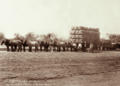
Wool bales from Claverton Station at Wyandra Railway Station, circa 1897

