
Yowie Bay, New South Wales facts for kids
Quick facts for kids Yowie BaySydney, New South Wales |
|||||||||||||||
|---|---|---|---|---|---|---|---|---|---|---|---|---|---|---|---|

Yowie Bay marina
|
|||||||||||||||

Yowie Bay
Location in New South Wales
|
|||||||||||||||
| Population | 3,167 (2011 census) | ||||||||||||||
| Established | 1889 | ||||||||||||||
| Postcode(s) | 2228 | ||||||||||||||
| Elevation | 28 m (92 ft) | ||||||||||||||
| Location | 24 km (15 mi) south of Sydney CBD | ||||||||||||||
| LGA(s) | Sutherland Shire | ||||||||||||||
| State electorate(s) | Cronulla, Miranda | ||||||||||||||
| Federal Division(s) | Cook | ||||||||||||||
|
|||||||||||||||
Yowie Bay is a suburb in southern Sydney, in the state of New South Wales, Australia. Yowie Bay is located 24 kilometres south of the Sydney central business district, in the local government area of the Sutherland Shire.
Yowie Bay takes its name from the small bay on the north shore of the Port Hacking estuary (also known locally as the Port Hacking River). It is bounded to the north by the suburb of Miranda and shares its postcode of 2228. Located to the east, across the Yowie Bay waterway, is Caringbah South. To the west is the suburb of Gymea Bay, across the bay of the same name.
History
Yowie is an Aboriginal name meaning 'place of echoes'. There appears to be no relationship to the mythical Australian creature called a Yowie.
Land in the area was originally released as the Village of 'Weerona' in 1889. The name 'Ewey Bay' was also recognised by the electoral office and post office in the early days. It has been suggested that the name is a corruption of ewes (female sheep). Yowie Bay was named by Surveyor Dixon in 1827. The suburb was officially assigned the name in 1973 by the Geographical Names Board.
-
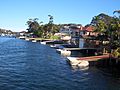
Yowie Bay homes and jetties
-
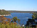
Yowie Bay view towards Port Hacking


Images for kids
-
Yowie Bay marina
-
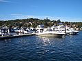
Yowie Bay marina
-
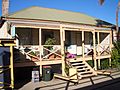
Yowie Bay general store


