
Yunta, South Australia facts for kids
Quick facts for kids YuntaSouth Australia |
|||||||||||||||
|---|---|---|---|---|---|---|---|---|---|---|---|---|---|---|---|
.jpg)
The hotel at Yunta
|
|||||||||||||||

Yunta
Location in South Australia
|
|||||||||||||||
| Population | 85 (2016 census) | ||||||||||||||
| Established | 13 January 1887 (town) 23 October 2003 (locality) |
||||||||||||||
| Postcode(s) | 5440 | ||||||||||||||
| Elevation | 302 m (991 ft) | ||||||||||||||
| Time zone | ACST (UTC+9:30) | ||||||||||||||
| • Summer (DST) | ACDT (UTC+10:30) | ||||||||||||||
| Location |
|
||||||||||||||
| LGA(s) | Pastoral Unincorporated Area | ||||||||||||||
| Region | Far North | ||||||||||||||
| County | Herbert | ||||||||||||||
| State electorate(s) | Stuart | ||||||||||||||
| Federal Division(s) | Grey | ||||||||||||||
|
|||||||||||||||
|
|||||||||||||||
| Footnotes | Locations Adjoining localities |
||||||||||||||
Yunta is a town and locality in the Australian state of South Australia located in the state's east about 275 kilometres (171 mi) north-east of the state capital of Adelaide. It is a service centre supporting both the local area and travellers passing through on the Barrier Highway. It lies south west of Broken Hill and north east of Peterborough.
Images for kids
-
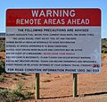
Warning sign at the start of Tea Tree Road to Arkaroola.


All content from Kiddle encyclopedia articles (including the article images and facts) can be freely used under Attribution-ShareAlike license, unless stated otherwise. Cite this article:
Yunta, South Australia Facts for Kids. Kiddle Encyclopedia.