
Zetland, New South Wales facts for kids
Quick facts for kids ZetlandSydney, New South Wales |
|||||||||||||||
|---|---|---|---|---|---|---|---|---|---|---|---|---|---|---|---|

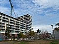
Infinity Building, Botany Road
|
|||||||||||||||
| Population | 10,078 (2016 census) | ||||||||||||||
| • Density | 12,600/km2 (33,000/sq mi) | ||||||||||||||
| Postcode(s) | 2017 | ||||||||||||||
| Area | 0.8 km2 (0.3 sq mi) | ||||||||||||||
| Time zone | AEST (UTC+10) | ||||||||||||||
| • Summer (DST) | AEDT (UTC+11) | ||||||||||||||
| Location | 4 km (2 mi) south of Sydney CBD | ||||||||||||||
| LGA(s) | City of Sydney | ||||||||||||||
| State electorate(s) | Heffron | ||||||||||||||
| Federal Division(s) | Sydney | ||||||||||||||
|
|||||||||||||||
Zetland is an inner suburb of Sydney, New South Wales, Australia 4 kilometres south of the Sydney central business district, in the local government area of the City of Sydney.
Zetland is a largely industrial suburb with medium- to high-density residential areas. Zetland is part of the Green Square district which is currently undergoing extensive gentrification. This involves an urban renewal project that is constructing modern retail, life-style options, business and residential developments.
A new zone of Zetland made by Landcom called Victoria Park, is designated for medium to high density residential development and retail along South Dowling Street, with its other boundaries along O'Dea and Joynton Avenues.
History
Zetland was named for Thomas Dundas, 2nd Earl of Zetland, who was a friend of Governor Sir Hercules Robinson. Zetland is an archaic spelling of Shetland.
Zetland originally featured a lagoon and swamp which was drained in the early 1900s to create the Victoria Park racecourse. It was bordered by O’Dea Avenue, South Dowling Street, Epsom Road and Joynton Avenue. The privately owned racecourse was closed after World War II. The land was bought by British businessman Lord Nuffield in 1947 and from 1950 the site was utilised by Nuffield Australia for a motor vehicle assembly facility. Vehicle production was continued by Nuffield Australia and its successors BMC Australia and Leyland Australia until the factory was closed in 1975. The site was acquired by the Commonwealth of Australia for a Naval Stores depot which operated until the mid-1990s. The land was subsequently redeveloped into high density housing (location: 33°54′29″S 151°12′38″E / 33.908°S 151.2105°E).
Zetland Post Office was first opened on 4 January 1937 and closed on 29 September 1983.
Former tram line
From 1902 a tram service operated through Zetland. The line initially ran via Chalmers and Redfern Streets and south along Elizabeth Street to Zetland via Elizabeth Street. In 1924, the line was extended to Epsom Road in Rosebery. In 1948, to facilitate construction of the Eastern Suburbs Railway, a new line was constructed down Elizabeth Street between Devonshire Street and Redfern Street and the route was deviated to run down this new section. The line was electrified double track throughout. The line was closed in 1957.
Waterloo Swamp
The Waterloo Swamp once dominated the landscape of the surrounding areas of Waterloo and Zetland. Woolwash Park Pond is the only remnant of this landscape which connected to a vast aquifer that still runs below the site. In the 1800s industries such as wool washing and tanning were attracted to this area by the clean water from the aquifer. Vegetation remains.
Woolwash Park Pond is an important part of the innovative water management and irrigation system at Victoria Park, Zetland. To ensure that the pond is able to effectively perform its important functions, residents are advised of the following by signage. The presence of fish is detrimental to water quality, as fish disturb sediments, produce waste, damage the macrophytes, and block the irrigation system. Any fish introduced into the pond will be removed. Aquatic plants are not to be introduced into the pond. These plants often infest the pond, killing the macrophytes and blocking the irrigation pumps.
Transport
Zetland is a transport hub with rail, bus and cycle way connections to the rest of the city. Green Square railway station on the Airport & South Line of the Sydney Trains network is located on the southwestern edge of Zetland. Central railway station is the next station to the north and Mascot railway station is the next station to the south.
Gallery
-
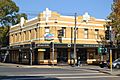
Zetland Hotel
-
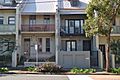
Zetland terrace houses
-
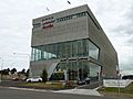
Audi Centre
-
Apartments, Victoria Park Parade


_02.jpg)
_01.jpg)
Images for kids
-
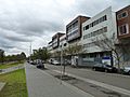
Apartments along Ascot Avenue
_05.jpg)
