
Brighton, Queensland facts for kids
Quick facts for kids BrightonBrisbane, Queensland |
|||||||||||||||
|---|---|---|---|---|---|---|---|---|---|---|---|---|---|---|---|

Hornibrook Bridge towards Brighton, 2007
|
|||||||||||||||

Brighton
Location in Queensland
|
|||||||||||||||
| Population | 9,479 (2016 census) | ||||||||||||||
| • Density | 1,247/km2 (3,230/sq mi) | ||||||||||||||
| Postcode(s) | 4017 | ||||||||||||||
| Area | 7.6 km2 (2.9 sq mi) | ||||||||||||||
| Time zone | AEST (UTC+10:00) | ||||||||||||||
| Location | 22.6 km (14 mi) N of Brisbane GPO | ||||||||||||||
| LGA(s) | City of Brisbane (Deagon Ward) |
||||||||||||||
| State electorate(s) | Sandgate | ||||||||||||||
| Federal Division(s) | Lilley | ||||||||||||||
|
|||||||||||||||

Brighton is a coastal northern suburb in the City of Brisbane, Queensland, Australia. In the 2016 census Brighton had a population of 9,479 people.
Contents
Demographics
In the 2011 census, Brighton recorded a population of 9,012 people, 51.1% female and 48.9% male.
The median age of the Brighton population was 40 years of age, 3 years above the Australian median.
78.4% of people living in Brighton were born in Australia, compared to the national average of 69.8%; the next most common countries of birth were England 5.3%, New Zealand 4.3%, Scotland 0.8%, Philippines 0.6%, Ireland 0.5%.
91.4% of people spoke only English at home; the next most popular languages were 0.5% German, 0.3% French, 0.3% Italian, 0.2% Tagalog, 0.2% Cantonese.
History
The main pub in Brighton is the Brighton Hotel located along Beaconsfield Terrace. An early settler, Captain William Townsend, bought the Brighton Hotel and used it as his home and, once sold in 1893, it was used as an orphanage. It resumed being a hotel in 1912.
Brighton Wetlands
Brighton has a wonderful woodland wetland protected by the local government. This natural reserve is made up of three woods; namely Goodenia Woods, Pimelea Woods and Dianella Woods. The land is so called a wetland as it fills with water during heavy rain which flows into a small tidal creek, Copold Creek, that flows under one of the main roads of Brighton, Beaconsfield Terrace, and then leads to Bramble Bay between 15th and 16th Avenues.
Brighton Esplanade

Brighton is a desirable Brisbane suburb due to both the ease of public transport, such as the train service from nearby Sandgate, and also the bayside esplanade. This peaceful parkland esplanade follows the coast between the Houghton Highway bridge and Sandgate. The esplanade is used by walkers, cyclists and families. Brighton's beach is used by kite surfers and also walkers during low tide. The road that follows the esplanade is called Flinders Parade named after the navigator Captain Matthew Flinders who was the first European to discover the area in order to establish a penal colony for Lord Brisbane, Governor of New South Wales.
Bridges
All three bridges that have connected City of Brisbane to Redcliffe City commenced at their southern end at Brighton and at their northern end at Clontarf. The first bridgeHornibrook Bridge has been closed and is now mostly demolished save for the . Currently there are two bridges, Houghton Highway and Ted Smout Memorial Bridge. Government Traffic monitoring cameras enable a real-time view looking north from brighton to Clontarf. http://www.tmr.qld.gov.au/Traffic-cameras-by-location/Traffic-cameras.aspx?name=Brighton - Houghton Highway Bridge - Deagon Deviation (North-East)
Heritage listings
Brighton has a number of heritage-listed sites, including:
- Hornibrook Highway: Hornibrook Bridge (mostly demolished in 2011)
Amenities
Brighton is serviced by a fortnightly visit of the Brisbane City Council's mobile library service in the car park at Decker Park on 25th Avenue.
- — full text available online
Education
Brighton State School is a government primary (Prep-6) school for boys and girls at 2 North Road (27°17′39″S 153°03′04″E / 27.2942°S 153.0512°E). In 2018, the school had an enrolment of 435 students with 32 teachers (27 full-time equivalent) and 21 non-teaching staff (12 full-time equivalent).
Nashville State School is a government primary (Prep-6) school for boys and girls on the corner of Baskerville and Douglas Streets (27°18′25″S 153°03′01″E / 27.3070°S 153.0503°E). In 2018, the school had an enrolment of 352 students with 26 teachers (23 full-time equivalent) and 18 non-teaching staff (11 full-time equivalent).
St Kieran's Catholic School is a Catholic primary (Prep-6) school for boys and girls at 15 Greenwood Street (27°17′37″S 153°03′18″E / 27.2935°S 153.0551°E). In 2018, the school had an enrolment of 277 students with 23 teachers (17 full-time equivalent) and 18 non-teaching staff (9 full-time equivalent).
Autism Queensland Education & Therapy Centre is a private primary and secondary (Prep-12) facility of Autism Queensland Education & Therapy Centre (headquartered at Sunnybank Hills) at 136 North Road (27°17′37″S 153°03′28″E / 27.2937°S 153.0577°E).
Images for kids
-
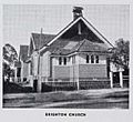
Brighton Methodist Church, circa 1947

