
Caliente, Nevada facts for kids
Quick facts for kids
Caliente, Nevada
|
|
|---|---|

The historic Caliente Railroad Depot,
January 2007 |
|
| Nickname(s):
City of Roses
|
|

Location of Caliente, Nevada
|
|

Caliente, Nevada
Location in Nevada

Caliente, Nevada
Location in the United States
|
|
| Country | United States |
| State | Nevada |
| County | Lincoln |
| Area | |
| • Total | 54.80 sq mi (141.93 km2) |
| • Land | 54.80 sq mi (141.93 km2) |
| • Water | 0.00 sq mi (0.00 km2) |
| Elevation | 4,406 ft (1,343 m) |
| Population
(2010)
|
|
| • Total | 1,130 |
| • Estimate
(2019)
|
1,076 |
| • Density | 19.64/sq mi (7.58/km2) |
| Time zone | UTC−8 (Pacific (PST)) |
| • Summer (DST) | UTC−7 (PDT) |
| ZIP code |
89008
|
| Area code(s) | 775 |
| FIPS code | 32-08500 |
| GNIS feature ID | 0847266 |
Caliente formerly known as Culverwell and Calientes, is a city in Lincoln County, Nevada, United States. Its elevation is 4,300 feet (1,300 m). The population was 1,130 at the 2010 census, making it the least populated incorporated city in Nevada. The city's name originated from the nearby hot springs, as "caliente" is the Spanish word meaning "hot".
History
Caliente was founded in 1901 on Culverwell Ranch (or just Culverwell), built on land owned by William and Charles Culverwell. The town was initially given the name of Calientes, due to the hot springs present in the area, but later in the year a post office was erected and workers removed the "s" from the name of the town. In 1905, the Union Pacific railroad was completed, followed by the construction of the train depot in the style of Spanish mission architecture. The train depot, built in 1923, is now home to some city and county offices and a museum that exhibits historical information. The town once reached a peak of over 5,000 residents, but its population continually declined.
Geography and climate
According to the United States Census Bureau, the city has a total area of 1.9 square miles (4.9 km2), all of it land.
| Climate data for Caliente, Nevada (1903-2014) | |||||||||||||
|---|---|---|---|---|---|---|---|---|---|---|---|---|---|
| Month | Jan | Feb | Mar | Apr | May | Jun | Jul | Aug | Sep | Oct | Nov | Dec | Year |
| Record high °F (°C) | 71.0 (21.7) |
81.0 (27.2) |
90.0 (32.2) |
94.0 (34.4) |
103.0 (39.4) |
109.0 (42.8) |
110.0 (43.3) |
108.0 (42.2) |
106.0 (41.1) |
95.0 (35.0) |
82.0 (27.8) |
71.0 (21.7) |
110.0 (43.3) |
| Average high °F (°C) | 46.4 (8.0) |
52.4 (11.3) |
60.7 (15.9) |
68.9 (20.5) |
78.6 (25.9) |
88.6 (31.4) |
95.4 (35.2) |
93.1 (33.9) |
85.3 (29.6) |
73.4 (23.0) |
59.1 (15.1) |
48.3 (9.1) |
70.9 (21.6) |
| Average low °F (°C) | 17.7 (−7.9) |
22.9 (−5.1) |
28.3 (−2.1) |
34.3 (1.3) |
42.0 (5.6) |
49.5 (9.7) |
56.6 (13.7) |
55.3 (12.9) |
46.1 (7.8) |
35.1 (1.7) |
25.1 (−3.8) |
18.9 (−7.3) |
36.0 (2.2) |
| Record low °F (°C) | −9.0 (−22.8) |
−9.0 (−22.8) |
2.0 (−16.7) |
15.0 (−9.4) |
22.0 (−5.6) |
33.0 (0.6) |
40.0 (4.4) |
34.0 (1.1) |
25.0 (−3.9) |
10.0 (−12.2) |
0.0 (−17.8) |
−9.0 (−22.8) |
−9.0 (−22.8) |
| Average precipitation inches (mm) | 0.82 (21) |
0.94 (24) |
1.01 (26) |
0.69 (18) |
0.53 (13) |
0.33 (8.4) |
0.78 (20) |
0.90 (23) |
0.61 (15) |
0.80 (20) |
0.68 (17) |
0.66 (17) |
8.75 (222.4) |
| Average snowfall inches (cm) | 3.5 (8.9) |
2.7 (6.9) |
1.2 (3.0) |
0.2 (0.51) |
0 (0) |
0 (0) |
0 (0) |
0 (0) |
0 (0) |
0.1 (0.25) |
0.7 (1.8) |
2.9 (7.4) |
11.3 (28.76) |
Demographics
| Historical population | |||
|---|---|---|---|
| Census | Pop. | %± | |
| 1940 | 970 | — | |
| 1950 | 792 | −18.4% | |
| 1960 | 916 | 15.7% | |
| 1970 | 982 | 7.2% | |
| 1980 | 1,111 | 13.1% | |
| 1990 | 1,123 | 1.1% | |
| 2000 | 1,130 | 0.6% | |
| 2010 | 1,130 | 0.0% | |
| 2019 (est.) | 1,076 | −4.8% | |
| U.S. Decennial Census | |||
As of the census of 2000, there were 1,123 people, 408 households, and 241 families residing in the city. The population density was 603.7 people per square mile (233.1/km2). There were 479 housing units at an average density of 257.5 per square mile (99.4/km2). The racial makeup of the city was 87.27% White, 1.96% Black or African American, 3.03% Native American, 0.62% Asian, 0.09% Pacific Islander, 3.56% from other races, and 3.47% from two or more races. 7.30% of the population were Hispanic or Latino or of any type of race.
There were 408 households, out of which 29.4% had children under the age of 18 living with them, 46.1% were married couples living together, 11.8% had a female householder with no husband present, and 40.9% were non-families. 37.3% of all households were made up of individuals, and 18.1% had someone living alone who was 65 years of age or older. The average household size was 2.34 and the average family size was 3.12.
In the city, the population was spread out, with 39.1% under the age of 18, 5.2% from 18 to 24, 17.5% from 25 to 44, 21.9% from 45 to 64, and 16.3% who were 65 years of age or older. The median age was 33 years. For every 100 females, there were 89.7 males. For every 100 females age 18 and over, there were 85.4 males.
The median income for a household in the city was $25,833, and the median income for a family was $38,667. Males had a median income of $39,500 versus $24,688 for females. The per capita income for the city was $20,555. About 17.3% of families and 22.3% of the population were below the poverty line, including 31.4% of those under age 18 and 17.9% of those age 65 or over.
Attractions
- Caliente is located near the Kershaw–Ryan State Park. This park contains hiking trails, campgrounds, volleyball courts, picnic pavilions, horseshoe pits, a playground, and a small natural swimming pool.
- The Caliente Railroad Depot is a two-story Union Pacific Railroad depot next to the rail line. It houses the city's offices, a library, and a gallery.
Images for kids
-
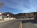
South along U.S. Route 93 in Caliente, January 2015

See also
 In Spanish: Caliente (Nevada) para niños
