
Castro County, Texas facts for kids
Quick facts for kids
Castro County
|
|
|---|---|

Castro County Courthouse in Dimmitt
|
|

Location within the U.S. state of Texas
|
|
 Texas's location within the U.S. |
|
| Country | |
| State | |
| Founded | 1891 |
| Named for | Henri Castro |
| Seat | Dimmitt |
| Largest city | Dimmitt |
| Area | |
| • Total | 899 sq mi (2,330 km2) |
| • Land | 894 sq mi (2,320 km2) |
| • Water | 4.9 sq mi (13 km2) 0.5% |
| Population
(2020)
|
|
| • Total | 7,371 |
| • Density | 8.199/sq mi (3.1657/km2) |
| Time zone | UTC−6 (Central) |
| • Summer (DST) | UTC−5 (CDT) |
| Congressional district | 19th |
Castro County is a county located in the U.S. state of Texas. As of the 2020 census, its population was 7,371. Its county seat is Dimmitt. The county was named for Henri Castro, who was consul general to France for the Republic of Texas and the founder of a colony in Texas.
The county was originally created in 1876. It was organized in 1891, and a courthouse was built about the town square. Temporary county office space, meanwhile, was obtained from businessman J. N. Morrison. The ornate, two-story courthouse was completed, but was destroyed by lightning in 1906.
Contents
Geography
According to the U.S. Census Bureau, the county has a total area of 899 square miles (2,330 km2), of which 894 square miles (2,320 km2) is land and 4.9 square miles (13 km2) (0.5%) is water.
Major highways
 U.S. Highway 385
 State Highway 86
 State Highway 194
Adjacent counties
- Deaf Smith County (north)
- Randall County (northeast)
- Swisher County (east)
- Hale County (southeast)
- Lamb County (south)
- Parmer County (west)
Demographics
| Historical population | |||
|---|---|---|---|
| Census | Pop. | %± | |
| 1890 | 9 | — | |
| 1900 | 400 | 4,344.4% | |
| 1910 | 1,850 | 362.5% | |
| 1920 | 1,948 | 5.3% | |
| 1930 | 4,720 | 142.3% | |
| 1940 | 4,631 | −1.9% | |
| 1950 | 5,417 | 17.0% | |
| 1960 | 8,923 | 64.7% | |
| 1970 | 10,394 | 16.5% | |
| 1980 | 10,556 | 1.6% | |
| 1990 | 9,070 | −14.1% | |
| 2000 | 8,285 | −8.7% | |
| 2010 | 8,062 | −2.7% | |
| 2015 (est.) | 7,656 | −5.0% | |
| U.S. Decennial Census 1850–2010 2010–2014 |
|||
As of the census of 2000, there were 8,285 people, 2,761 households, and 2,159 families residing in the county. The population density was 9 people per square mile (4/km²). There were 3,198 housing units at an average density of 4 per square mile (1/km²). The racial makeup of the county was 75.35% White, 2.27% Black or African American, 1.17% Native American, 0.02% Asian, 0.01% Pacific Islander, 19.12% from other races, and 2.05% from two or more races. 51.65% of the population were Hispanic or Latino of any race.
There were 2,761 households out of which 40.90% had children under the age of 18 living with them, 65.10% were married couples living together, 8.70% had a female householder with no husband present, and 21.80% were non-families. 20.50% of all households were made up of individuals and 10.20% had someone living alone who was 65 years of age or older. The average household size was 2.98 and the average family size was 3.45.
In the county, the population was spread out with 33.10% under the age of 18, 9.00% from 18 to 24, 24.30% from 25 to 44, 20.90% from 45 to 64, and 12.70% who were 65 years of age or older. The median age was 32 years. For every 100 females there were 100.50 males. For every 100 females age 18 and over, there were 98.20 males.
The median income for a household in the county was $30,619, and the median income for a family was $35,422. Males had a median income of $25,379 versus $20,433 for females. The per capita income for the county was $14,457. About 15.70% of families and 19.00% of the population were below the poverty line, including 25.30% of those under age 18 and 13.90% of those age 65 or over.
| Year | Democratic | Republican |
|---|---|---|
| 2016 | 26.4% 526 | 70.8% 1,413 |
| 2012 | 29.7% 630 | 69.4% 1,470 |
| 2008 | 31.4% 719 | 68.2% 1,562 |
| 2004 | 26.0% 631 | 73.8% 1,794 |
| 2000 | 30.9% 727 | 68.3% 1,607 |
| 1996 | 44.3% 1,107 | 49.2% 1,231 |
| 1992 | 38.2% 1,113 | 44.9% 1,307 |
| 1988 | 47.1% 1,436 | 52.6% 1,604 |
| 1984 | 33.0% 1,009 | 66.3% 2,026 |
| 1980 | 37.3% 1,199 | 60.3% 1,955 |
| 1976 | 66.1% 2,033 | 32.7% 1,007 |
| 1972 | 30.6% 751 | 68.7% 1,685 |
| 1968 | 41.6% 1,181 | 36.4% 1,033 |
| 1964 | 74.8% 1,865 | 25.1% 626 |
| 1960 | 64.8% 1,544 | 34.0% 810 |
Communities
Cities
Unincorporated communities
Education
School districts:
- Dimmitt Independent School District
- Happy Independent School District
- Hart Independent School District
- Hereford Independent School District
- Lazbuddie Independent School District
- Nazareth Independent School District
- Springlake-Earth Independent School District
All of the county is in the service area of Amarillo College.
Images for kids
-
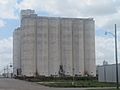
Grain elevator in Dimmitt

See also
 In Spanish: Condado de Castro para niños
