
City of Queanbeyan facts for kids
Quick facts for kids City of QueanbeyanNew South Wales |
|||||||||||||||
|---|---|---|---|---|---|---|---|---|---|---|---|---|---|---|---|

Location in New South Wales
|
|||||||||||||||
| Population | 40,568 (2013 est) | ||||||||||||||
| • Density | 235.9/km2 (611/sq mi) | ||||||||||||||
| Abolished | 12 May 2016 | ||||||||||||||
| Area | 172 km2 (66.4 sq mi) | ||||||||||||||
| Last Mayor | Tim Overall | ||||||||||||||
| Council seat | Queanbeyan | ||||||||||||||
| Region | Southern Tablelands | ||||||||||||||
| State electorate(s) | Monaro | ||||||||||||||
| Federal Division(s) | Eden-Monaro | ||||||||||||||
| Website | City of Queanbeyan | ||||||||||||||
|
|||||||||||||||
Queanbeyan City was a local government area located in south eastern New South Wales, Australia. The former area is located adjacent to Canberra and the Australian Capital Territory, the Queanbeyan River, the Molonglo River, the Kings Highway and the Sydney-Canberra railway.
On 12 May 2016 the Minister for Local Government announced dissolution of Queanbeyan City with immediate effect. Together with the Palerang Council the combined council areas were merged to establish the Queanbeyan-Palerang Regional Council.
The last mayor of the Queanbeyan City Council was Tim Overall, an independent politician.
Cities, towns and localities
The Queanbeyan City Council area included the suburbs and villages of:
- Carwoola
- Crestwood
- Environa
- Googong
- Greenleigh
- Jerrabomberra
- Karabar
- Queanbeyan East
- Queanbeyan West
- Queanbeyan
- The Ridgeway
- Royalla
- Tralee
In 1998 Queanbeyan Council applied to have the localities of Letchworth, Larmer, Dodsworth and De Salis recognised as suburbs and these names were assigned by the Geographical Names Board of New South Wales. A more recent Council has had these names withdrawn.
Amalgamation
A 2015 review of local government boundaries recommended that the Queanbeyan City Council merge with adjoining councils. The NSW Government considered two options. The first option was to merge Queanbeyan Council with parts of the Palerang Council to form a new council with an area of 3,791 square kilometres (1,464 sq mi) and support a population of approximately 55,000. The alternative, proposed by Palerang Council on 29 January 2016, was for an amalgamation of the whole of Palerang with Queanbeyan Council. On 12 May 2016 the Minister for Local Government announced dissolution of Queanbeyan City with immediate effect. Together with the Palerang Council the combined council areas were merged to establish the Queanbeyan-Palerang Regional Council.
Images for kids
-
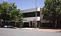
Former Queanbeyan City Council Chambers in Crawford Street (December 2011)
.jpg)
