
Flemish Brabant facts for kids
Quick facts for kids Flemish Brabant (Dutch: Vlaams-BrabantFrench: Brabant flamand) |
|||
| Province of Belgium | |||
 Leuven Town Hall.
|
|||
|
|||
| Country | |||
|---|---|---|---|
| Region | |||
| Capital | Leuven | ||
| - coordinates | 50°53′N 04°42′E / 50.883°N 4.700°E | ||
| Highest point | Walshoutem | ||
| - location | Landen, Leuven, Flemish Brabant | ||
| - elevation | 137.33 m (451 ft) | ||
| Area | 2,106 km² (813 sq mi) | ||
| Population | 1,129,849 (1 January 2017) | ||
| Density | 536 /km² (1,388 /sq mi) | ||
| Subdivisions | 2 Arrondissements 65 Municipalities |
||
| Governor | Lode De Witte | ||
| Timezone | CET (UTC+1) | ||
| - summer (DST) | CEST (UTC+2) | ||
| Postal codes | 1500-1999 / 3000–3499 | ||
| ISO 3166-2 | BE-VBR | ||


Flemish Brabant (Dutch: Vlaams-Brabant, French: Brabant flamand) is the youngest and smallest province of the Flemish Region, one of the three regions of Belgium. It covers the Dutch-speaking northern part of the former province of Brabant. Flemish Brabant also completely surrounds the Brussels-Capital Region, which forms an enclave within the territory of the province.
Its capital, and also the largest city of the province, is the university city of Leuven (French: Louvain, often used in English).
Contents
History
Flemish in Flemish Brabant means that it is in the Flemish part of the former province of Brabant of Belgium. Brabant was an old region, the Duchy of Brabant. The word Brabant appears for the first time in the seventh century when the abbey of Nivelles was founded in the pagus Bracbatensis (pagus is a Latin word meaning a very small town, with only few houses).
Flemish Brabant was created in 1995 by the splitting of the former province of Brabant into three parts: two new provinces, Flemish Brabant and Walloon Brabant; and the Brussels-Capital Region, which no longer belongs to any province. The split was made to accommodate the eventual division of Belgium in three regions (Flanders, Wallonia and the Brussels-Capital Region).
Geography
The province borders on (clockwise from the North) the Belgian provinces of Antwerp, Limburg, Liège, Walloon Brabant, Hainaut and East Flanders.
The province has an area of 2,106 km2 (813 sq mi); it is about 90 km (56 mi) long (east-west direction) and about 40 km (25 mi) wide (north-south direction).
It has a population of 1,129,849 and a density of 536.5 inhabitants per km². The province is divided into two districts (arrondissements in French and arrondissementen in Dutch) with 65 municipalities.
The main rivers of the province are the Dyle, the Demer and the Zenne.
Administrative divisions
The province of Flemish Brabant is divided into two districts: Halle-Vilvoorde has Brussels in its middle and, therefore, is mainly a residential area, but it also has large industrial zones; the other district is Leuven, centered on the city of Leuven.


Population by arrondissement
Population on 1 January of each year.
| Arrondissement | 2007 | 2008 | 2009 | 2010 | 2011 | 2012 |
|---|---|---|---|---|---|---|
| Hal-Vilvorde | 580,407 | 584,416 | 588,743 | 593,455 | 598,944 | 604,097 |
| Leuven | 472,060 | 475,816 | 480,095 | 483,469 | 487,502 | 490,654 |
| Province of Flemish Brabant | 1,052,467 | 1,060,232 | 1,068,838 | 1,076,924 | 1,086,446 | 1,094,751 |
Images for kids
-
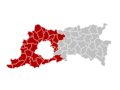
Map showing the location of the Arrondissement of Halle-Vilvoorde
See also
 In Spanish: Provincia del Brabante Flamenco para niños
