
Grand Traverse County, Michigan facts for kids
Quick facts for kids
Grand Traverse County
|
|||
|---|---|---|---|

Grand Traverse County Courthouse in Traverse City
|
|||
|
|||

Location within the U.S. state of Michigan
|
|||
 Michigan's location within the U.S. |
|||
| Country | |||
| State | |||
| Founded | 1851 | ||
| Named for | Grand Traverse Bay | ||
| Seat | Traverse City | ||
| Largest city | Traverse City | ||
| Area | |||
| • Total | 601 sq mi (1,560 km2) | ||
| • Land | 464 sq mi (1,200 km2) | ||
| • Water | 137 sq mi (350 km2) 23%% | ||
| Population | |||
| • Estimate
(2020)
|
95,238 | ||
| • Density | 198/sq mi (76/km2) | ||
| Time zone | UTC−5 (Eastern) | ||
| • Summer (DST) | UTC−4 (EDT) | ||
| Congressional district | 1st | ||

Grand Traverse County is located in the U.S. state of Michigan. As of the 2020 census, the population was 95,238. The county seat is Traverse City.
According to the United States Census Bureau, during the 2020 census the population of Grand Traverse County was 95,238.
Grand Traverse County is part of the Traverse City, MI, Micropolitan Statistical Area, which also includes Benzie, Kalkaska, and Leelanau counties.
Interlochen, home of the Interlochen Center for the Arts, is located in Green Lake Township.
Grand Traverse County was originally known as Omeena County.
Contents
History
In 1840 it was separated and originally named Omeena County. Grand Traverse County was organized by an act of the state legislature on April 7, 1851. Grand Traverse is derived from a French phrase meaning "long crossing" and the county is so named because it is situated at the Grand Traverse Bay. The first permanent settlement in the county was the mission now known as Old Mission.
Historical markers
There are twelve recognized Michigan historical markers in the county: They are:
- City Opera House
- Congregation Beth El
- Fife Lake Union District No. 1 Schoolhouse
- Grand Traverse Bay
- Grand Traverse County Courthouse
- Hesler Log House
- Interlochen
- Ladies Library Association
- Novotny's Saloon
- Park Place Hotel
- Traverse City Regional Psychiatric Hospital
Geography
According to the U.S. Census Bureau, the county has a total area of 601 square miles (1,560 km2), of which 464 square miles (1,200 km2) is land and 137 square miles (350 km2) (23%) is water. Grand Traverse County is considered to be part of Northern Michigan.
Adjacent counties
- Antrim County (northeast)
- Kalkaska County (east)
- Wexford County (south)
- Benzie County (west)
- Leelanau County (northwest)
- Manistee County (southwest)
Lakes
- Arbutus Lake
- Bass Lake
- Cedar Hedge Lake
- Christmas Tree Lake
- Coffield Lake
- Duck Lake (Wahbekaness)
- Dyer Lake
- Elk Lake (Largest in more than one county including Grand Traverse)
- Ellis Lake
- Fife Lake
- Fish Lake
- Green Lake (Wahbekanetta)
- High Lake
- Huellmantel Lake
- Long Lake (Largest in County)
- Lost Lake
- Mirror Lake
- Mud Lake
- Muncie Lake
- Pickerel Lake
- Rennie Lake
- Rush Pond
- Silver Lake (Deepest in County)
- Spider lake
- Lake Skegemog
- Strombolis Lake
- Truax Lake
- Twin Lake
- Vandervoight Lake
Creeks
- Acme Creek
- Angell Creek
- Beitner Creek
- Campbell Creek
- Cedar Run
- Coleys Creek
- Desmond Creek
- Fife Outlet
- Fourmile Creek
- Gens Creek
- Harris Creek
- Headquarters Creek
- Kids Creek
- Kingsley Creek
- Mitchell Creek
- Neal Creek
- Orchard Valley Creek
- Rudhardt Creek
- Swainston Creek
- Vanderali (West) Creek
- Vanderlip (East) Creek
- Williamsburg Creek
- Woodland Creek
- Yuba Creek
Rivers
- Betsie River
- Boardman River (North and South branches)
- Little Betsie River
- Platte River
- South Skegemog River
Transportation
Air travel
Grand Traverse County is served by Cherry Capital Airport, which is located near Traverse City. It serves the 21-county Northern Michigan area, and has destinations around the country. Other airparks in the county include:
- Acme Skyport
- Green Lake Airport
- Tramps Aerodrome
- Yuba Airport
Other than Cherry Capital Airport, all other airports in the county are unpaved
Formerly, there was an airport on the south side of Traverse City called Ransom Field. This was located on Rennie Hill. This airport closed sometime in the 1930s.

Major highways
The county contains about 103 miles (166 km), about 1.07% of the Michigan State Trunkline Highway System. These highways include the ones listed below.
 US 31 runs through the county southwest to northeast. It provides access to cities to the north (like Charlevoix and Petoskey) and southwest (like Ludington and Muskegon). The highway runs all the way to Spanish Fort, Alabama, to the south and runs through major cities like Indianapolis, Louisville, Nashville, and Birmingham.
 US 131 runs through the far southeastern part of the county, entirely within Fife Lake Township. The highway provides access to Kalkaska and Petoskey to the north, and cities like Grand Rapids and Kalamazoo to the south. The southern end is at the Indiana Toll Road just across the state line.
 M-22 is the shortest highway segment within the county. It begins at an intersection in Traverse City, and runs northwest along the Grand Traverse Bay towards the county line. It then continues in Leelanau County up towards Northport and then runs southwesterly towards Glen Arbor, Frankfort, and Manistee.
 M-37 is the longest highway in the county. It runs from a cul-de-sac at Old Mission Point southerly to Traverse City and through Buckley. The highway then continues down through the state to Baldwin, Grand Rapids, Hastings, and Battle Creek.
 M-72 runs east-to-west in the county from northern Long Lake Township to near Williamsburg. The highway provides access to Empire and central Leelanau County to the west, and Kalkaska, Grayling, and Harrisville to the east.
- M-113 runs through the southern portion of the county, connecting M-37 to US 131 while passing through Kingsley and Walton.
- M-137 was a state highway that connected US 31 near Interlochen with Interlochen Center for the Arts and Interlochen State Park. However, this highway was decommissioned in 2020.
 M-186 is a short highway providing a direct route from M-113 to US 131 and Fife Lake.
Demographics
| Historical population | |||
|---|---|---|---|
| Census | Pop. | %± | |
| 1860 | 1,286 | — | |
| 1870 | 4,443 | 245.5% | |
| 1880 | 8,422 | 89.6% | |
| 1890 | 13,355 | 58.6% | |
| 1900 | 20,479 | 53.3% | |
| 1910 | 23,784 | 16.1% | |
| 1920 | 19,518 | −17.9% | |
| 1930 | 20,011 | 2.5% | |
| 1940 | 23,390 | 16.9% | |
| 1950 | 28,598 | 22.3% | |
| 1960 | 33,490 | 17.1% | |
| 1970 | 39,175 | 17.0% | |
| 1980 | 54,899 | 40.1% | |
| 1990 | 64,273 | 17.1% | |
| 2000 | 77,654 | 20.8% | |
| 2010 | 86,986 | 12.0% | |
| 2020 | 95,238 | 9.5% | |
| U.S. Decennial Census 1790-1960 1900-1990 1990-2000 2010-2018 |
|||
As of the census of 2000, there were 77,654 people, 30,396 households, and 20,730 families residing in the county. The population density was 167 inhabitants per square mile (64/km2). There were 34,842 housing units at an average density of 75 per square mile (29/km2). The racial makeup of the county was 96.51% White, 0.40% Black or African American, 0.93% Native American, 0.49% Asian, 0.03% Pacific Islander, 0.54% from other races, and 1.09% from two or more races. 1.49% of the population were Hispanic or Latino of any race. 25.1% were of German, 11.3% English, 10.7% Irish, 8.4% American and 7.4% Polish ancestry, 96.4% spoke English and 1.6% Spanish as their first language.
There were 30,396 households, out of which 32.80% had children under the age of 18 living with them, 55.70% were married couples living together, 9.20% had a female householder with no husband present, and 31.80% were non-families. 25.00% of all households were made up of individuals, and 9.00% had someone living alone who was 65 years of age or older. The average household size was 2.49 and the average family size was 2.99.
In the county, the population was spread out, with 25.40% under the age of 18, 7.90% from 18 to 24, 29.70% from 25 to 44, 24.00% from 45 to 64, and 13.10% who were 65 years of age or older. The median age was 38 years. For every 100 females, there were 95.20 males. For every 100 females age 18 and over, there were 92.10 males.
The median income for a household in the county was $43,169, and the median income for a family was $51,211. Males had a median income of $34,796 versus $24,139 for females. The per capita income for the county was $22,111. About 3.80% of families and 5.90% of the population were below the poverty line, including 5.30% of those under age 18 and 5.90% of those age 65 or over.
Religion
Grand Traverse County is part of the Roman Catholic Diocese of Gaylord.
Communities
City
- Traverse City (county seat) (partially in Leelanau County)
Villages
- Buckley (mostly in Wexford County)
- Fife Lake
- Kingsley
Census-designated places
Other unincorporated places
- Acme
- Brookside
- Karlin
- Monroe Center
- Summit City
- Traverse Heights
- Williamsburg
Ghost towns
- Angell
- Bates
- Garfield
- Grawn
- Hardwood Acres
- Hodge
- Mayfield
- Mitchell
- Neahtawanta
- Old Mission Point
- Schell
- Tunk
- Westminster
- Wylie
Charter townships
- Garfield
- East Bay
Townships
Economy
According to the Grand Traverse Economic Development Corporation, the largest employers in Grand Traverse County, as of 2017, are:
| # | Employer | Full-time employees |
|---|---|---|
| 1 | Munson Healthcare | 3,100 |
| 2 | Traverse City Area Public Schools | 1,800 |
| 3 | Northwestern Michigan College | 750 |
| 4 | Grand Traverse Resort and Spa | 550 |
| 5 | Hagerty Insurance Agency | 500 |
| 6 | Grand Traverse County | 500 |
| 7 | Interlochen Center for the Arts | 475 |
| 8 | Grand Traverse Pavilions | 415 |
| 9 | Britten Banners | 380 |
| 10 | Tyson Foods | 300 |
Education
Grand Traverse County has many schools. TCAPS is by far the largest school district in the area, with its headquarters in Traverse City. All of its schools are located within the county, although some of the district itself extends into nearby Benzie and Leelanau counties. Other districts in the county are Forest Area, GTA, Benzie Central, and Elk Rapids school districts. There are independent Catholic schools in the county as well.
Images for kids
-
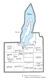
U.S. Census data map showing local municipal boundaries within Grand Traverse County. Shaded areas represent incorporated cities.


See also
 In Spanish: Condado de Grand Traverse para niños
