
Greenbank, Queensland facts for kids
Quick facts for kids GreenbankLogan City, Queensland |
|||||||||||||||
|---|---|---|---|---|---|---|---|---|---|---|---|---|---|---|---|

Original Greenbank State School building, 2014
|
|||||||||||||||

Greenbank
Location in Queensland
|
|||||||||||||||
| Population | 7,694 (2016 census) | ||||||||||||||
| • Density | 69.63/km2 (180.3/sq mi) | ||||||||||||||
| Postcode(s) | 4124 | ||||||||||||||
| Area | 110.5 km2 (42.7 sq mi) | ||||||||||||||
| Time zone | AEST (UTC+10:00) | ||||||||||||||
| Location |
|
||||||||||||||
| LGA(s) | Logan City | ||||||||||||||
| State electorate(s) | Jordan | ||||||||||||||
| Federal Division(s) | Wright | ||||||||||||||
|
|||||||||||||||
Greenbank is a rural residential suburb in the City of Logan, Queensland, Australia. In the 2016 census Greenbank had a population of 7,694 people.
Geography
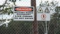
[File:Danger sign, Greenbank Military Range, 2014.JPG|thumb|Danger sign, Greenbank Military Range, 2014] Once divided between the Shire of Beaudesert and Logan City, the Queensland Government's council amalgamations resulted in Greenbank becoming entirely within Logan City, since the 15th March 2008.
The suburb is surrounded by farmland and includes the forested [Greenbank Military Range], which is a registered Australian Heritage Site. A strip of parkland and a watercourse originally named {The Platypus Pools and Bracken Way} is natural habitat to a large species of flora and fauna including live Platypus, the rare Black Cockatoo, Kookaburra, the Blue Wren, King Fisher, Honey Eaters, Owls, Kangaroos, Wallabies, Koalas, Possums, Bearded Dragons, Legless Lizards and Water Monitors up to 2.5 metres in length plus many more species have been sighted living in this natural habitat. The watercourse and natural forest is fed by torrential rains and natural springs dotted throughout the Spring Mountain area. Snakes mostly consisting of (Pythons, Whip Tails and Red Bellied Blacks and to a much lesser degree Brown Snakes), (Bird Spiders, Huntsman, Red Back, Saint Davids Star and the Orb Spider) also share this watercourse and natural forest which runs right through the middle of the residential part of Spring Mountain Estate and continues through to Greenbank, Browns Plains and finishes at Karrawatha National Park.
The parkland stretches along on either side of the watercourse and a variety of walking tracks of different fitness levels are used by residents for casual strolls, nature lovers and serious athletic enthusiasts, horse and bike riding. These walking tracks extend out into different Estates of Greenbank such a Blue Grass, New Beith, Lyons and Teviot Downs Estates which cover more forested areas, while Spring Mountain Estate contains the natural forest areas and watercourse which if followed along the platypus pools and bracken way length; the walking track connects up with neighbouring Boronia Heights.
The size of Greenbank is approximately 49 km². It has 7 parks covering nearly 18% of the total area.
History
The early name of the district was Teviot but derives its present name Greenbank from the name of a cattle property belonging to William Slack.
Greenbank was first settled by Europeans in the 1840s. In the 1880s the main industries were dairying, farming and timber cutting. Cobb and Co had a changing station for their coaches at a hotel on the corner of Teviot Road and Pub Lane; from there, they would travel to Beaudesert via the Old Paradise Road between Acacia Ridge and Jimboomba. When the coach service ceased in 1924, the hotel licence lapsed.
Greenbank Provision School was built by volunteer labour and opened on 23 January 1893 with 12 pupils under teacher Mary Mulroney who received an annual salary of £50. It became Greenbank State School in 1909. It closed between 1943 and 1950 due to low student numbers.
Amenities
The Greenbank Community Centre and Library, operated since March 2008 by the Logan City Council, is located at 145-167 Teviot Road (27°43′49″S 152°59′01″E / 27.73040°S 152.98357°E).
Demographics
The population of Greenbank in 1996 was 5,098 people. By 2001 the population was 5,261 showing a population growth of 3% in the area during that time. In 2011, the figure had grown to 7,328.
Mostly consisting of acreage blocks close to Springfield, Queensland, households in Greenbank are primarily couples with children and are likely to be repaying between $800.00 – $1500.00 per month on mortgage repayments. In general, people in Greenbank work in a trades position occupation, through to management positions and owner operated businesses. In 1996, 84% of the homes in Greenbank were owner-occupied compared with 86% in 2001. In May 2014, the median sale price of houses in the area in Australian dollars was $395,000. As of June 2017, the median sale price of houses had risen to $560,000.
Sports


The Greenbank Recreation Reserve is home to the Greenbank Sports & Recreation Club and the Greenbank Raiders Rugby League Club. Situated on Middle Rd (27°43′11″S 152°59′01″E / 27.71971°S 152.98365°E) the rugby club caters for teams from under 6 to under 18 in 2009. Three teams won premierships in 2009. Under 15 division 4, Under 18 division 1 and the very successful under 16 division 2 which completed the year undefeated. They were minor premiers and won the grand final.
Greenbank is also home to the successful Greenbank Football Club. In 2011, the team made history by winning three senior Premierships and two Championships in three divisions. Greenbank FC is affiliated with Football Brisbane and provides an avenue for both junior and senior players. In 2011, Greenbank FC fielded teams from squirts up to under 14 age groups and both men and women teams. 2016 was Greenbank FC's 40th anniversary.
Education

Greenbank State School is a government primary (Prep-6) school for boys and girls at 12-54 Goodna Road (27°42′37″S 152°58′39″E / 27.7103°S 152.9776°E). In 2013, the school had an enrolment of 1,117 students with 72 teachers (63 full-time equivalent). In 2018, the school had an enrolment of 1,048 students with 76 teachers (66 full-time equivalent) and 37 non-teaching staff (25 full-time equivalent). It includes a special education program.
Everleigh State School is a government primary (Prep-6) school for boys and girls at 46-76 Ivory Parkway (27°44′21″S 152°59′44″E / 27.7391°S 152.9956°E). It opened in January 2022.
There are no secondary schools in Greenbank. The nearest secondary schools are Park Ridge State High School in neighbouring Park Ridge to the east and Springfield Central State High School in Springfield Central to the west.
Images for kids
-
Danger sign, Greenbank Military Range, 2014

