
Hinesville, Georgia facts for kids
Quick facts for kids
Hinesville, Georgia
|
|
|---|---|
| City of Hinesville | |

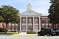
Hinesville city hall
|
|
| Motto(s):
"Home for a day or a lifetime"
|
|

Location in Liberty County and the state of Georgia
|
|

Hinesville, Georgia
Location in the United States
|
|
| Country | United States |
| State | Georgia |
| County | Liberty |
| Area | |
| • City | 18.38 sq mi (47.61 km2) |
| • Land | 18.31 sq mi (47.42 km2) |
| • Water | 0.07 sq mi (0.19 km2) |
| Elevation | 75 ft (23 m) |
| Population
(2020)
|
|
| • City | 34,891 |
| • Density | 1,905.67/sq mi (735.78/km2) |
| • Metro | 77,917 |
| Time zone | UTC-5 (Eastern (EST)) |
| • Summer (DST) | UTC-4 (EDT) |
| ZIP Code |
31310, 31313
|
| Area code(s) | 912 |
| FIPS code | 13-38964 |
| GNIS feature ID | 0331992 |
Hinesville is a city in Liberty County, Georgia, United States, located on the Atlantic coastal plain. The population was 33,437 at the 2010 census and an estimated 33,273 in 2019. The city is the county seat of Liberty County. It is the principal city of the Hinesville metropolitan area, which comprises all of Liberty County, including the Fort Stewart army installation, plus neighboring Long County.
Contents
History
Hinesville was founded in 1837. That same year, the seat of Liberty County was transferred to Hinesville from Riceboro. It was incorporated as a city in 1916. The city is named for Charleton Hines, a state senator.
Geography
Hinesville is located at 31°49′57″N 81°36′42″W / 31.83250°N 81.61167°W (31.832442, -81.611703).
According to the United States Census Bureau, the city has an area of 16.3 square miles (42 km2), of which 16.2 square miles (42 km2) is land and 0.1 square miles (0.26 km2) (0.61%) is water.
Hinesville is located next to the Atlantic coast which has an abundance of coastal streams and waterways. It is known for its pine trees, oaks, deer, wild hogs, and other wildlife. The Cay Creek Wetlands is a waterway that sits in Midway, Georgia and Hinesville in which can be seen nature and the historical Liberty Trail. It is the second largest city on U.S. Route 84 in Georgia after Valdosta. It is 58 miles west from U.S. Route 84 eastern terminus and 275 miles east of Dothan, Alabama.
Demographics
| Historical population | |||
|---|---|---|---|
| Census | Pop. | %± | |
| 1880 | 162 | — | |
| 1910 | 174 | — | |
| 1920 | 315 | 81.0% | |
| 1930 | 416 | 32.1% | |
| 1940 | 630 | 51.4% | |
| 1950 | 1,217 | 93.2% | |
| 1960 | 3,174 | 160.8% | |
| 1970 | 4,115 | 29.6% | |
| 1980 | 11,309 | 174.8% | |
| 1990 | 21,603 | 91.0% | |
| 2000 | 30,392 | 40.7% | |
| 2010 | 33,437 | 10.0% | |
| 2020 | 34,891 | 4.3% | |
| U.S. Decennial Census | |||
2020 census
| Race | Num. | Perc. |
|---|---|---|
| White (non-Hispanic) | 9,796 | 28.08% |
| Black or African American (non-Hispanic) | 16,870 | 48.35% |
| Native American | 96 | 0.28% |
| Asian | 869 | 2.49% |
| Pacific Islander | 318 | 0.91% |
| Other/Mixed | 2,374 | 6.8% |
| Hispanic or Latino | 4,568 | 13.09% |
As of the 2020 United States census, there were 34,891 people, 13,332 households, and 9,354 families residing in the city.
2010 census
As of the 2010 United States Census, there were 33,437 people living in the city. The racial makeup of the city was 45.8% Black, 35.0% White, 0.4% Native American, 2.5% Asian, 0.7% Pacific Islander, 0.2% from some other race and 3.9% from two or more races. 11.5% were Hispanic or Latino of any race.
Sister Cities
Education

The Liberty County School District, based in Hinesville, holds pre-school to 12th grade, and consists of seven elementary schools, three middle schools, and two high schools. As of 2010[update] the district has 674 full-time teachers and over 11,274 students. As of 2014[update] the superintendent is Dr. Valya S. Lee. Liberty County High School and Bradwell Institute are the comprehensive high schools serving the community.
Georgia Southern University's Liberty campus is in the community.
Live Oak Public Libraries operates the Hinesville Library.
Images for kids
-
Hinesville Post Office
-
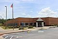
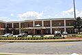
Liberty County High School
-
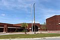
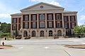
Georgia Southern University Hinesville Campus
-
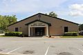
Live Oak Public Libraries
-
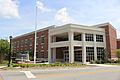
Hinesville Police Department and Law Enforcement Center
-
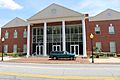
Liberty County Justice Center
-
Liberty County Courthouse Annex
-
Liberty County Recreation Department
-
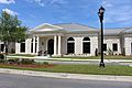
Liberty County Courthouse
-
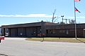
Fire Department


See also
 In Spanish: Hinesville para niños
