Hoylake facts for kids
Quick facts for kids Hoylake |
|
|---|---|
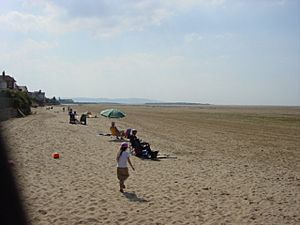 Hoylake beach, looking towards Hilbre Island |
|
| Population | 5,710 (2001 census) |
| OS grid reference | SJ215888 |
| • London | 183 mi (295 km) SE |
| Metropolitan borough | |
| Metropolitan county | |
| Region | |
| Country | England |
| Sovereign state | United Kingdom |
| Post town | WIRRAL |
| Postcode district | CH47, CH48 |
| Dialling code | 0151 |
| ISO 3166 code | GB-WRL |
| Police | Merseyside |
| Fire | Merseyside |
| Ambulance | North West |
| EU Parliament | North West England |
| UK Parliament |
|
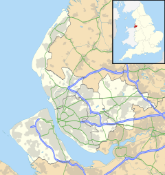
Hoylake is a seaside town in the Metropolitan Borough of Wirral, Merseyside, England. It is at the north west of the Wirral Peninsula, near West Kirby and where the River Dee meets the Irish Sea. Historically part of Cheshire, the Domesday Book recorded it within the Hundred of Wilaveston.
At the 2001 census, the population of Hoylake was 5,710 of a total population of 13,042, as part of the Hoylake and Meols local government ward. By the time of the 2011 census specific population figures for Hoylake were no longer maintained. The total population for the Hoylake and Meols Ward at this census was 13,348.
Contents
History
In 1690, William III set sail from Hoylake, then known as Hyle or High-lake, with a 10,000-strong army to Ireland, where his army was to take part in the Battle of the Boyne. The location of departure remains known as King's Gap. The previous year a large force under Marshal Schomberg had also departed from Hoylake on 12 August, crossing to Ireland to capture Carrickfergus.
The present day township grew up in the nineteenth century around the small fishing village of Hoose, the name of which means "hollows". The 1848 Topographical Dictionary of England described the inhabitants of Hoose as:
"...principally boatmen and fishermen, who have frequently evinced the greatest courage and alacrity in rescuing mariners from the horrors of shipwreck; large banks of sand, extending for miles on the northwest, being annually the scene of most fatal disasters to shipping."
The name Hoylake was derived from Hoyle Lake, a channel of water between Hilbre Island and Dove Point. Protected by a wide sandbank known as Hoyle Bank and with a water depth of about 20 feet, it provided a safe anchorage for ships too large to sail up the Dee to Chester.
Civic history
The township of Hoose was part of the West Kirby Parish of the Wirral Hundred. It existed as a civil parish between 1866 and 1894 when it was merged into Hoylake and West Kirby civil parish. Between 1894 and 1974 Hoylake was governed by its own urban district council. On 1 April 1974, local government reorganisation in England and Wales resulted in most of the Wirral Peninsula, including Hoylake, transfer from the county of Cheshire to the nascent county of Merseyside.
The population of the town over time was measured at 60 in 1801, 589 in 1851 and 2,701 in 1901. The total population of the Hoylake Urban District (which included West Kirby) was recorded as 19,745 in 1931.
Landmarks
The Hoylake and West Kirby War Memorial is a notable local landmark, as it was designed in 1922 by the British sculptor Charles Sargeant Jagger who was responsible for a number of war memorials around the world, including the Royal Artillery Memorial at Hyde Park Corner in London.
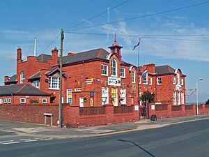
The former Town Hall, on the corner of Albert Road and Market Street, is due to be converted to a new arts centre, known as The Beacon, with craft workshops, restaurant, and flats above.
Kings Gap roundabout is home to a sculpture by Scottish sculptor David Annand. Called 'Knots', it consists of seabirds looping around four poles. It was commissioned by the council as part of the regeneration of Hoylake and was installed in June 2006 in time for the 2006 Open Championship.
Lighthouses
 |
|
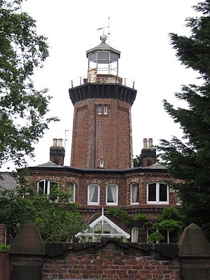
| The old upper lighthouse | |
| Location | Hoylake Merseyside England |
|---|---|
| Coordinates | 53°23′32″N 3°10′57″W / 53.392089°N 3.182614°W |
| Year first constructed | 1764 (first) |
| Year first lit | 1865 (current) |
| Deactivated | 1886 |
| Construction | brick tower |
| Tower shape | octagonal prism tower with balcony and lantern attached to 2-storey keeper's house |
| Markings / pattern | unpainted tower, black balcony, white lantern |
| Height | 17 metres (56 ft) |
| Original lens | 4th order fixed optic (azimuthal condensing) |
| ARLHS number | ENG-055 |
To facilitate safe access into the Hoylake anchorage, two lighthouses were constructed in 1763, at the initiative of William Hutchinson. The lower light was a wooden structure that could be moved according to differing tides and shifting sands to remain aligned to the upper light, which was a permanent brick building. By the start of the 19th century each lighthouse was equipped with a single 3 ft-diameter reflector, built to Hutchinson's design.
Both of these structures were rebuilt a century later, and in 1865 new lenses (a pair of fourth-order fixed optics) were designed and manufactured for the two towers by James Chance. The upper lighthouse, consisting of an octagonal brick tower, last shone on 14 May 1886 and is now part of a private residence in Valentia Road. The building was given Grade II listed status in 1988. The lower lighthouse, closer to the shore in Alderley Road, was deactivated in 1908 and demolished in 1922.
Former landmarks
The Royal Hotel was built by Sir John Stanley in 1792, with the intention of developing the area as a holiday resort. The numerous steam packet vessels sailing between Liverpool and North Wales which called at the hotel provided valuable patronage. By the mid-19th century a racecourse was laid out in the grounds of the hotel. The hotel building was demolished in the 1950s.
Hoylake's lido, located on the promenade, was opened in June 1913 and rebuilt in the late 1920s. In 1976, the Hoylake Pool and Community Trust took over the running of the facility from Wirral Borough Council. The baths finally closed in 1981.
Geography
Hoylake is at the north-western corner of the Wirral Peninsula, and is situated on the eastern side of the mouth of the Dee Estuary and adjacent to the Irish Sea. Hoylake is approximately 11 km (6.8 mi) west-south-west of the River Mersey at New Brighton. The centre of Hoylake is situated at an elevation of about 9 m (30 ft) above sea level.
To the west of the town at Hilbre Point is Red Rocks, a designated Site of Special Scientific Interest. The area is an exposed sandstone outcrop consisting of sand dunes, brackish marsh and reed beds.
 |
Liverpool Bay (Irish Sea) | Liverpool Bay (Irish Sea) | Hightown (across Liverpool Bay) |  |
| Hilbre Islands (across Dee Estuary) | Meols | |||
| Hilbre Islands (across Dee Estuary) | West Kirby | Larton and Newton |
Governance
Hoylake is within the parliamentary constituency of Wirral West. The current Member of Parliament is Margaret Greenwood, a Labour representative.
At local government level, the town is incorporated into the Hoylake and Meols Ward of the Metropolitan Borough of Wirral, in the metropolitan county of Merseyside. It is represented on Wirral Metropolitan Borough Council by three councillors. The most recent local elections took place on 2 May 2019.
Community
Hoylake is a largely residential area and there is an active nightlife in the town centre, which is located at the original village of Hoose.
The town supports a permanent lifeboat station, manned by the RNLI. Initially founded in 1803 by the Mersey Docks and Harbour Board, it is one of the oldest in the country. In 2008, the RNLI began to raise £2 million for a new lifeboat station and new generation all-weather lifeboat, to facilitate a faster response time to emergencies and rescues in the Irish Sea and the rivers Dee and Mersey. The building was opened in November 2009.
The Kings Gap conservation area has been designated by Wirral Borough Council. Bounded by the coastline and the Royal Liverpool Golf Club, it consists of large nineteenth and early twentieth century houses, Hoylake Lighthouse and St Hildeburgh's Church.
Education
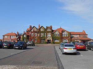
Hoylake includes the independent Kingsmead School, which educates girls and boys from 2 to 16 years old. Hoylake Holy Trinity C of E Primary School is the town's main primary school, educating children from the ages of 3 to 11.
Sport
Golf
Hoylake is the home of the Royal Liverpool Golf Club, built in 1869 on the site of the Royal Hotel racecourse. It is the second oldest golf links in England, predated only by the Royal North Devon Golf Club, in Westward Ho!, Devon. It has hosted many major tournaments such as the Open Championship and the Walker Cup. The club is often referred to as "Hoylake". It hosted the Open again in July 2006, after a gap of almost 40 years, with Tiger Woods earning the Claret Jug for the second year in a row. The 2014 Open Championship is the most recent of the event to be held at Hoylake. This was won by Rory McIlroy. The Open is due to return to the course for the 13th time in 2022.
Hoylake-born amateur golfer John Ball Jnr. won the Open in 1890, becoming the first Englishman to do so. Another local amateur, Harold Hilton became Open champion two years later. He won again in 1897 at his home club of Royal Liverpool.
On the other side of Meols Drive and the railway is Hoylake Municipal Golf course which is used by Hoylake Golf Club (since 1933), West Hoyle GC and Irby GC. It was used as the 2006 Open Championship practice course.
Rugby Union
Hoylake RFC rugby club was founded in 1922. They currently play in South Lancs/Cheshire Division One, the seventh tier of English rugby. Its predecessor, connected with the Royal Liverpool Golf Club, had been founded in the 1890s. British Open golf champion Harold Hilton was also captain of the rugby team for the 1890–91 season.
Swimming
Hoylake ASC was founded in 1931. The club now trains at the West Kirby Concourse and the Calday Grange Swimming Pool.
Sailing
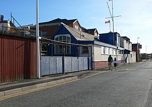
Hoylake Sailing Club was founded in 1887 and has a clubhouse and boatyard on North Parade. The club hosts an annual regatta and sends a team to the Southport 24 Hour Race.
Sand yachting
Hoylake is one of the premier sites for sand yachting in Britain, with banks around a quarter of a mile offshore. The town's beach was the venue for the European Sand Yacht Championships in 2007 and 2011 and hosted the 2017 event with Laytown & Bettystown, County Meath.
Cricket
Cricket was played at the now disused Ellerman Lines Cricket Ground from as early as the 1920s, when the then newly formed West Wirral Cricket Club played at the ground. It was later sold to Ellerman Lines, who transformed the site into their social club. Cheshire played minor counties cricket there from 1957 to 1968. The ground also held Cheshire's first ever appearance in List A cricket against Surrey in the first round of the 1964 Gillette Cup.
The ground was later sold, with the site becoming a nightclub, before being demolished following a fire. In 2011 the site of the ground was selected for construction of 62 affordable homes. Planning permission for this, and a revised plan for 26 properties, were refused. In 2020 a further planning proposal was submitted for 30 semi-detached bungalows and up to 61 assisted living retirement apartments.
Transport
Hoylake and Manor Road railway stations serve the town. Both are on the West Kirby branch of Merseyrail's Wirral line.
See also
 In Spanish: Hoylake para niños


