
Image: 2007SanDiegoFiresradar1008z
Size of this preview: 800 × 500 pixels. Other resolutions: 320 × 200 pixels | 829 × 518 pixels.
Original image (829 × 518 pixels, file size: 345 KB, MIME type: image/png)
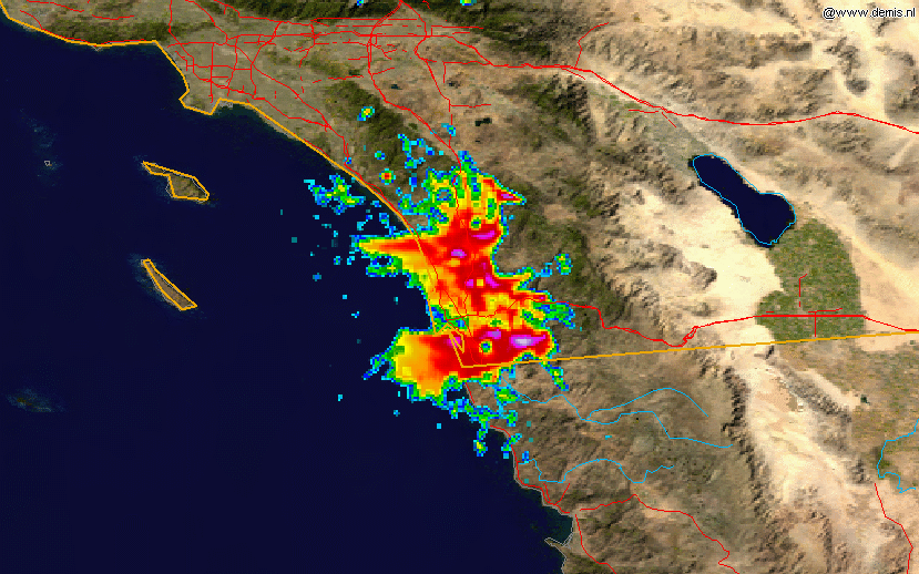
Description: This radar image shows the smoke plume from the southern California fires of 2007 on 2007-10-23, at 10:08 UTC, overlain on a map. The data is from the NWS NEXRAD radar at KNKX (San Diego) and was processed in the NCDC's JAVA NEXRAD tool.
Title: 2007SanDiegoFiresradar1008z
Credit: Radar data is from the NCDC NEXRAD database and the background map is from the NASA.
Author: Background map by NASA. Radar data from NCDC. Image created by Hello32020.
Usage Terms: Public domain
License: Public domain
Attribution Required?: No
Image usage
The following 2 pages link to this image:

All content from Kiddle encyclopedia articles (including the article images and facts) can be freely used under Attribution-ShareAlike license, unless stated otherwise.