
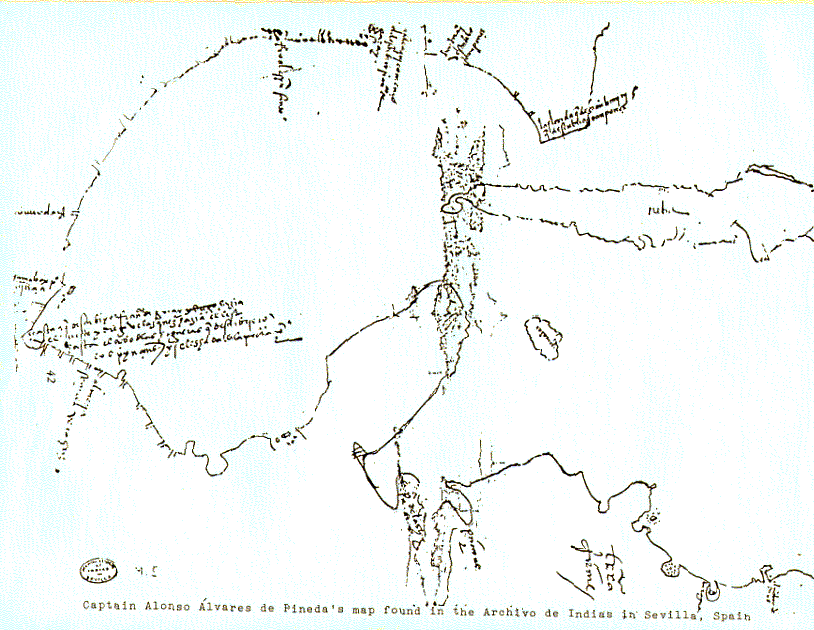
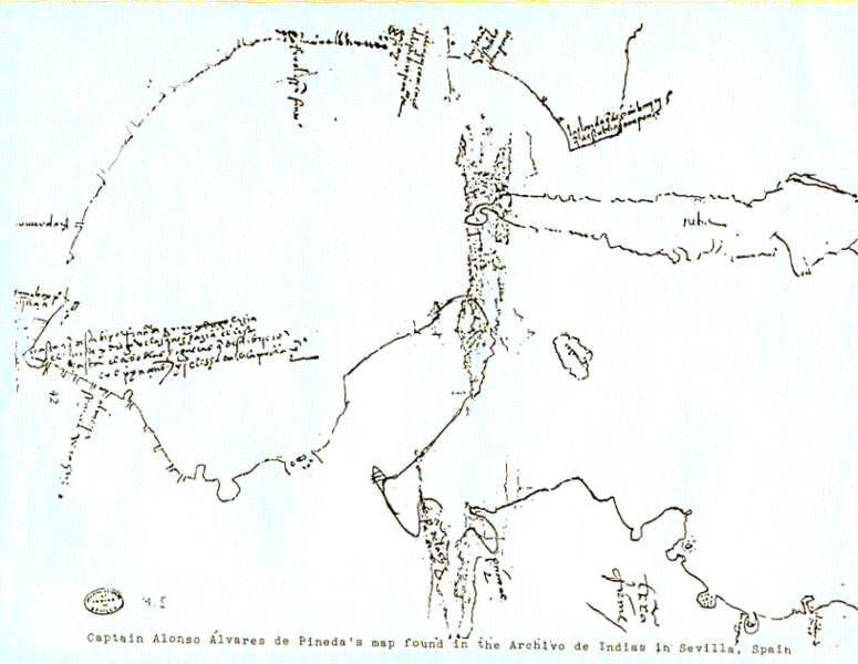
Image: Alonso Alvarez de Pineda Map of Gulf Coast
Size of this preview: 775 × 600 pixels. Other resolutions: 310 × 240 pixels | 814 × 630 pixels.
Original image (814 × 630 pixels, file size: 68 KB, MIME type: image/png)
Description: The map drawn by Alonso Alvarez de Pineda of the coast of the Gulf of Mexico in 1519.
Title: Alonso Alvarez de Pineda Map of Gulf Coast
Credit: Scan or photograph of 1519 map. Transferred from en.wikipedia to Commons. http://pares.mcu.es/ParesBusquedas/servlets/Control_servlet?accion=3&txt_id_desc_ud=20814&fromagenda=N
Author: Alonso Alvarez de Pineda
Usage Terms: Public domain
License: Public domain
Attribution Required?: No
Image usage
The following page links to this image:

All content from Kiddle encyclopedia articles (including the article images and facts) can be freely used under Attribution-ShareAlike license, unless stated otherwise.