
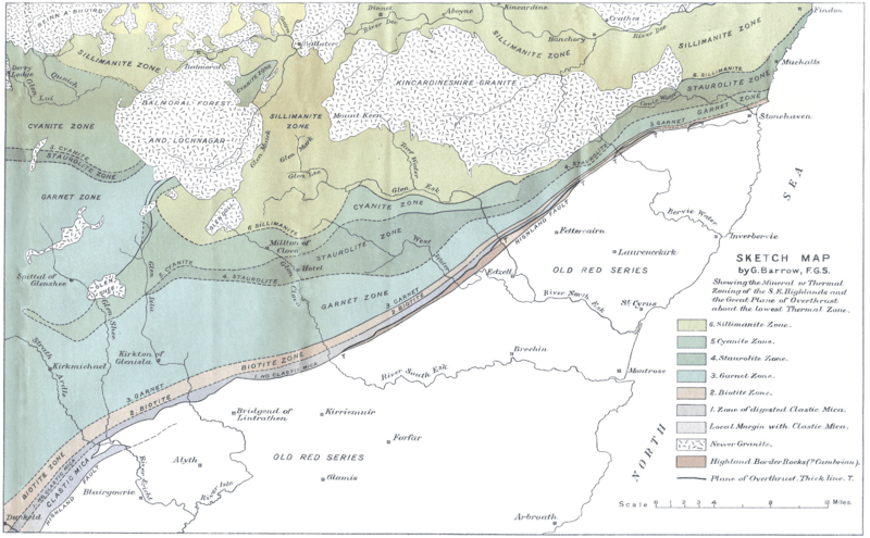
Image: BarrowHighlandBoundaryFault

Size of this preview: 800 × 495 pixels. Other resolutions: 320 × 198 pixels | 3,039 × 1,880 pixels.
Original image (3,039 × 1,880 pixels, file size: 6.55 MB, MIME type: image/png)
Description: Map by George Barrow published in 1912 showing what became known as the Highland Boundary Fault
Title: BarrowHighlandBoundaryFault
Credit: On the Geology of Lower Dee-side and the Southern Highland Border. Proceedings of the Geologists' Association,1912. Volume 23, Issue 5, page 268-273. doi:10.1016/S0016-7878(12)80018-6
Author: George Barrow, 1853–1932
Usage Terms: Public domain
License: Public domain
Attribution Required?: No
Image usage
The following page links to this image:

All content from Kiddle encyclopedia articles (including the article images and facts) can be freely used under Attribution-ShareAlike license, unless stated otherwise.