
Image: Box hill map
No higher resolution available.
Box_hill_map.png (287 × 290 pixels, file size: 45 KB, MIME type: image/png)
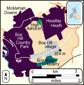
Description: Map of Box Hill in Surrey, showing areas managed by the National Trust (purple), Surrey County Council (green) and Surrey Wildlife Trust (turquoise). Box Hill village is indicated in grey. Created in Inkscape. Map data from Open Source Maps.
Title: Box hill map
Credit: Own work
Author: Mertbiol
Usage Terms: Creative Commons Attribution-Share Alike 3.0
License: CC BY-SA 3.0
License Link: http://creativecommons.org/licenses/by-sa/3.0
Attribution Required?: Yes
Image usage
The following page links to this image:

All content from Kiddle encyclopedia articles (including the article images and facts) can be freely used under Attribution-ShareAlike license, unless stated otherwise.