
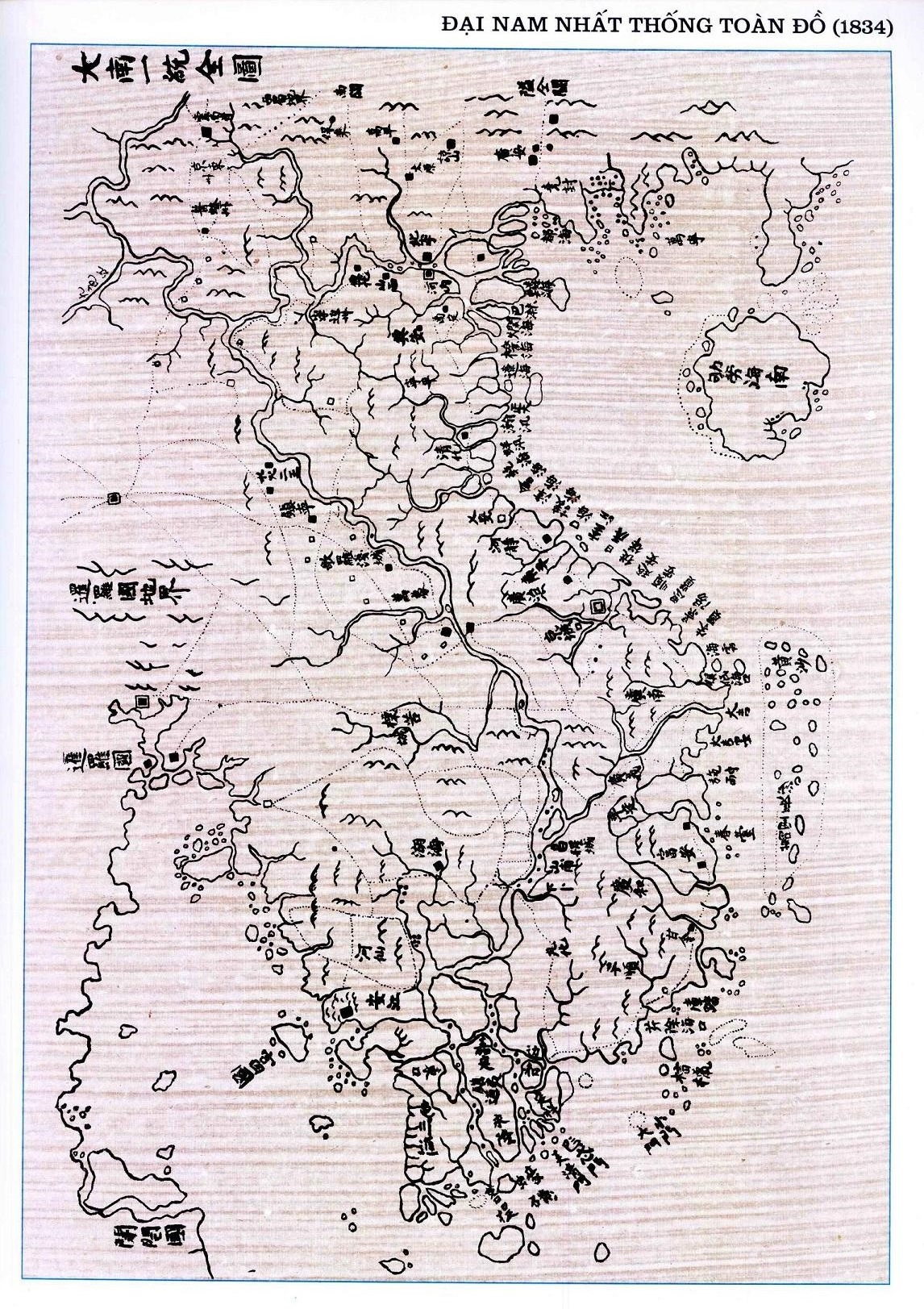
Image: DaiNamNhatThongToanDo 1834-1838
Size of this preview: 423 × 599 pixels. Other resolutions: 169 × 240 pixels | 1,146 × 1,623 pixels.
Original image (1,146 × 1,623 pixels, file size: 890 KB, MIME type: image/jpeg)
Description: Vietnamese map showing the Spratly and Paracel Islands in the 19th century. Background: between 1834 and 1838, at the time of Emperor Minh Mang, Phan Huy Chú published the Đại Nam Thống Nhất Toàn Đồ (the Unified Đại Nam Complete Map) that distinctly delineated Vạn Lý Trường Sa, the present-day Spratly Islands, from Hoàng Sa, the present-day Paracel archipelago. Vạn Lý Trường Sa:Ten-thousand-league Long Sandbank. Hoàng Sa: Golden Sandbank.
Title: DaiNamNhatThongToanDo 1834-1838
Credit: Own work by the original uploader *Source: Vietnam - public domain
Author: en:Phan Huy Chú (1782–1840)
Usage Terms: Public domain
License: Public domain
Attribution Required?: No
Image usage
The following page links to this image:

All content from Kiddle encyclopedia articles (including the article images and facts) can be freely used under Attribution-ShareAlike license, unless stated otherwise.