
Image: Durham UK location map

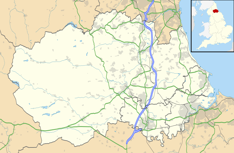
Description: Map of County Durham, UK with the following information shown: Administrative borders Coastline, lakes and rivers Roads and railways Urban areas Equirectangular map projection on WGS 84 datum, with N/S stretched 170% Geographic limits: West: 2.40W East: 1.05W North: 54.95N South: 54.43N
Title: Durham UK location map
Credit: Ordnance Survey OpenData. Administrative borders and coastline data from Boundary-Line product. All other geographic data from Meridian 2 product. Inset derived from England location map.svg by Spischot.
Author: Nilfanion, created using Ordnance Survey data
Permission: This file is licensed under the Creative Commons Attribution-Share Alike 3.0 Unported license. Attribution: Contains Ordnance Survey data © Crown copyright and database right You are free: to share – to copy, distribute and transmit the work to remix – to adapt the work Under the following conditions: attribution – You must attribute the work in the manner specified by the author or licensor (but not in any way that suggests that they endorse you or your use of the work). share alike – If you alter, transform, or build upon this work, you may distribute the resulting work only under the same or similar license to this one. http://creativecommons.org/licenses/by-sa/3.0 CC BY-SA 3.0 Creative Commons Attribution-Share Alike 3.0 truetrue
Usage Terms: Creative Commons Attribution-Share Alike 3.0
License: CC BY-SA 3.0
License Link: http://creativecommons.org/licenses/by-sa/3.0
Attribution Required?: Yes
Image usage
More than 100 pages link to this image. The following list shows the first 100 page links to this image only. A full list is available.
- Aislaby, County Durham
- Annfield Plain
- Archdeacon Newton
- Barforth
- Barmpton
- Barnard Castle
- Barningham, County Durham
- Beamish, County Durham
- Bearpark
- Belmont, County Durham
- Billingham
- Bishop Auckland
- Bishopton, County Durham
- Blackwell, County Durham
- Brafferton, County Durham
- Brandon, County Durham
- Branksome, County Durham
- Bridge End, County Durham
- Burnhope
- Burnopfield
- Butsfield
- Carlton, County Durham
- Causey, County Durham
- Chester-le-Street
- Chilton, County Durham
- Cockfield, County Durham
- Consett
- Copley, County Durham
- Crook, County Durham
- Daddry Shield
- Darlington
- Denton, County Durham
- Durham, England
- Eaglescliffe
- Easington, County Durham
- East Briscoe
- East Hedleyhope
- Eastbourne, County Durham
- Eastgate, County Durham
- Elton, County Durham
- Elvet
- Elwick, County Durham
- Esh, County Durham
- Fairfield, County Durham
- Ferryhill
- Fir Tree, County Durham
- Flint Hill, County Durham
- Gainford, County Durham
- Grange Hill, County Durham
- Grindon, County Durham
- Hardwick, County Durham
- Hart, County Durham
- Hartburn, County Durham
- Hartlepool
- Haswell, County Durham
- Hawthorn, County Durham
- Heighington, County Durham
- High Dyke, County Durham
- Holwick
- Lanchester, County Durham
- Ludworth, County Durham
- Mickleton, County Durham
- Mowden, County Durham
- Murton, County Durham
- Neasham
- Nettlesworth
- New Lambton, County Durham
- Newton Aycliffe
- Newton Bewley
- Norton, County Durham
- Ovington, County Durham
- Oxhill, County Durham
- Pelton Fell
- Perkinsville, County Durham
- Peterlee
- Quaking Houses
- Quebec, County Durham
- Royal Oak, County Durham
- Sacriston
- Scargill, County Durham
- Seaham
- Seaton, County Durham
- Sedgefield
- Sheraton, County Durham
- Sherburn, County Durham
- Shildon
- South Side, County Durham
- Spennymoor
- St John's Chapel, County Durham
- Stainton, County Durham
- Stanhope, County Durham
- Stanley, County Durham
- Stillington, County Durham
- Stockton-on-Tees
- The Grove, County Durham
- Thornley, Durham
- Todhills, County Durham
- Toft Hill, County Durham
- Toronto, County Durham
- Tow Law
