
Image: GreatBlackSwampMap
No higher resolution available.
GreatBlackSwampMap.png (500 × 500 pixels, file size: 129 KB, MIME type: image/png)
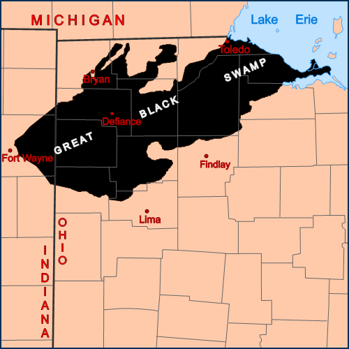
Description: Map showing the area of NW Ohio and NE Indiana once covered by the Great Black Swamp.
Title: GreatBlackSwampMap
Credit: Self-made, based on USGS data. Note: The swamp boundaries shown on this map are consistent with those shown on the map, Changing Landscape - the Great Black Swamp, on the St. Joseph River Watershed Initiative's Western Lake Erie Conservation Assessment Project – St. Joseph River Watershed page: http://www.sjrwi.org/cp_5.
Author: Drdpw
Usage Terms: Creative Commons Attribution-Share Alike 2.5
License: CC BY-SA 2.5
License Link: https://creativecommons.org/licenses/by-sa/2.5
Attribution Required?: Yes
Image usage
The following 2 pages link to this image:

All content from Kiddle encyclopedia articles (including the article images and facts) can be freely used under Attribution-ShareAlike license, unless stated otherwise.