
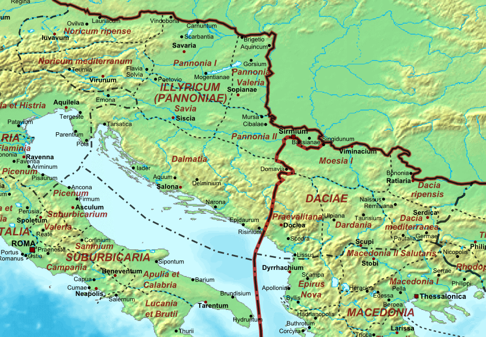
Image: Illyricum & Dacia - AD 400
Size of this preview: 800 × 554 pixels. Other resolutions: 320 × 222 pixels | 971 × 673 pixels.
Original image (971 × 673 pixels, file size: 368 KB, MIME type: image/png)
Description: Map of the Roman Empire ca. 400 AD, showing the administrative division into dioceses and provinces, as well as the major cities. The demarcation between Eastern and Western Empires is noted in red.
Title: Illyricum & Dacia - AD 400
Credit: This file was derived from: The Roman Empire ca 400 AD.png:
Author: The_Roman_Empire_ca_400_AD.png: Cplakidas derivative work: Jbribeiro1
Usage Terms: Public domain
License: Public domain
Attribution Required?: No
Image usage
The following page links to this image:

All content from Kiddle encyclopedia articles (including the article images and facts) can be freely used under Attribution-ShareAlike license, unless stated otherwise.