
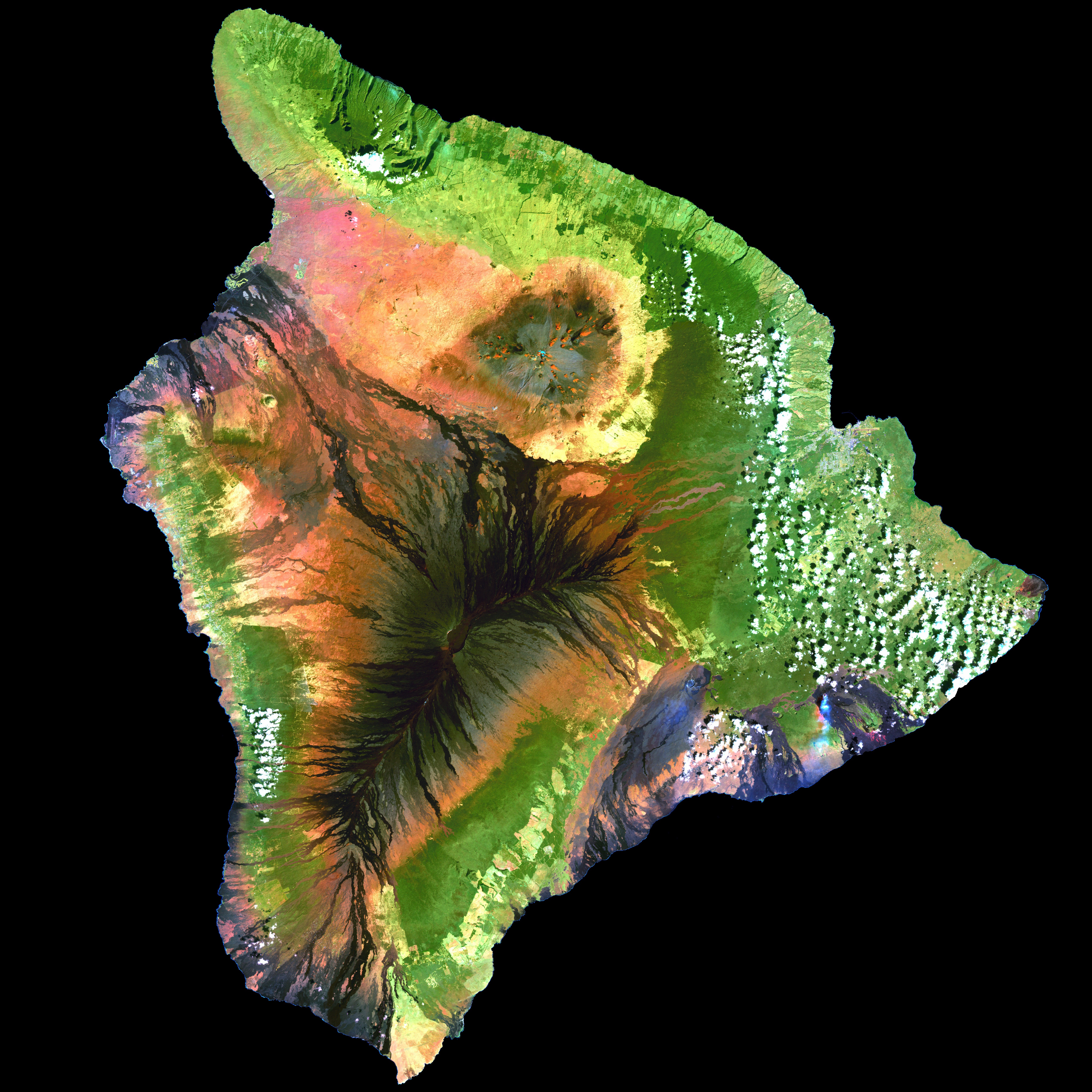
Image: Island of Hawai'i - Landsat mosaic
Size of this preview: 600 × 600 pixels. Other resolutions: 240 × 240 pixels | 5,076 × 5,076 pixels.
Original image (5,076 × 5,076 pixels, file size: 5.19 MB, MIME type: image/jpeg)
Description: This simulated true-color image of the island of Hawai'i was derived from data gathered by the Enhanced Thematic Mapper plus (ETM+) on the Landsat 7 satellite between 1999 and 2001.
Title: Island of Hawai'i - Landsat mosaic
Credit: Image and its description.
Author: Hawaii Land Cover Analysis project, NOAA Coastal Services Center
Permission: Public domain - original work of NASA and NOAA
Usage Terms: Public domain
License: Public domain
Attribution Required?: No
Image usage
The following 3 pages link to this image:

All content from Kiddle encyclopedia articles (including the article images and facts) can be freely used under Attribution-ShareAlike license, unless stated otherwise.