
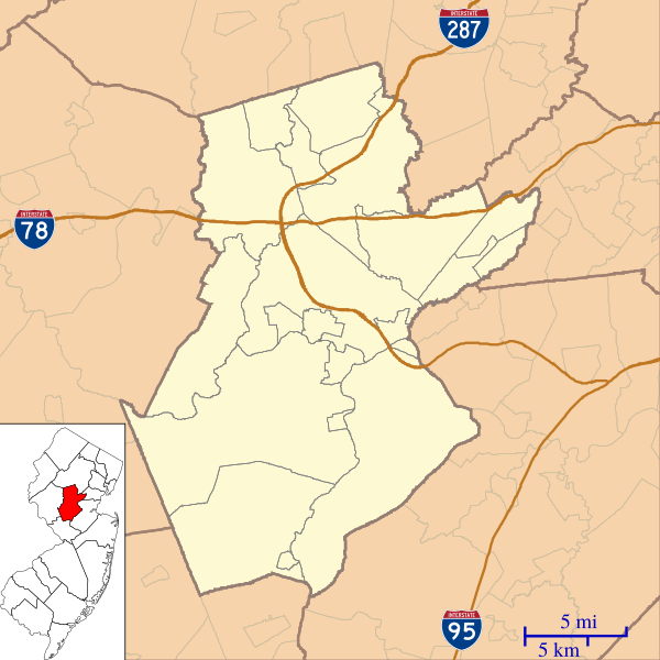
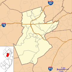
Image: Location map of Somerset County, New Jersey

Size of this PNG preview of this SVG file: 600 × 600 pixels. Other resolution: 240 × 240 pixels.
Original image (SVG file, nominally 768 × 768 pixels, file size: 355 KB)
Description: This is a map of Somerset County, New Jersey, USA.
Title: Location map of Somerset County, New Jersey
Credit: My own work, using custom-written MapScript applications with United States Census Bureau data
Author: Omnedon
Usage Terms: Public domain
License: Public domain
Attribution Required?: No
Image usage
The following 66 pages link to this image:
- Amwell, New Jersey
- Basking Ridge, New Jersey
- Belle Mead, New Jersey
- Bernardsville station
- Blackwells Mills, New Jersey
- Blawenburg, New Jersey
- Bradley Gardens, New Jersey
- Brick Academy
- Bridgewater Township, New Jersey
- Clyde, New Jersey
- Dutchtown, Somerset County, New Jersey
- East Franklin, New Jersey
- East Millstone, New Jersey
- East Rocky Hill, New Jersey
- Far Hills station
- Finderne, New Jersey
- Flagtown, New Jersey
- Franklin Center, New Jersey
- General John Frelinghuysen House
- Gladstone, New Jersey
- Green Knoll, New Jersey
- Griggstown, New Jersey
- Harlingen, New Jersey
- Hutcheson Memorial Forest
- Jacobus Vanderveer House
- John Parker Tavern
- Lamington, New Jersey
- Lamington River
- Liberty Corner, New Jersey
- Lyons, New Jersey
- Lyons station
- Martinsville, New Jersey
- Middle Brook (Raritan River tributary)
- Middlebrook, New Jersey
- Middlebrook encampment
- Middlebush, New Jersey
- Middlebush Village Historic District
- Millstone Valley Agricultural District
- Moggy Hollow Natural Area
- Neshanic, New Jersey
- Neshanic Station, New Jersey
- North Branch, New Jersey
- Old Dutch Parsonage
- Old Stone Arch Bridge (Bound Brook, New Jersey)
- Pleasant Plains, New Jersey
- Pluckemin, New Jersey
- Pluckemin Village Historic District
- Presbyterian Church at Bound Brook
- Presbyterian Church in Basking Ridge
- River Road Historic Rural District
- Rockingham, New Jersey
- Rockingham (house)
- Six Mile Run, New Jersey
- Skillman, New Jersey
- Somerville, New Jersey
- South Branch, New Jersey
- Staats House (South Bound Brook, New Jersey)
- Ten Mile Run, New Jersey
- Tulipwood (Somerset, New Jersey)
- Van Veghten House
- Van Wickle House
- Voorhees (CDP), New Jersey
- Wallace House (Somerville, New Jersey)
- Weston, New Jersey
- Zarephath, New Jersey
- Zion, New Jersey

All content from Kiddle encyclopedia articles (including the article images and facts) can be freely used under Attribution-ShareAlike license, unless stated otherwise.