
Image: MRT Route Map MR

Size of this preview: 800 × 560 pixels. Other resolutions: 320 × 224 pixels | 1,000 × 700 pixels.
Original image (1,000 × 700 pixels, file size: 41 KB, MIME type: image/png)
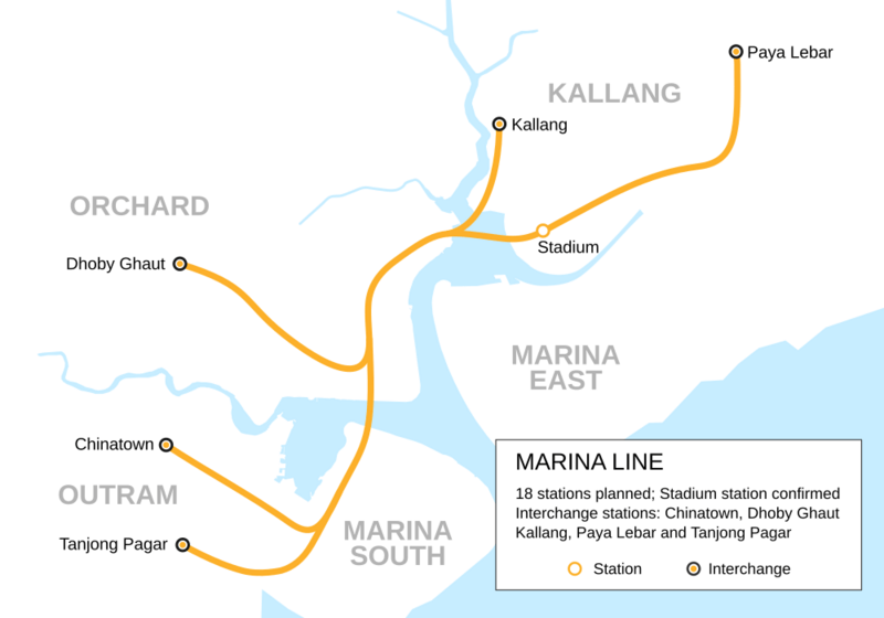
Description: Route map of the planned Marina Line as announced in 1997. Segments of it were eventually merged into the Circle Line and Downtown Line, with the extensions to Tanjong Pagar and Kallang stations scrapped.
Title: MRT Route Map MR
Credit: Own work
Author: Seloloving
Usage Terms: Creative Commons Attribution-Share Alike 4.0
License: CC BY-SA 4.0
License Link: https://creativecommons.org/licenses/by-sa/4.0
Attribution Required?: Yes
Image usage
The following 3 pages link to this image:

All content from Kiddle encyclopedia articles (including the article images and facts) can be freely used under Attribution-ShareAlike license, unless stated otherwise.