
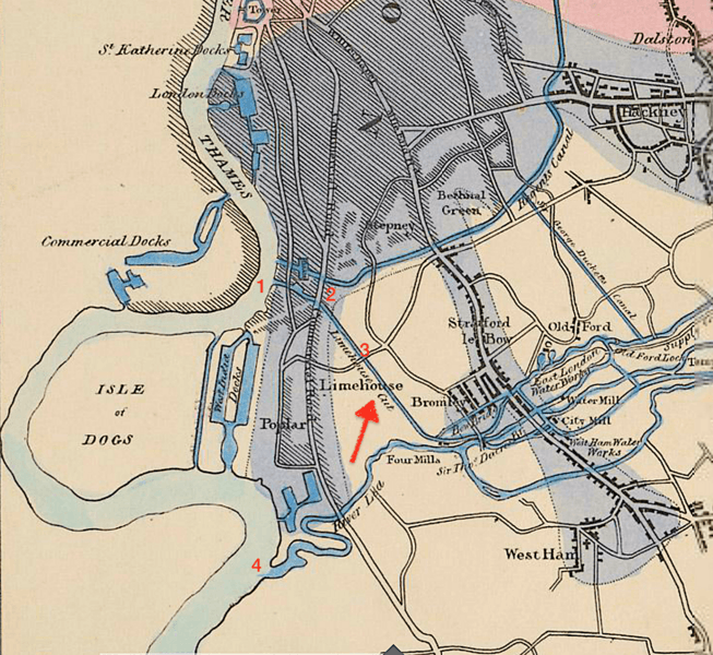
Image: Map of the southern end of the River Lee Navigation

Size of this preview: 653 × 600 pixels. Other resolutions: 261 × 240 pixels | 1,214 × 1,115 pixels.
Original image (1,214 × 1,115 pixels, file size: 2.68 MB, MIME type: image/png)
Description: The Lime House Cut shown in relation to the Lee Navigation and the River Thames
Title: Map of the southern end of the River Lee Navigation
Credit: British Library
Author: Thomas Telford
Usage Terms: Public domain
License: Public domain
Attribution Required?: No
Image usage
The following page links to this image:

All content from Kiddle encyclopedia articles (including the article images and facts) can be freely used under Attribution-ShareAlike license, unless stated otherwise.