
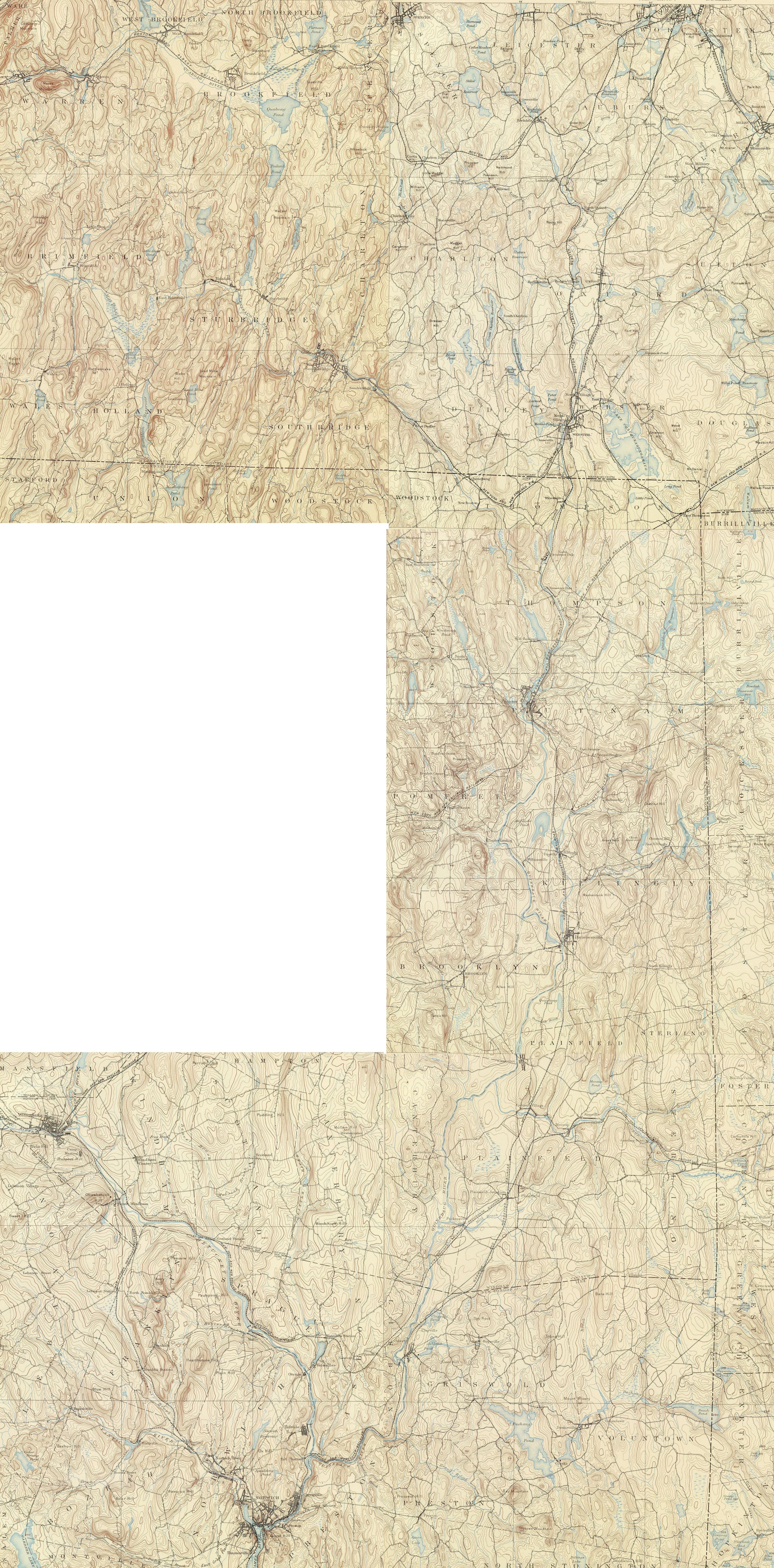
Image: Quinebaug River (Massachusetts + Connecticut) map
Size of this preview: 296 × 599 pixels. Other resolutions: 118 × 240 pixels | 3,918 × 7,935 pixels.
Original image (3,918 × 7,935 pixels, file size: 9.59 MB, MIME type: image/jpeg)
Description: Map of the Quinebaug River and environs, Massachusetts and Connecticut, USA.
Title: Quinebaug River (Massachusetts + Connecticut) map
Credit: This image is stitched together from 5 maps in the following series: United States Geological Survey, 1893, sheets for Massachusetts (Brookfield, Webster) and Connecticut (Putnam, Moosup, Norwich). Published in the Topographic Atlases for the Commonwealth of Massachusetts and State of Connecticut, 1893.
Author: United States Geological Survey, US Department of the Interior.
Permission: Public domain - original work of the US Federal Government.
Usage Terms: Public domain
License: Public domain
Attribution Required?: No
Image usage
The following page links to this image:

All content from Kiddle encyclopedia articles (including the article images and facts) can be freely used under Attribution-ShareAlike license, unless stated otherwise.
_map.jpg)