
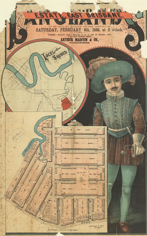
Image: Real estate map of Langlands Estate East, Brisbane, 1886 (25795153513)
Description: Creator: Arthur Martin & Co., Auctioneers ; Nicholas W. Bell, Suveyor. Location: Coorparoo, Brisbane, Queensland. Description: Plan of allotments to be sold Saturday, 6th February, 1886. Estate covers area now in Coorparoo and Greenslopes. With sketch illustration (uniformal human figure) Published by McKellar lithographer (Brisbane). 104 x 60 cm. Map includes conditions of purchase, with locality map. Read more about SLQ's map collections: http://blogs.slq.qld.gov.au/?s=maps View this image at the State Library of Queensland: http://hdl.handle.net/10462/deriv/264265 Information about State Library of Queensland’s collection: http://www.slq.qld.gov.au/resources/picture-queensland You are free to use this image without permission. Please attribute State Library of Queensland.
Title: Real estate map of Langlands Estate East, Brisbane, 1886 (25795153513)
Credit: https://www.flickr.com/photos/statelibraryqueensland/25795153513/
Author: State Library of Queensland, Australia
Permission: At the time of upload, the image license was automatically confirmed using the Flickr API. For more information see Flickr API detail.
Usage Terms: Public domain
License: Public domain
Attribution Required?: No
Image usage
The following page links to this image:

.jpg)