
Image: Satellite image of Cape peninsula

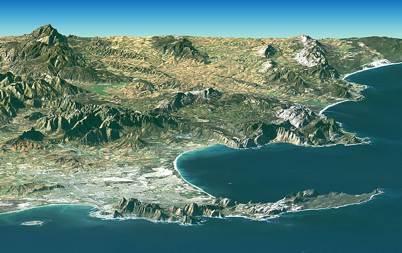
Description: PIA04961: Cape Town, South Africa, Perspective View, Landsat Image over SRTM Elevation. Cape Town and the Cape of Good Hope, South Africa, appear in the foreground of this perspective view generated from a Landsat satellite image and elevation data from the Shuttle Radar Topography Mission (SRTM). The city center is located at Table Bay (at the lower left), adjacent to Table Mountain, a 1,086-meter (3,563-foot) tall sandstone and granite natural landmark. The large bay facing right (South) is False Bay. The perspective is computer generated, combining a photograph with elevation data collected using radar. This Landsat and SRTM perspective view uses a 2-times vertical exaggeration to enhance topographic expression. The back edges of the data sets form a false horizon and a false sky was added. Colors of the scene were enhanced by image processing but are the natural color band combination from the Landsat satellite.
Title: Satellite image of Cape peninsula
Credit: 8.727 MB TIFF ALSO AVAILABLE: http://photojournal.jpl.nasa.gov/catalog/PIA04961 http://www.nasa.gov/multimedia/imagegallery/image_feature_186.html
Author: NASA
Usage Terms: Public domain
License: Public domain
Attribution Required?: No
Image usage
The following 3 pages link to this image:
