
Image: Swisstopo Matterhorn

Size of this preview: 630 × 600 pixels. Other resolutions: 252 × 240 pixels | 3,174 × 3,021 pixels.
Original image (3,174 × 3,021 pixels, file size: 9.49 MB, MIME type: image/jpeg)
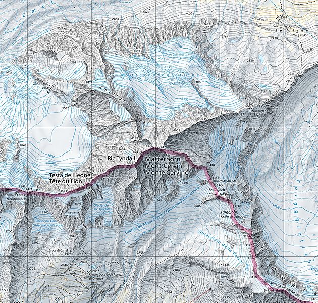
Description: Extract of the 1:25'000 national map (1347 Matterhorn). The map is centered on the Matterhorn and shows the international border between Switzerland and Italy (in magenta). Full version can be consulted on the geographical portal.
Title: Swisstopo Matterhorn
Credit: Original TIFF file: Swiss Map Raster 25 Geographical portal: map.geo.admin.ch
Author: Bundesamt für Landestopografie swisstopo
Usage Terms: Attribution-Swisstopo
License: Attribution-Swisstopo
License Link: {{{tos_url}}}
Attribution Required?: Yes
Image usage
The following page links to this image:

All content from Kiddle encyclopedia articles (including the article images and facts) can be freely used under Attribution-ShareAlike license, unless stated otherwise.