
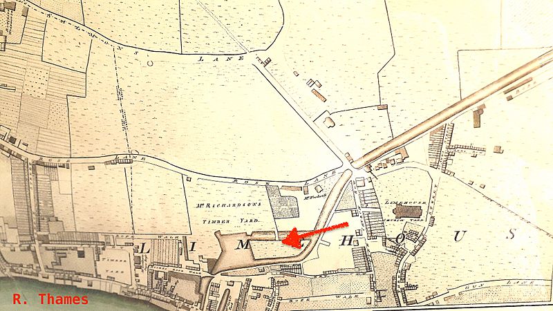
Image: The Limehouse end of the Limehouse Cut c.1800

Size of this preview: 800 × 450 pixels. Other resolutions: 320 × 180 pixels | 4,128 × 2,322 pixels.
Original image (4,128 × 2,322 pixels, file size: 3.07 MB, MIME type: image/jpeg)
Description: Extract from Richard Horwood's 'Plan of the Cities of London and Westminster' (1799) showing the southwestern end of the Limehouse Cut, including the first Limehouse basin with its island (denoted by arrow).
Title: The Limehouse end of the Limehouse Cut c.1800
Credit: Horwood, 'Plan of the Cities of London and Westminster', 1799
Author: Horwood
Usage Terms: Public domain
License: Public domain
Attribution Required?: No
Image usage
The following page links to this image:

All content from Kiddle encyclopedia articles (including the article images and facts) can be freely used under Attribution-ShareAlike license, unless stated otherwise.