
Image: The River Lea navigation in Elizabethan times (map)

Size of this preview: 800 × 429 pixels. Other resolutions: 320 × 172 pixels | 1,531 × 821 pixels.
Original image (1,531 × 821 pixels, file size: 475 KB, MIME type: image/png)
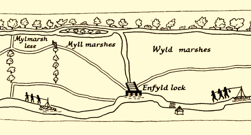
Description: Detail from a large strip map preserved at Hatfield House, England showing river traffic on the Lea c.1594. In this extract boatmen are depicted towing barges near Enfield.
Title: The River Lea navigation in Elizabethan times (map)
Credit: Bull. G.B.G., 'Elizabethan Maps of the Lower Lea Valley', The Geographical Journal, Vol. 124, No. 3 (Sep., 1958), pp. 375-378
Author: Humphrey Gyfforde (attrib)
Usage Terms: Public domain
License: Public domain
Attribution Required?: No
Image usage
The following page links to this image:

All content from Kiddle encyclopedia articles (including the article images and facts) can be freely used under Attribution-ShareAlike license, unless stated otherwise.
.png)