
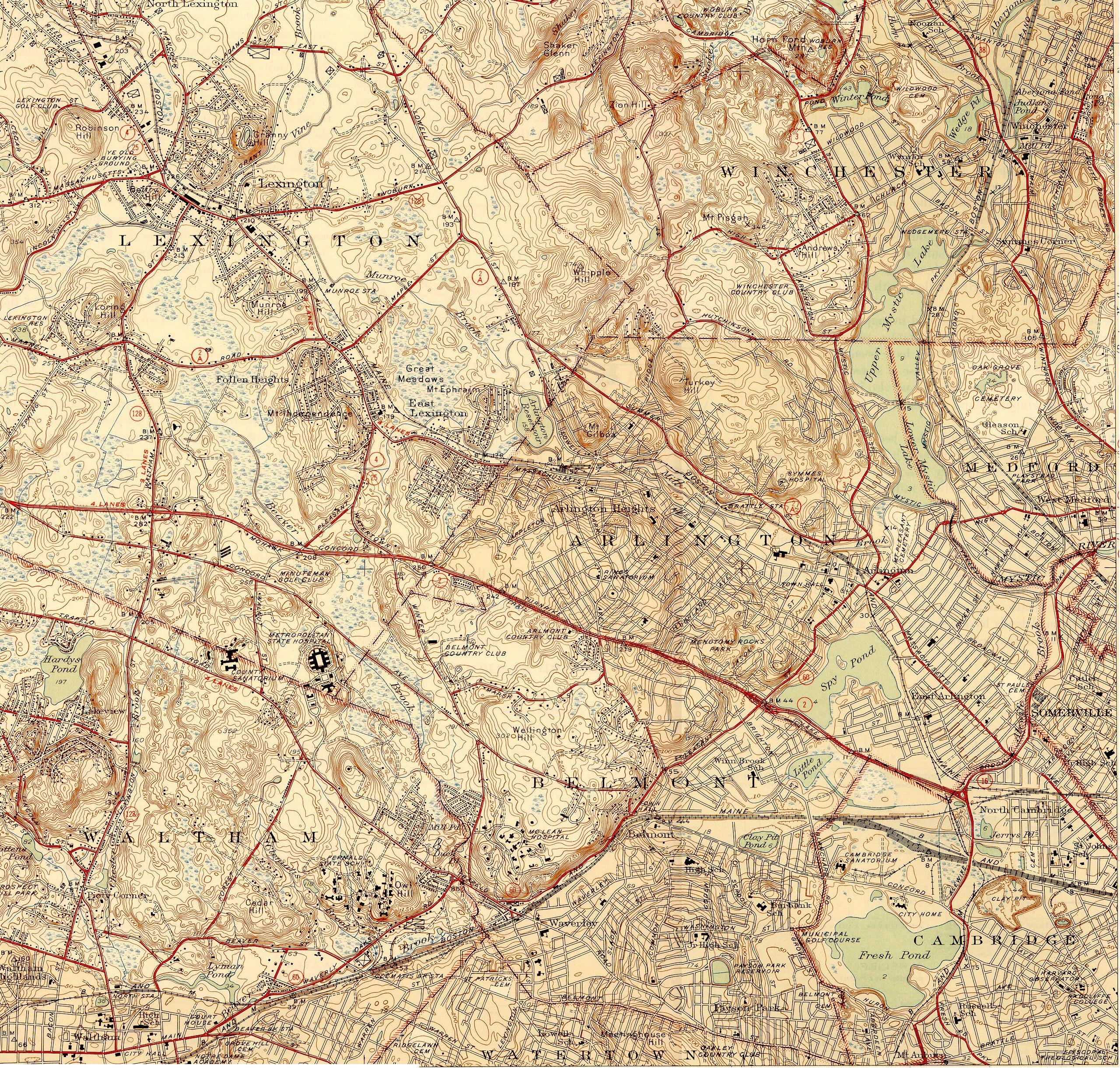
Image: Topographic maps of Arlington, Belmont, Lexington Massachusetts 1946
Size of this preview: 629 × 600 pixels. Other resolutions: 252 × 240 pixels | 2,560 × 2,440 pixels.
Original image (2,560 × 2,440 pixels, file size: 2.68 MB, MIME type: image/jpeg)
Description: Topographic maps of Arlington, Belmont, and Lexington, Massachusetts, as of 1946. Also includes much of Winchester.
Title: Topographic maps of Arlington, Belmont, Lexington Massachusetts 1946
Credit: USGS 7.5 Minute Series, Lexington, MA Quadrangle, 1946. Surveyed 1943.
Author: United States Geological Survey, US Department of the Interior.
Permission: Public domain - original work of the US Federal Government.
Usage Terms: Public domain
License: Public domain
Attribution Required?: No
Image usage
The following 4 pages link to this image:

All content from Kiddle encyclopedia articles (including the article images and facts) can be freely used under Attribution-ShareAlike license, unless stated otherwise.