
Image: WestPoint1780
Size of this preview: 433 × 599 pixels. Other resolutions: 173 × 240 pixels | 2,656 × 3,672 pixels.
Original image (2,656 × 3,672 pixels, file size: 3.51 MB, MIME type: image/jpeg)
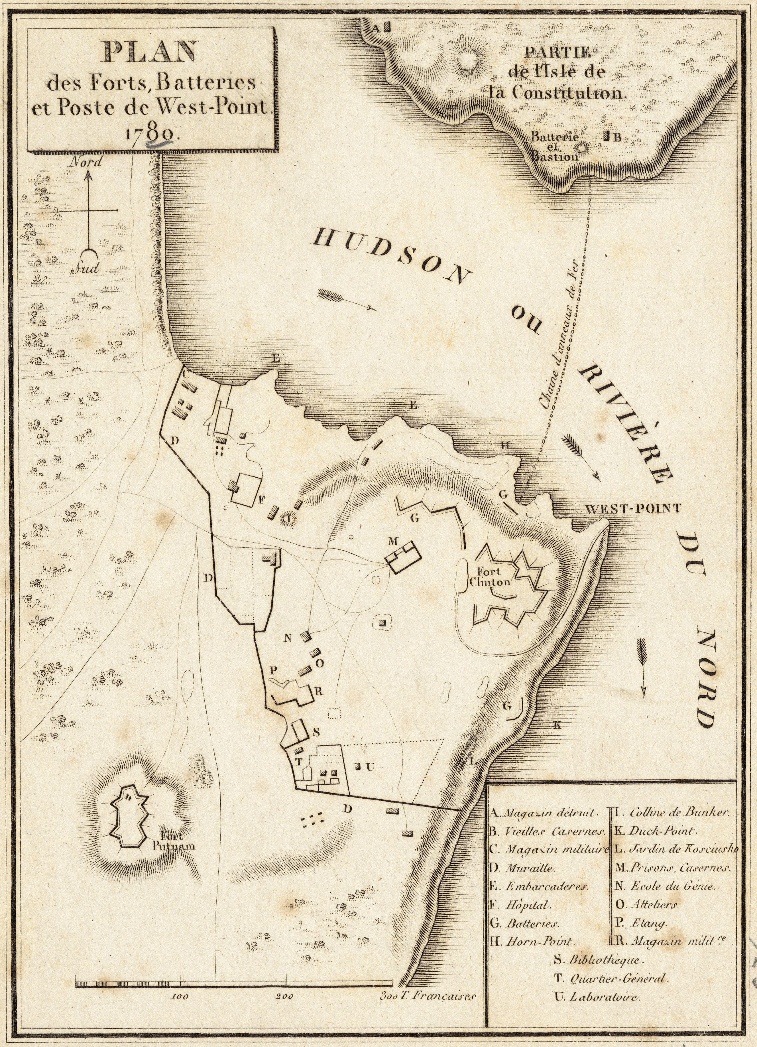
Description: Map depicting the fortifications of West Point in 1780, at the time Benedict Arnold attempted to surrender it to the British.
Title: WestPoint1780
Credit: From the Boston Public Library Digital Map Collection Call number: G3804.W53S3 1780 .P5
Author: Pierre Didot
Usage Terms: Public domain
License: Public domain
Attribution Required?: No
Image usage
The following page links to this image:

All content from Kiddle encyclopedia articles (including the article images and facts) can be freely used under Attribution-ShareAlike license, unless stated otherwise.