
Image: West Yorkshire UK location map

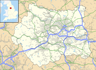
Description: Map of West Yorkshire, UK with the following information shown: Administrative borders Coastline, lakes and rivers Roads and railways Urban areas Equirectangular map projection on WGS 84 datum, with N/S stretched 170% Geographic limits: West: 2.30W East: 1.18W North: 53.98N South: 53.50N
Title: West Yorkshire UK location map
Credit: Ordnance Survey OpenData. Administrative borders and coastline data from Boundary-Line product. All other geographic data from Meridian 2 product. Inset derived from England location map.svg by Spischot.
Author: Nilfanion, created using Ordnance Survey data
Permission: This file is licensed under the Creative Commons Attribution-Share Alike 3.0 Unported license. Attribution: Contains Ordnance Survey data © Crown copyright and database right You are free: to share – to copy, distribute and transmit the work to remix – to adapt the work Under the following conditions: attribution – You must attribute the work in the manner specified by the author or licensor (but not in any way that suggests that they endorse you or your use of the work). share alike – If you alter, transform, or build upon this work, you may distribute the resulting work only under the same or similar license to this one. http://creativecommons.org/licenses/by-sa/3.0 CC BY-SA 3.0 Creative Commons Attribution-Share Alike 3.0 truetrue
Usage Terms: Creative Commons Attribution-Share Alike 3.0
License: CC BY-SA 3.0
License Link: http://creativecommons.org/licenses/by-sa/3.0
Attribution Required?: Yes
Image usage
More than 100 pages link to this image. The following list shows the first 100 page links to this image only. A full list is available.
- Adel, Leeds
- Allerton, West Yorkshire
- Bagley, West Yorkshire
- Batley
- Beckhill
- Beeston, Leeds
- Belle Isle, Leeds
- Bingley
- Birkenshaw, West Yorkshire
- Blenheim, Leeds
- Bramham, West Yorkshire
- Bramley, Leeds
- Brighouse
- Broomfields, Bradford
- Burley, Leeds
- Burley in Wharfedale
- Buslingthorpe, Leeds
- Castleford
- Chapeltown, Leeds
- Church of St John the Divine, Calder Grove
- Church of St Thomas, Thurstonland
- Clayton, West Yorkshire
- Clifford, West Yorkshire
- Colton, Leeds
- Cottingley, Bradford
- Cross Gates
- Denholme
- Dewsbury
- Eastburn, West Yorkshire
- Eccleshill, Bradford
- Elland
- Emley Moor transmitting station
- Farnley, Leeds
- Featherstone
- Ferrybridge Henge
- Fieldhead Hospital
- Grubstones
- Halifax, West Yorkshire
- Halton, Leeds
- Harewood
- Hawksworth, Leeds
- Headingley
- Heaton, West Yorkshire
- Hebden Royd
- Hemsworth
- Holywell Green
- Horsforth
- Huddersfield
- Idle, West Yorkshire
- Ilkley
- Ilkley Roman Fort
- Keighley
- Kirkburton
- Kirkstall Abbey
- Lagentium
- Leeds city centre
- Little London, Leeds
- Low Moor, Bradford
- Manningham, Bradford
- Manston, Leeds
- Meltham
- Middleton, Leeds
- Mirfield
- Moortown, Leeds
- Morley, West Yorkshire
- Netherton, Wakefield
- Newland with Woodhouse Moor
- Normanton, West Yorkshire
- Oakenshaw, West Yorkshire
- Oakwood, Leeds
- Ossett
- Otley
- Pontefract
- Potterton, West Yorkshire
- Pudsey
- Queensbury, West Yorkshire
- Rawdon, West Yorkshire
- Richmond Hill, Leeds
- Robin Hood, West Yorkshire
- Rothwell, West Yorkshire
- Sandal Castle
- Sandal Magna
- Scholes, Leeds
- Seacroft
- Shadwell, West Yorkshire
- Shipley, West Yorkshire
- Silsden
- Slaithwaite
- South Elmsall
- St Aidan's
- Stainland
- Theatre Royal, Wakefield
- Thornbury, Bradford
- Thornton, West Yorkshire
- Tingley
- Todmorden
- Wakefield
- Walton, Wakefield
- Wetherby
- Wortley, Leeds
