
Image: Worldmaphedo
No higher resolution available.
Worldmaphedo.jpg (700 × 437 pixels, file size: 57 KB, MIME type: image/jpeg)
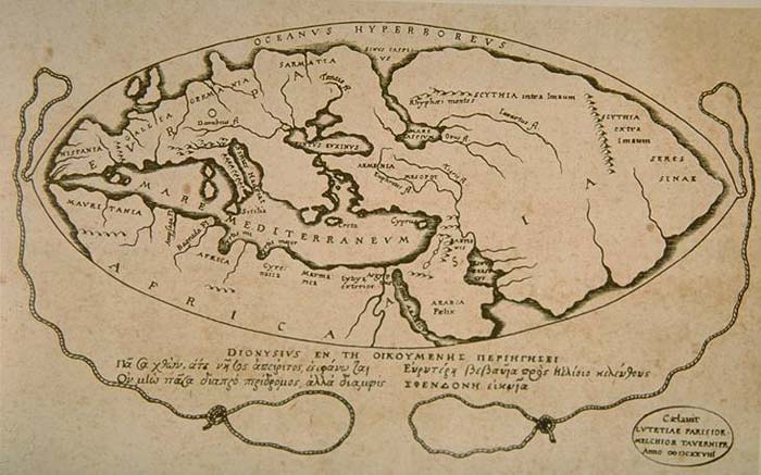
Description: World map according to ideas by Posidonius (150-130 B.C.), drawn by 16th century cartographers Petrus Bertius & Melchior Tavernier in 1628. Many of the details in this map couldn't have been known by Posidonius, rather, Bertius and Tavernier show Posidonius' ideas about the positions of the continents
Title: Worldmaphedo
Credit: http://www.armenica.org/cgi-bin/history/en/getHistory.cgi?3=1==Historical%20maps==1=3=AAA
Usage Terms: Public domain
License: Public domain
Attribution Required?: No
Image usage
The following 3 pages link to this image:

All content from Kiddle encyclopedia articles (including the article images and facts) can be freely used under Attribution-ShareAlike license, unless stated otherwise.