
Kennebunk, Maine facts for kids
Quick facts for kids
Kennebunk, Maine
|
||
|---|---|---|
| Kennebunk, Maine | ||

First Parish Church in 1909
|
||
|
||
| Nickname(s):
“The Only Town in the World, So Named & Famed”
|
||
| Motto(s):
"The only village in the world so named"
|
||

Kennebunk, Maine
Location in Maine
|
||
| Country | United States | |
| State | Maine | |
| County | York | |
| Incorporated | June 24, 1820 | |
| Boroughs |
List
Constituent Communities & Villages:
• Kennebunk Village • Kennebunk Landing • Lower Village • West Kennebunk • Bartlett Mills • Kennebunk Beach / Goochs Beach • Lords Point • Sea Road Crossing • Webhannet Grove • Coopers Crossing • Cheshire Meadows • Brine Pines |
|
| Government | ||
| • Type | Town Meeting | |
| Area | ||
| • Total | 43.87 sq mi (113.62 km2) | |
| • Land | 35.05 sq mi (90.78 km2) | |
| • Water | 8.82 sq mi (22.84 km2) | |
| Elevation | 92 ft (28 m) | |
| Population
(2020)
|
||
| • Total | 11,536 | |
| • Density | 329/sq mi (127.1/km2) | |
| Time zone | UTC-5 (Eastern (EST)) | |
| • Summer (DST) | UTC-4 (EDT) | |
| ZIP code |
04043
|
|
| Area code(s) | 207 | |
| FIPS code | 23-36535 | |
| GNIS feature ID | 0582539 | |

Kennebunk is a town in York County, Maine, United States. The population was 11,536 at the 2020 census (The population does not include Kennebunkport, a separate town). Kennebunk is home to several beaches, the Rachel Carson National Wildlife Refuge, the 1799 Kennebunk Inn, many historic shipbuilders' homes, the Brick Store Museum and the Nature Conservancy Kennebunk Plains (known locally as the Blueberry Plains), with 1,500 acres (6 km2) of nature trails and blueberry fields. The municipality includes the constituent villages of Kennebunk Village (Town), the Lower Village (Lower Kennebunk), Kennebunk Landing (the Landing), Bartlett Mills, West Kennebunk, Kennebunk Beach, Lords Point, Coopers Corner Crossing, Sea Roads Crossing, Webahennet Grove, and Vinegarhill, Cheshire Commons, Kennebunk Meadows, and various newer neighborhoods.
Contents
History
First settled in 1621, the town developed as a trading and, later, shipbuilding and shipping center with light manufacturing. It was part of the town of Wells until 1820, when it incorporated as a separate town. "Kennebunk, the only village in the world so named," was featured on a large locally famous sign attached to the Kesslen Shoe Mill on Route One. To the Abenaki Indians, Kennebunk meant "the long cut bank," presumably the long bank behind Kennebunk Beach. Kennebunk's coastline is divided into three major sections. Mother's Beach, Middle Beach or Rocky Beach, and Gooches Beach or Long Beach. Separate from Kennebunk Beach is secluded Parson's Beach, a quiet alternative to the summer crowds. Note there is some local controversy regarding the "Mother's Beach" moniker, (nickname). According to many local residents, the smaller of the three main beaches - at the intersection of Beach Ave and Ridge Ave - is officially Kennebunk Beach or, alternatively, Boothby Beach. The term Boothby beach was from the mid-1730s when a Mabel Littlefield married Richard Boothby and settled on land near what came to be known as Boothby Beach.The information about the Boothbys was taken from "Old News From Southern Maine" article on Mable and Richard Boothby, by Sharon Cummins. Many natives today may not remember it being called Boothby Beach and over the years the beach came to be known as Kennebunk Beach or Mothers Beach. Older residents also recall the name Dipsy Bath Beach, a reference to the baths once located there. The term Mother's Beach didn't come into widespread use until the mid '80s; Although other native residents will dispute that date and say they remember it being called "Mothers Beach" as far back as the late 1950s. The name likely evolved due to its small size and generally calmer water, due to the rocks under and above the ocean, thus making it a natural made harbor of refuge that is safer for swimming and which makes it popular with mothers keeping a watchful eye on their progeny, (children). The name is clearly descriptive rather than official, in spite of the recent installation of road signs pointing the way to "Mother's Beach". Contradicting the above beach naming is the Town's website listing "Permits are valid for Gooch’s Beach, Kennebunk Beach (Middle Beach) and Mother’s Beach." Additionally without public parking access both Libbys and Crescent beaches are in Kennebunk between Parson's beach and Mother's beach.
In the 19th Century and early 20th Century many industrial concerns were attracted to Mousam River at Kennebunk to provide motive force for their mills. Among the firms to do business there were the Kennebunk Manufacturing Company, the Mousam Manufacturing Company, the Leatheroid Company and the Rogers Fibre Company.
The town is a popular summer tourist destination. Kennebunk contains fine examples of early architecture, the most noted of which is the Wedding Cake House, a Federal-style dwelling extensively decorated with scroll saw Gothic trim. This was added to the house for his wife of many years by George Washington Bourne late in his life, and not as legend has it by a ship captain for a young bride lost at sea. Local economy is tourism based. The headquarters for the natural health-care product manufacturer Tom's of Maine is located in Kennebunk. The town's archives are located at the local history and art center, the Brick Store Museum, on Main Street. Many residents commute to Portland, New Hampshire, and Massachusetts.
The Lafayette Elm was a tree which was planted to commemorate General Lafayette's 1825 visit to Kennebunk. It became famous for its age, size, and survival of the Dutch elm disease that destroyed the hundreds of the other elms that once lined Kennebunk's streets. The elm is featured on the town seal. The restored Kesslen Shoe Mill has been renamed the Lafayette Center. Kennebunk is home to two of the state's oldest banks—Ocean Bank (1854) and Kennebunk Savings Bank (1871). Only Saco & Biddeford Savings Institution (1827) and Bangor Savings Bank (1852) are older. Summer Street was Maine's first Historic District that was listed on the National Register of Historic Places.
-
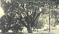
The Lafayette Elm
-

Kennebunk Beach in 1905
-
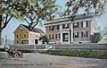
Storer Mansion in 1909
-

Lexington elms in 1908


Geography

According to the United States Census Bureau, the town has a total area of 43.87 square miles (113.62 km2), of which, 35.05 square miles (90.78 km2) of it is land and 8.82 square miles (22.84 km2) is water. Kennebunk is drained by the Kennebunk River and Mousam River.
Transportation links are:
- Interstate 95
- U.S. 1 which goes through the center of Kennebunk and is part of the main street.
- Route 9A
- Route 35
Amtrak also goes through Kennebunk, but does not have a station stop. There will be a Downeaster stop in the summer of 2018. The closest Amtrak station to Kennebunk is in Wells, towards Boston, and Saco, towards Portland.
Adjacent towns
Demographics

| Historical population | |||
|---|---|---|---|
| Census | Pop. | %± | |
| 1820 | 2,145 | — | |
| 1830 | 2,233 | 4.1% | |
| 1840 | 2,323 | 4.0% | |
| 1850 | 2,650 | 14.1% | |
| 1860 | 2,679 | 1.1% | |
| 1870 | 2,603 | −2.8% | |
| 1880 | 2,852 | 9.6% | |
| 1890 | 3,172 | 11.2% | |
| 1900 | 3,228 | 1.8% | |
| 1910 | 3,099 | −4.0% | |
| 1920 | 3,138 | 1.3% | |
| 1930 | 3,302 | 5.2% | |
| 1940 | 3,698 | 12.0% | |
| 1950 | 4,273 | 15.5% | |
| 1960 | 4,551 | 6.5% | |
| 1970 | 5,646 | 24.1% | |
| 1980 | 6,621 | 17.3% | |
| 1990 | 8,004 | 20.9% | |
| 2000 | 10,476 | 30.9% | |
| 2010 | 10,798 | 3.1% | |
| 2020 | 11,536 | 6.8% | |
2010 census
As of the census of 2010, there were 10,798 people, 4,689 households, and 2,966 families living in the town. The population density was 308.1 inhabitants per square mile (119.0/km2). There were 5,906 housing units at an average density of 168.5 per square mile (65.1/km2). The racial makeup of the town was 96.9% White, 0.00% African American, 0.2% Native American, 1.0% Asian, 0.3% from other races, and 1.1% from two or more races. Hispanic or Latino of any race were 1.0% of the population.
There were 4,689 households, of which 26.9% had children under the age of 18 living with them, 52.1% were married couples living together, 8.5% had a female householder with no husband present, 2.7% had a male householder with no wife present, and 36.7% were non-families. 31.1% of all households were made up of individuals, and 16.5% had someone living alone who was 65 years of age or older. The average household size was 2.27 and the average family size was 2.85.
The median age in the town was 48.2 years. 20.8% of residents were under the age of 18; 5.2% were between the ages of 18 and 24; 18.7% were from 25 to 44; 33.4% were from 45 to 64, and 21.9% were 65 years of age or older. The gender makeup of the town was 46.5% male and 53.5% female.
Sites of interest
- Kennebunk Free Library
Education
Kennebunk, along with neighboring Kennebunkport and Arundel, form Regional School District 21. The schools in RSU 21 are Consolidated School, Kennebunk Elementary School, Mildred L. Day School, Sea Road School, Middle School of the Kennebunks, and Kennebunk High School. The Middle School of the Kennebunks is part of Maine's project that gives laptops to all of the 6th, 7th and 8th graders in the school called MLTI, or Maine Learning Technology Initiative.
In 2000, a group of students teamed up with parents and local community members to found The New School, a small alternative high school, with students coming from as close as Kennebunk and Wells and as far away as Portland and Somersworth. The school is accredited by the State of Maine and the first group of students graduated in June 2001. The New School has a focus on community-based learning.
Notable people

- Kate Chappell, businesswoman
- Tom Chappell, businessman
- Eunice Hale Waite Cobb, writer, public speaker, activist
- Jack Coombs, baseball player who grew up in Kennebunk
- Joseph Dane, US congressman
- Judith Hunt, illustrator
- Hugh McCulloch, secretary of the U.S. Treasury
- Brooke McEldowney, cartoonist
- Bruce McMillan, children's book author, photo-illustrator, and watercolor artist
- Thomas W. Murphy Jr., eight-term State Representative and chair of the Maine Republican Party
- Edmund S. Muskie, U.S. Senator and 58th U.S. Secretary of State, summer resident of Kennebunk Beach
- Erik Nedeau, runner
- Jeff Olson, musician
- Kenneth Roberts, author
- Clement Storer, US congressman and senator
- Pinkerton Thugs, musicians
- Mary Alice Willcox, zoologist
Images for kids
-
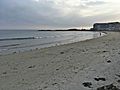
Gooch's Beach in 2017

See also
 In Spanish: Kennebunk (Maine) para niños
