List of Indiana state historical markers in Jackson County facts for kids
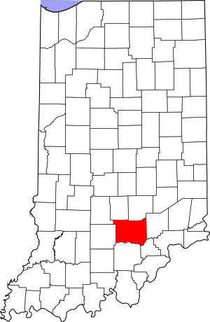
This is a list of the Indiana state historical markers in Jackson County.
This is intended to be a complete list of the official state historical markers placed in Jackson County, Indiana, United States by the Indiana Historical Bureau. The locations of the historical markers and their latitude and longitude coordinates are included below when available, along with their names, years of placement, and topics as recorded by the Historical Bureau. There are 7 historical markers located in Jackson County.
Historical markers
| Marker title | Image | Year placed | Location | Topics |
|---|---|---|---|---|
| Fort Vallonia | 1951 | Southwestern corner of the junction of State Road 135 and Main Street in Vallonia 38°50′58″N 86°5′25.4″W / 38.84944°N 86.090389°W |
Military, Early Settlement and Exploration | |
| Indian Treaty Corner | 1966 | Northern side of U.S. Route 50 at Crane Cemetery, 1 mile west of Seymour 38°56′18″N 85°55′52″W / 38.93833°N 85.93111°W |
Early Settlement and Exploration | |
| In Memory of Col. John Ketcham 1782-1865/Time Capsule Brownstown Area Sesquicentennial October 1–8, 1966 |  |
1966 | Southwestern corner of the Jackson County Courthouse grounds at the junction of Main (U.S. Route 50) and E. Cross Streets in Brownstown 38°52′42″N 86°2′31″W / 38.87833°N 86.04194°W |
Early Settlement and Exploration, Historic District, Neighborhoods, and Towns |
| Freeman Field |  |
1997 | Northwestern corner of the junction of Walnut Street (State Road 11) and B Avenue E. at the eastern entrance to Freeman Field near Seymour 38°56′20″N 85°53′24.5″W / 38.93889°N 85.890139°W |
Military |
| Freeman Field |  |
1997 | Southwestern corner of the junction of U.S. Route 50 and Airport Road at the northern entrance to Freeman Field near Seymour 38°57′3″N 85°54′30″W / 38.95083°N 85.90833°W |
Military |
| Medora Shale Brick Plant | 2008 | By the State Bank of Medora at the junction of Main and Perry Streets 38°49′31″N 86°10′12″W / 38.82528°N 86.17000°W |
Business, Industry, and Labor | |
| Alexander McClure |  |
2008 | 100 N. Broadway Street in Seymour 38°57′33.4″N 85°53′9.2″W / 38.959278°N 85.885889°W |
[none] |

All content from Kiddle encyclopedia articles (including the article images and facts) can be freely used under Attribution-ShareAlike license, unless stated otherwise. Cite this article:
List of Indiana state historical markers in Jackson County Facts for Kids. Kiddle Encyclopedia.

