List of National Monuments in County Tipperary facts for kids
The Irish state has officially approved the following List of National Monuments in County Tipperary. In the Republic of Ireland, a structure or site may be deemed to be a "National Monument", and therefore worthy of state protection, if it is of national importance. If the land adjoining the monument is essential to protect it, this land may also be protected.
National Monuments
| NM# | Monument name | Description | Image | Townland | Location |
|---|---|---|---|---|---|
| 378 | Lackeen Castle | Castle |  |
Abbeville | 53°05′18″N 8°04′26″W / 53.0884°N 8.0738°W |
| 124 | Ahenny High Crosses | High Crosses |  |
Ahenny | 52°24′45″N 7°23′41″W / 52.412577°N 7.394614°W |
| 396 | St. Berrihert's Kyle | Crosses & Inscribed Slabs |  |
Ardane | 52°24′39″N 8°05′34″W / 52.410727°N 8.092677°W |
| 604 | Ardcroney Burial Mound | Burial Mound (Cist) | Ardcroney | 52°56′28″N 8°11′09″W / 52.941172°N 8.18571°W | |
| 573 | Ashleypark Burial Mound | Burial Moundy (Cist) | Ashleypark | 52°56′02″N 8°11′20″W / 52.933858°N 8.188848°W | |
| 120 | Athassel Abbey | Priory (Augustinian) |  |
Cashel | 52°28′46″N 7°59′01″W / 52.479444°N 7.983611°W |
| 581 | Ballycomisk Ringforts | Three Ringforts | Ballycomisk | 52°29′22″N 7°50′27″W / 52.489523°N 7.840805°W | |
| 659 | Ballingarry Warhouse | House with historical associations |  |
Farranrory Upper | 52°37′09″N 7°31′22″W / 52.619273°N 7.522898°W |
| 234 | Ballynahow Castle | Castle |  |
Ballynahow | 52°41′35″N 7°52′41″W / 52.693070°N 7.878118°W |
| 123 | Ballynoran Church | Church | Ballynoran | 52°21′20″N 7°29′24″W / 52.355605°N 7.490105°W | |
| 370 | Burncourt Castle | Castle or fortified house |  |
Burncourt | 52°18′36″N 8°04′12″W / 52.310015°N 8.069911°W |
| 595 | Cahir Abbey | Priory (Augustinian) |  |
Caherabbey Upper | 52°22′45″N 7°55′43″W / 52.379263°N 7.928563°W |
| 507 | Cahir Castle | Castle |  |
Townparks | 52°22′28″N 7°55′38″W / 52.374571°N 7.927254°W |
| 577 | Cahir Castle Cottage | Cahir Castle Cottage | Townparks | 52°22′26″N 7°55′38″W / 52.374018°N 7.927183°W | |
| 647 | Swiss Cottage | Cottage |  |
Kilcommon Beg | 52°21′27″N 7°55′25″W / 52.357395°N 7.923524°W |
| 447 | Carrick-on-Suir Castle | Castle |  |
Carrick-on-Suir | 52°20′42″N 7°24′25″W / 52.345084°N 7.406971°W |
| 537 | Rathanadav | Ringfort | Carron (St. Johnbaptist) | 52°28′32″N 7°53′16″W / 52.475425°N 7.887863°W | |
| 550 | Carron fort | Ringfort | Carron (Tipperary town) | 52°29′37″N 8°10′48″W / 52.493514°N 8.179885°W | |
| 127 | Hore Abbey | Abbey (Cistercian) | Cashel | 52°31′07″N 7°53′52″W / 52.5186°N 7.897893°W | |
| 128 | Rock of Cashel | Ecclesiastical site |  |
Cashel | 52°31′12″N 7°53′25″W / 52.51995°N 7.890288°W |
| 667 | Clonmel Main Guard | Courthouse |  |
Burgagery-Lands West | 52°21′10″N 7°41′54″W / 52.352879°N 7.698455°W |
| 353 | Timoney Hills Standing Stones | Standing Stones | Cullaun, Timenyhills, Timoney | 52°54′01″N 7°43′12″W / 52.900309°N 7.720127°W | |
| 533 | Derryvella | Early Medieval Ecclesiastical Site | Derryvella | 52°37′05″N 7°40′09″W / 52.617944°N 7.669056°W | |
| 193 | St. Dominic's Abbey | Abbey (Dominican) | 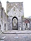 |
St. Dominick's Abbey | 52°31′05″N 7°53′16″W / 52.518066°N 7.887777°W |
| 122 | Donaghmore Church | Church | Donaghmore | 52°24′47″N 7°43′29″W / 52.412987°N 7.724840°W | |
| 407 | Grallagh Castle | Castle & Bawn |  |
Grallagh (Graystown) | 52°35′41″N 7°46′16″W / 52.594772°N 7.771243°W |
| 121 | Holy Cross Abbey | Abbey (Cistercian) (part of) |  |
Holycross | 52°38′25″N 7°52′11″W / 52.640342°N 7.869773°W |
| 654 | Kilcash Church | Church & graveyard |  |
Kilcash | 52°23′50″N 7°31′24″W / 52.397176°N 7.523361°W |
| 654 | Kilcash Castle | Castle |  |
Kilcash | 52°23′50″N 7°31′16″W / 52.397326°N 7.521244°W |
| 218 | Kilcooly Abbey | Abbey (Cistercian) | 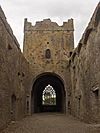 |
Kilcoolyabbey | 52°40′15″N 7°34′16″W / 52.670731°N 7.571237°W |
| 584 | Knockgraffon | Motte & Bailey |  |
New Inn | 52°24′44″N 7°55′59″W / 52.412111°N 7.933144°W |
| 266 | Liathmore Churches | Two Churches |  |
Leigh | 52°40′14″N 7°40′07″W / 52.670486°N 7.66858°W |
| 348 | Lismacrory Mounds | Mounds |  |
Lismacrory | 53°02′16″N 8°01′54″W / 53.037717°N 8.031574°W |
| 524 | Longstone Rath | Standing Stone & prehistoric earthworks |  |
Longstone | 52°30′22″N 8°17′52″W / 52.506051°N 8.297753°W |
| 673 | Lorrha Church | Church & two crosses |  |
Lorrha | 53°05′30″N 8°07′13″W / 53.091572°N 8.120249°W |
| 357 | Lorrha Priory | Priory (Augustinian) |  |
Lorrha | 53°05′31″N 8°07′17″W / 53.092012°N 8.121414°W |
| 361 | Lorrha Friary | Friary (Dominican) |  |
Lorrha | 53°05′28″N 8°07′34″W / 53.091081°N 8.126113°W |
| 335 | Derrynaflan Church | Church & Early Medieval Ecclesiastical site | Lurgoe | 52°35′50″N 7°44′02″W / 52.597315°N 7.733829°W | |
| 125 | Monaincha Church | Church & Cross |  |
Monaincha | 52°56′47″N 7°44′53″W / 52.946321°N 7.74795°W |
| 292 | Moor Abbey | Friary (Franciscan) |  |
Moorabbey | 52°24′09″N 8°16′42″W / 52.402466°N 8.278207°W |
| 513 | Nenagh Castle | Castle | 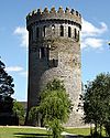 |
Nenagh | 52°51′54″N 8°11′53″W / 52.865014°N 8.198154°W |
| Roscrea Friary | Friary (Franciscan) | 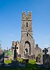 |
Roscrea | 52°57′09″N 7°47′59″W / 52.952579°N 7.799620°W | |
| 451 | Portland Church | Church | Portland | 53°05′24″N 8°10′32″W / 53.090070°N 8.175483°W | |
| 126 | Roscrea Church | Church, Round Tower, High Cross & Mill |  |
Roscrea | 52°57′20″N 7°47′45″W / 52.955606°N 7.795717°W |
| 211 | Roscrea Castle | Castle | 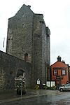 |
Roscrea | 52°57′19″N 7°47′53″W / 52.9553°N 7.7980°W |
| 548 | Shrough Passage Tomb | Passage Tomb | Shrough | 52°25′37″N 8°13′58″W / 52.426943°N 8.232823°W | |
| 363 | Terryglass Castle | Castle |  |
Terryglass | 53°03′34″N 8°12′43″W / 53.059364°N 8.211910°W |
| 332 | Toureen Peakaun | Church, Crosses & Slabs | Toureen | 52°24′32″N 7°59′36″W / 52.408754°N 7.993235°W |

All content from Kiddle encyclopedia articles (including the article images and facts) can be freely used under Attribution-ShareAlike license, unless stated otherwise. Cite this article:
List of National Monuments in County Tipperary Facts for Kids. Kiddle Encyclopedia.
