List of bridges in Canada facts for kids
This is a list of bridges and viaducts in Canada, including those for pedestrians and vehicular traffic.
Contents
Historical and architectural interest bridges
There are only a few covered bridges left in Canada compared to all those that were built in the past. In the Quebec province, if we already counted 1200 in the last century, today there are only 88 remaining. In New Brunswick, 58 covered bridges have been identified.
| Name | Distinction | Length | Type | Carries Crosses |
Opened | Location | Province | Ref. | ||
|---|---|---|---|---|---|---|---|---|---|---|
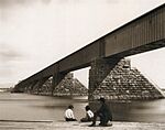 |
1 | Victoria Bridge | Longest bridge in the world when inaugurated Span : 100 m (330 ft) |
2,009 m (6,591 ft) | Tubular Wrought iron |
St. Lawrence River |
1859 | Montreal–Saint-Lambert 45°29′30.4″N 73°31′44.1″W / 45.491778°N 73.528917°W |
Quebec | |
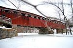 |
2 | Powerscourt Covered Bridge | Last McCallum truss type bridge in use. The oldest covered bridge still existing in Canada. Historic monument |
50 m (160 ft) | Covered bridge Wood, McCallum truss, masonry piers |
Chemin de la 1ère Concession Châteauguay River |
1862 | Elgin – Hinchinbrooke 45°00′25.2″N 74°09′39.7″W / 45.007000°N 74.161028°W |
Quebec | |
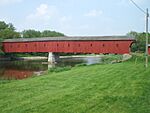 |
3 | West Montrose Covered Bridge | Only remaining covered bridge in Ontario Cultural heritage |
60 m (200 ft) | Covered bridge Wood and steel, Howe truss, concrete piers |
Covered Bridge Dr Grand River (Ontario) |
1881 | West Montrose 43°35′08.1″N 80°28′53.3″W / 43.585583°N 80.481472°W |
Ontario | |
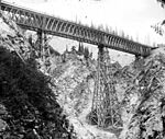 |
4 | Stoney Creek Bridge (1885) | Highest timber bridge ever built Height : 84 m (276 ft) |
138 m (453 ft) | Truss Wooden Howe truss deck, wooden piers |
Stoney Creek |
1885 | Golden 51°22′46.6″N 117°27′57.2″W / 51.379611°N 117.465889°W |
British Columbia | |
 |
5 | Frontière Bridge | Historic monument | 31 m (102 ft) | Covered bridge Wood, Town truss |
Chemin du Pont Couvert Mud stream |
1896 | Potton 45°00′42.5″N 72°22′24.4″W / 45.011806°N 72.373444°W |
Quebec | |
 |
6 | Félix-Gabriel-Marchand Bridge | Historic monument | 152 m (499 ft) | Covered bridge Wood, Town and queen post truss, wooden piers filled with stones |
Chemin du Pont-Rouge Coulonge River |
1898 | Mansfield-et-Pontefract 45°51′40.8″N 76°44′26.6″W / 45.861333°N 76.740722°W |
Quebec | |
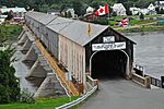 |
7 | Hartland Covered Bridge | World's longest covered bridge Historic monument |
391 m (1,283 ft) | Covered bridge Wood, Howe truss, concrete piers |
Hartland Bridge Hill Road Saint John River |
1901 | Hartland 46°17′48.1″N 67°31′49.1″W / 46.296694°N 67.530306°W |
New Brunswick | |
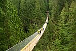 |
8 | Capilano Suspension Bridge | Span : 137 m (449 ft) Height : 70 m (230 ft) |
137 m (449 ft) | Suspension Steel |
Capilano River |
1903 | North Vancouver 49°20′34.5″N 123°06′53.4″W / 49.342917°N 123.114833°W |
British Columbia | |
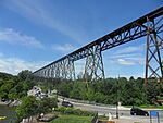 |
9 | Cap-Rouge trestle | Height : 52 m (171 ft) | 1,016 m (3,333 ft) | Trestle bridge Steel |
Rivière du Cap Rouge |
1908 | Quebec City 46°44′53.1″N 71°20′33.0″W / 46.748083°N 71.342500°W |
Quebec | |
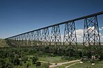 |
10 | Lethbridge Viaduct | Largest railway structure in Canada and the largest of its type in the world Height : 96 m (315 ft) |
1,625 m (5,331 ft) | Trestle bridge Steel |
Oldman River |
1909 | Lethbridge 49°41′51.3″N 112°52′06.1″W / 49.697583°N 112.868361°W |
Alberta | |
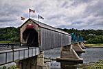 |
11 | Florenceville Bridge | Local Historic Place | Covered bridge Wood, Howe truss Sort |
Promenade Jim Davis Saint John River |
1911 | Florenceville-Bristol 46°26′30.0″N 67°37′16.2″W / 46.441667°N 67.621167°W |
New Brunswick | ||
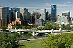 |
12 | Centre Street Bridge | Municipal Historic Resource | 178 m (584 ft) | Arch Concrete deck arch |
Centre Street (Calgary) Bow River |
1916 | Calgary 51°03′10.6″N 114°03′45.1″W / 51.052944°N 114.062528°W |
Alberta | |
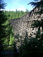 |
13 | Kinsol Trestle | One of the largest wooden trestle in Canada Height : 44 m (144 ft) |
187 m (614 ft) | Trestle bridge Wood, 46 spans, 8 levels, Howe truss |
Koksilah River |
1920 | Shawnigan Lake 48°40′06.4″N 123°41′38.1″W / 48.668444°N 123.693917°W |
British Columbia | |
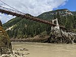 |
14 | Alexandra Suspension Bridge | Local Historic Place | Suspension Steel truss deck, concrete pylons |
Fraser Canyon |
1926 | Spuzzum 49°42′26.6″N 121°25′00.2″W / 49.707389°N 121.416722°W |
British Columbia | ||
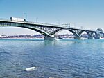 |
15 | Peace Bridge | Canada–United States border | 1,768 m (5,801 ft) | Arch Steel deck arch |
Queen Elizabeth Way Niagara River |
1927 | Fort Erie–Buffalo 42°54′24.9″N 78°54′19.0″W / 42.906917°N 78.905278°W |
Ontario |
|
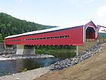 |
16 | Routhierville Bridge | Historic monument Cultural Heritage Register |
78 m (256 ft) | Covered bridge Wood, Quebec Town Truss |
Chemin du Rang A Matapedia River |
1931 | Routhierville 48°10′56.4″N 67°8′55.9″W / 48.182333°N 67.148861°W |
Quebec | |
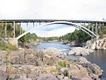 |
17 | Arvida Bridge | First bridge in the world built entirely of aluminum Span : 91 m (299 ft) Heritage monument |
154 m (505 ft) | Arch Aluminium deck arch |
Route du Pont Saguenay River |
1950 | Arvida 48°26′41.2″N 71°13′06.2″W / 48.444778°N 71.218389°W |
Quebec | |
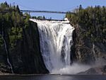 |
18 | Montmorency Falls Suspension Bridge | Suspension Steel |
Montmorency Falls Montmorency River |
1993 | Quebec City 46°53′26.9″N 71°08′51.7″W / 46.890806°N 71.147694°W |
Quebec | |||
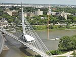 |
19 | Esplanade Riel | 197 m (646 ft) | Cable-stayed Side-spar, concrete box girder deck, 1 steel pylon 86+106 |
Red River of the North |
2003 | Winnipeg 49°53′26.9″N 97°07′36.6″W / 49.890806°N 97.126833°W |
Manitoba |
Major road and railway bridges
Canada's longest bridge is the Confederation Bridge in the Gulf of St. Lawrence with a total of 12,910 metres (8.02 mi) between abutments, it's also the world's longest bridge over ice-covered water. More than 5,000 local workers helped with the project, which cost about $1 billion.
The Quebec Bridge has been the longest cantilever bridge span in the world since 1917, measuring 549 metres (1,801 ft) between its two piles. It helds the record of all-categories longest span in the world until the opening of the Ambassador Bridge, it's the last bridge that broke such a record before suspension bridges hold the award by far. It was designated a National Historic Sites of Canada in 1995.
In 1929, the Ambassador Bridge between Canada and United States surpassed the Quebec Bridge with a 564 metres (1,850 ft) main span and became the largest crossing in the world until the inauguration of the George Washington Bridge in 1931 in New York City which almost doubled the range hitherto achieved.
Studies have been carried out for crossing the Saguenay River near Tadoussac just before the confluence with the St. Lawrence River, the latest project presented by the COWI A/S company includes the construction of a 1,145 metres (3,757 ft) span suspension bridge with a 70 metres (230 ft) clearance above the river.
This table presents the structures with spans greater than 100 meters (non-exhaustive list).
| Name | Span | Length | Type | Carries Crosses |
Opened | Location | Province | Ref. | ||
|---|---|---|---|---|---|---|---|---|---|---|
| 1 | Gordie Howe International Bridge under construction |
853 m (2,799 ft) | 2,500 m (8,200 ft) | Cable-stayed Steel box girder deck, concrete pylons |
Detroit River |
2024 | Windsor–Detroit 42°17′14.3″N 83°05′53.1″W / 42.287306°N 83.098083°W |
Ontario |
||
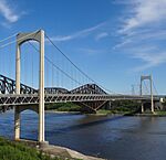 |
2 | Pierre Laporte Bridge | 667 m (2,188 ft) | 1,041 m (3,415 ft) | Suspension Steel truss deck, steel pylons 186+667+186 |
St. Lawrence River |
1970 | Quebec City 46°44′43.3″N 71°17′25.9″W / 46.745361°N 71.290528°W |
Quebec | |
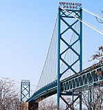 |
3 | Ambassador Bridge | 564 m (1,850 ft) | 2,286 m (7,500 ft) | Suspension Steel truss deck, steel pylons |
Lake Erie Circle Tour Detroit River |
1929 | Windsor–Detroit 42°18′42.5″N 83°04′26.0″W / 42.311806°N 83.073889°W |
Ontario |
|
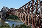 |
4 | Quebec Bridge | 549 m (1,801 ft) | 987 m (3,238 ft) | Cantilever Steel truss 157+549+157 |
Canadian National Railway Via Rail St. Lawrence River |
1917 | Quebec City–Lévis 46°44′43.9″N 71°17′16.3″W / 46.745528°N 71.287861°W |
Quebec | |
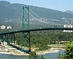 |
5 | Lions Gate Bridge | 473 m (1,552 ft) | 1,517 m (4,977 ft) | Suspension Steel truss deck, steel pylons 187+473+187 |
Burrard Inlet |
1938 | Vancouver 49°18′55.1″N 123°08′19.5″W / 49.315306°N 123.138750°W |
British Columbia | |
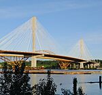 |
6 | Port Mann Bridge (2012) | 470 m (1,540 ft) | 2,020 m (6,630 ft) | Cable-stayed Composite steel/concrete deck, concrete pylons 190+470+190 |
Trans-Canada Highway Fraser River |
2012 | Surrey 49°13′10.9″N 122°48′46.8″W / 49.219694°N 122.813000°W |
British Columbia | |
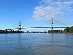 |
7 | Alex Fraser Bridge | 465 m (1,526 ft) | 2,524 m (8,281 ft) | Cable-stayed Composite steel/concrete deck, concrete pylons 50+183+465+183+50 |
Fraser River |
1986 | Delta 49°09′35.2″N 122°56′34.8″W / 49.159778°N 122.943000°W |
British Columbia | |
 |
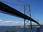
8 | Angus L. Macdonald Bridge | 441 m (1,447 ft) | 1,347 m (4,419 ft) | Suspension Steel truss deck, steel pylons 160+441+160 |
Halifax Harbour |
1955 | Halifax, Nova Scotia 44°39′48.7″N 63°35′05.6″W / 44.663528°N 63.584889°W |
Nova Scotia | |
 |
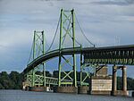
9 | A. Murray MacKay Bridge | 427 m (1,401 ft) | 1,236 m (4,055 ft) | Suspension Steel truss deck, steel pylons 156+427+156 |
Halifax Harbour |
1970 | Halifax, Nova Scotia 44°40′38.5″N 63°36′44.6″W / 44.677361°N 63.612389°W |
Nova Scotia | |
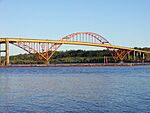 |
10 | Port Mann Bridge (1964) dismantled in 2012 |
366 m (1,201 ft) | 2,093 m (6,867 ft) | Arch Steel through arch 110+366+110 |
Trans-Canada Highway Fraser River |
1964 | Surrey 49°13′06.0″N 122°48′41.7″W / 49.218333°N 122.811583°W |
British Columbia | |
 |
11 | Ogdensburg–Prescott International Bridge | 351 m (1,152 ft) | 2,248 m (7,375 ft) | Suspension Steel truss deck, steel pylons |
St. Lawrence River |
1960 | Johnstown–Ogdensburg 44°44′06.5″N 75°27′33.3″W / 44.735139°N 75.459250°W |
Ontario |
|
 |
12 | Skybridge (TransLink) | 340 m (1,120 ft) | 616 m (2,021 ft) | Cable-stayed Concrete deck, concrete pylons |
(Expo Line) Fraser River |
1990 | Surrey–New Westminster 49°12′19.4″N 122°53′46.9″W / 49.205389°N 122.896361°W |
British Columbia | |
 |
13 | Ironworkers Memorial Second Narrows Crossing | 335 m (1,099 ft) | 1,292 m (4,239 ft) | Cantilever Steel 4x86+142+335+142 |
Trans-Canada Highway Burrard Inlet |
1960 | Vancouver–North Vancouver 49°17′40.8″N 123°01′33.5″W / 49.294667°N 123.025972°W |
British Columbia | |
 |
14 | Laviolette Bridge | 335 m (1,099 ft) | 2,707 m (8,881 ft) | Arch Steel through arch 124+167+335+167 +2x124 |
St. Lawrence River |
1967 | Trois-Rivières 46°18′25.9″N 72°33′41.8″W / 46.307194°N 72.561611°W |
Quebec | |
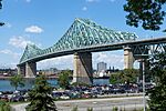 |
15 | Jacques Cartier Bridge | 334 m (1,096 ft) | 2,687 m (8,816 ft) | Cantilever Steel 128+334+128 |
St. Lawrence River |
1930 | Montreal–Longueuil 45°31′18.7″N 73°32′30.0″W / 45.521861°N 73.541667°W |
Quebec | |
| 16 | New Pattullo Bridge under construction |
332 m (1,089 ft) | 1,227 m (4,026 ft) | Cable-stayed 1 concrete pylon 332+162+84 |
Fraser River |
2024 | Surrey–New Westminster 49°12′30.9″N 122°53′37.6″W / 49.208583°N 122.893778°W |
British Columbia | ||
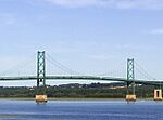 |
17 | Île d'Orléans Bridge | 323 m (1,060 ft) | 1,838 m (6,030 ft) | Suspension Steel truss deck, steel pylons 72+127+323+127+72 |
St. Lawrence River |
1936 | Quebec City–Île d'Orléans 46°52′46.3″N 71°08′03.0″W / 46.879528°N 71.134167°W |
Quebec | |
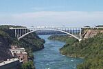 |
18 | Lewiston–Queenston Bridge | 305 m (1,001 ft) | 488 m (1,601 ft) | Arch Steel deck arch |
Niagara River |
1962 | Queenston–Lewiston 43°09′11.2″N 79°02′40.5″W / 43.153111°N 79.044583°W |
Ontario |
|
 |
19 | Grand-Mère Bridge | 289 m (948 ft) | 337 m (1,106 ft) | Suspension Steel truss deck, steel pylons |
Saint-Maurice River |
1929 | Shawinigan 46°37′11.6″N 72°40′35.7″W / 46.619889°N 72.676583°W |
Quebec | |
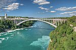 |
20 | Rainbow Bridge (Niagara Falls) | 289 m (948 ft) | 442 m (1,450 ft) | Arch Steel deck arch |
Niagara River |
1941 | Niagara Falls–Niagara Falls, New York 43°05′24.6″N 79°04′03.3″W / 43.090167°N 79.067583°W |
Ontario |
|
| 21 | Peace River Suspension Bridge collapse in 1957 |
283 m (928 ft) | 640 m (2,100 ft) | Suspension Steel truss, steel pylons 142+283+142 |
Alaska Highway Peace River |
1943 | Taylor 56°08′15.2″N 120°40′21.5″W / 56.137556°N 120.672639°W |
British Columbia | ||
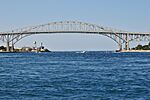 |
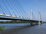
22 | Second Blue Water Bridge | 281 m (922 ft) | 1,862 m (6,109 ft) | Arch Steel through arch 85+281+85 |
St. Clair River |
1997 | Sarnia–Port Huron 42°59′54.6″N 82°25′25.0″W / 42.998500°N 82.423611°W |
Ontario |
|
 |
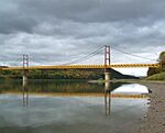
23 | Olivier-Charbonneau Bridge | 280 m (920 ft) | 1,200 m (3,900 ft) | Cable-stayed Composite steel/concrete deck, concrete pylons 115+280+115 |
Rivière des Prairies |
2011 | Montreal–Laval 45°38′19.7″N 73°37′17.0″W / 45.638806°N 73.621389°W |
Quebec | |
 |
24 | Dunvegan Bridge | 274 m (899 ft) | Suspension Steel truss deck, steel pylons |
Peace River |
1960 | Dunvegan 55°55′16.5″N 118°36′16.0″W / 55.921250°N 118.604444°W |
Alberta | ||
| 25 | Seaway International South Bridge | 273 m (896 ft) | 1,061 m (3,481 ft) | Suspension Steel truss deck, steel pylons |
St. Lawrence River |
1958 | Cornwall–Massena 44°59′21.9″N 74°44′23.3″W / 44.989417°N 74.739806°W |
Ontario |
||
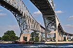 |
26 | Blue Water Bridge | 265 m (869 ft) | 1,883 m (6,178 ft) | Cantilever Steel truss 100+265+100 |
St. Clair River |
1938 | Sarnia–Port Huron 42°59′56.0″N 82°25′24.8″W / 42.998889°N 82.423556°W |
Ontario |
|
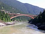 |
27 | Alexandra Bridge (Trans-Canada) | 257 m (843 ft) | 487 m (1,598 ft) | Arch Steel deck arch |
Trans-Canada Highway Fraser River |
1964 | Spuzzum 49°42′05.8″N 121°24′36.6″W / 49.701611°N 121.410167°W |
British Columbia | |
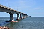 |
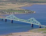
28 | Confederation Bridge | 250 m (820 ft)(x43) | 12,910 m (42,360 ft) | Box girder Prestressed concrete 165+43x250+165 |
Prince Edward Island Route 1 Trans-Canada Highway Northumberland Strait |
1997 | Borden-Carleton–Cape Jourimain 46°12′17.5″N 63°45′30.9″W / 46.204861°N 63.758583°W |
Prince Edward Island New Brunswick |
|
 |
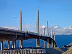
29 | J. C. Van Horne Bridge | 248 m (814 ft) | 804 m (2,638 ft) | Cantilever Steel truss |
Subway Street Restigouche River |
1961 | Campbellton–Pointe-à-la-Croix 48°00′39.5″N 66°40′50.1″W / 48.010972°N 66.680583°W |
New Brunswick Quebec |
|
 |
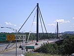
30 | Golden Ears Bridge | 242 m (794 ft)(x3) | 968 m (3,176 ft) | Extradosed Composite steel/concrete deck, 4 concrete pylons 121+3x242+121 |
Fraser River |
2009 | Langley–Maple Ridge 49°11′47.0″N 122°39′56.0″W / 49.196389°N 122.665556°W |
British Columbia | |
 |
31 | Papineau-Leblanc Bridge | 241 m (791 ft) | 421 m (1,381 ft) | Cable-stayed Steel box girder deck, steel pylons 90+241+90 |
Rivière des Prairies |
1969 | Montreal–Laval 45°34′34.5″N 73°40′00.9″W / 45.576250°N 73.666917°W |
Quebec | |
 |
32 | Champlain Bridge (2019) | 240 m (790 ft) | 3,335 m (10,942 ft) | Cable-stayed Triple steel box girder deck, 1 concrete pylons 80+124+240 |
Quebec Autoroute 15 Quebec Autoroute 20 St. Lawrence River St. Lawrence Seaway |
2019 | Montreal–Brossard 45°28′06.3″N 73°30′20.6″W / 45.468417°N 73.505722°W |
Quebec | |
 |
33 | Georgina Island Bridge | 228 m (748 ft) | 1,015 m (3,330 ft) | Suspension Steel truss deck, steel pylons |
St. Lawrence River |
1938 | Leeds and the Thousand Islands–Hill Island 44°21′47.4″N 75°58′57.3″W / 44.363167°N 75.982583°W |
Ontario | |
| 34 | Longs Creek Bridge | 218 m (715 ft) | Cable-stayed Steel girder deck, steel pylons 58+218+58 |
Saint John River |
1966 | Kingsclear 45°52′05.7″N 66°55′02.6″W / 45.868250°N 66.917389°W |
New Brunswick | |||
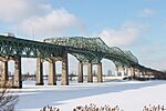
| 35 | Hawkshaw Bridge | 217 m (712 ft) | 333 m (1,093 ft) | Cable-stayed Steel girder deck, steel pylons 58+217+58 |
Saint John River |
1967 | Hawkshaw 45°57′41.4″N 67°14′53.0″W / 45.961500°N 67.248056°W |
New Brunswick | ||
 |
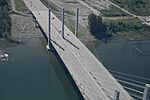
36 | Champlain Bridge (1962) dismantled in 2019 |
215 m (705 ft) | 3,440 m (11,290 ft) | Cantilever Steel truss 117+215+117 |
Quebec Autoroute 15 Quebec Autoroute 20 St. Lawrence River St. Lawrence Seaway |
1962 | Montreal–Brossard 45°28′02.5″N 73°30′13.0″W / 45.467361°N 73.503611°W |
Quebec | |
 |
37 | Pitt River Bridge | 190 m (620 ft) | 380 m (1,250 ft) | Cable-stayed Composite steel/concrete deck, concrete pylons 95+190+95 |
Pitt River |
2009 | Port Coquitlam–Pitt Meadows 49°14′52.1″N 122°43′45.0″W / 49.247806°N 122.729167°W |
British Columbia | |
 |
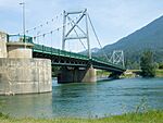
38 | Deh Cho Bridge | 190 m (620 ft) | 1,045 m (3,428 ft) | Extradosed Composite steel/concrete truss deck, steel pylons 3x112+190+3x112 |
Mackenzie River |
2012 | Fort Providence 61°15′52.6″N 117°31′32.0″W / 61.264611°N 117.525556°W |
Northwest Territories | |
 |
39 | Revelstoke Bridge | 183 m (600 ft) | 302 m (991 ft) | Suspension Steel truss deck, steel pylons |
Trans-Canada Highway Columbia River |
1961 | Revelstoke 51°00′22.9″N 118°13′12.7″W / 51.006361°N 118.220194°W |
British Columbia | |
| 40 | Burton Bridge | 183 m (600 ft) | 544 m (1,785 ft) | Arch Steel through arch 65+183+65 |
Saint John River |
1972 | Maugerville–Burton 45°51′53.1″N 66°27′05.0″W / 45.864750°N 66.451389°W |
New Brunswick | ||
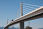
| 41 | Pont des Piles | 181 m (594 ft) | 285 m (935 ft) | Box girder Prestressed concrete 39+181+39 |
Saint-Maurice River |
1978 | Shawinigan 46°38′06.9″N 72°41′00.1″W / 46.635250°N 72.683361°W |
Quebec | ||
 |
42 | North Arm Bridge | 180 m (590 ft) | 562 m (1,844 ft) | Extradosed Concrete box girder deck, concrete pylons 52+139+180+139+52 |
(Canada Line) Fraser River (North Arm) |
2008 | Vancouver–Richmond 49°12′07.6″N 123°07′04.0″W / 49.202111°N 123.117778°W |
British Columbia | |
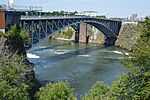 |
43 | Reversing Falls Bridge | 172 m (564 ft) | Arch Steel deck arch |
Saint John River (Reversing Falls) |
1916 | Saint John 45°15′34.3″N 66°05′12.4″W / 45.259528°N 66.086778°W |
New Brunswick | ||
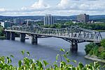 |
44 | Alexandra Bridge | 169 m (554 ft) | 563 m (1,847 ft) | Cantilever Steel truss 75+169+2x75 |
Boulevard des Allumettières Ottawa River |
1901 | Ottawa–Gatineau 45°25′48.7″N 75°42′15.8″W / 45.430194°N 75.704389°W |
Ontario Quebec |
|
 |
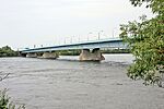
45 | Whirlpool Rapids Bridge | 167 m (548 ft) | 329 m (1,079 ft) | Arch Steel deck arch |
Niagara River |
1897 | Niagara Falls–Niagara Falls, New York 43°06′33.7″N 79°03′29.5″W / 43.109361°N 79.058194°W |
Ontario |
|
 |
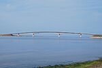
46 | Pont de la Concorde | 160 m (520 ft)(x3) | 690 m (2,260 ft) | Box girder Steel 104+3x160+104 |
Avenue Pierre Dupuy St. Lawrence River |
1965 | Montreal 45°30′22.1″N 73°32′20.3″W / 45.506139°N 73.538972°W |
Quebec | |
 |
47 | Miscou Bridge | 160 m (520 ft) | 505 m (1,657 ft) | Beam bridge Steel 60+110+160+110+65 |
Chaleur Bay |
1996 | Miscou Island–Lamèque Island 47°53′12.7″N 64°34′40″W / 47.886861°N 64.57778°W |
New Brunswick | |
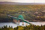 |
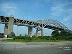
48 | Seal Island Bridge | 152 m (499 ft) | 747 m (2,451 ft) | Arch Steel through arch 107+152+107 |
Trans-Canada Highway Bras d'Or Lake |
1962 | Boularderie Island–Cape Breton Island 46°13′58.6″N 60°29′24.7″W / 46.232944°N 60.490194°W |
Nova Scotia | |
 |
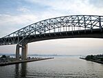
49 | Burlington Bay James N. Allan Skyway (1958) | 151 m (495 ft) | 2,560 m (8,400 ft) | Arch Steel through arch 84+151+84 |
Hamilton Harbour |
1958 | Hamilton–Burlington 43°17′53.7″N 79°47′49.1″W / 43.298250°N 79.796972°W |
Ontario | |
 |
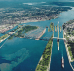
50 | Burlington Bay James N. Allan Skyway (1985) | 151 m (495 ft) | 2,215 m (7,267 ft) | Box girder Prestressed concrete |
Hamilton Harbour |
1985 | Hamilton–Burlington 43°17′53.4″N 79°47′50.0″W / 43.298167°N 79.797222°W |
Ontario | |
 |
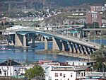
51 | Sault Ste. Marie International Bridge | 132 m (433 ft) | 4.5 km (2.8 mi) | Truss arch bridge Steel |
St. Marys River |
1962 | Sault Ste. Marie 46°30′25.31″N 84°21′40.75″W / 46.5070306°N 84.3613194°W |
Ontario |
|
 |
52 | Saint John Harbour Bridge | Beam bridge Steel |
Saint John River (Saint John Harbour) |
1968 | Saint John 45°16′09.7″N 66°04′29.5″W / 45.269361°N 66.074861°W |
New Brunswick | |||
 |
53 | Centennial Bridge | 1,180 m (3,870 ft) | Arch Steel through arch |
Miramichi River |
1967 | Miramichi 47°01′37.8″N 65°28′44.4″W / 47.027167°N 65.479000°W |
New Brunswick |
The old bridges over the Niagara
This part lists all the former bridges which succeeded one another on the Niagara River between the towns of Niagara Falls, Ontario and Queenston in Canada and Niagara Falls, New York and Lewiston in United States. The Whirlpool Rapids Bridge (1897), the Rainbow Bridge (1941) and the Lewiston–Queenston Bridge (1962), still in service are listed in the Major road and railway bridges part above.
| Name | Span | Length | Type | Note | Opened | Location | Ref. | ||
|---|---|---|---|---|---|---|---|---|---|
 |
1 | First Niagara Falls Suspension Bridge dismantled in 1855 |
232 m (761 ft) | Suspension Wooden pylons |
First crossing of the Niagara Conception by Charles Ellet Jr. Replaced by the second Niagara Falls Suspension Bridge |
1848 | Niagara Falls, Ontario– Niagara Falls, New York 43°06′33.2″N 79°03′29.4″W / 43.109222°N 79.058167°W |
||
| 2 | First Lewiston–Queenston Bridge wrecked by wind in 1864 |
257 m (843 ft) | 317 m (1,040 ft) | Suspension |
1854 | Queenston–Lewiston 43°09′42″N 79°02′47″W / 43.16167°N 79.04639°W |
|||
 |
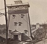
3 | Second Niagara Falls Suspension Bridge dismantled in 1897 |
251 m (823 ft) | Suspension with cable-stays, 2 levels wooden deck, masonry pylons |
World's first working railway suspension bridge Conception by John A. Roebling Replaced by the Whirlpool Rapids Bridge |
1855 | Niagara Falls, Ontario– Niagara Falls, New York 43°06′33.3″N 79°03′29.5″W / 43.109250°N 79.058194°W |
||
 |
4 | First Niagara Clifton Bridge destroyed by storm in 1889 |
386 m (1,266 ft) | Suspension with cable-stays, wooden deck and pylons |
Longest span in the world when inaugurated Conception by Samuel Keefer |
1868 | Niagara Falls, Ontario– Niagara Falls, New York 43°05′18.2″N 79°04′11.3″W / 43.088389°N 79.069806°W |
||
 |
5 | Niagara Cantilever Bridge dismantled in 1925 |
151 m (495 ft) | 276 m (906 ft) | Cantilever |
Replaced by the Michigan Central Railway Bridge | 1883 | Niagara Falls, Ontario– Niagara Falls, New York 43°06′30.2″N 79°03′28.4″W / 43.108389°N 79.057889°W |
|
 |
6 | Honeymoon Bridge destroyed by ice push in 1938 |
256 m (840 ft) | 378 m (1,240 ft) | Arch Steel deck arch |
Longest span arch bridge in the world when inaugurated | 1898 | Niagara Falls, Ontario– Niagara Falls, New York 43°05′18.0″N 79°04′10.5″W / 43.088333°N 79.069583°W |
|
 |
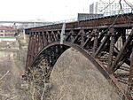
7 | Second Lewiston–Queenston Bridge dismantled in 1963 |
257 m (843 ft) | 257 m (843 ft) | Suspension | Former Second Niagara Clifton Bridge moved | 1899 | Queenston–Lewiston 43°09′42″N 79°02′46″W / 43.16167°N 79.04611°W |
|
 |
8 | Michigan Central Railway Bridge Out of service since 2001 |
195 m (640 ft) | Arch Steel deck arch |
1925 | Niagara Falls, Ontario– Niagara Falls, New York 43°06′31.4″N 79°03′28.9″W / 43.108722°N 79.058028°W |
Alphabetical list
This part is organized by province and territory.
Alberta
- Athabasca River Bridge - Fort McMurray
- Beverly Bridge − Edmonton
- Briggs Bridge – Briggs
- Capilano Bridge − Edmonton
- Centre Street Bridge − Calgary
- Clover Bar Bridge − Edmonton
- Dawson Bridge − Edmonton
- Dudley B. Menzies Bridge − Edmonton
- Dunvegan Suspension Bridge − Dunvegan
- Fabyan Trestle Bridge − Fabyan
- Grant MacEwan Bridge − Fort McMurray
- George C. King Bridge − Calgary
- Groat Bridge − Edmonton
- High Level Bridge − Edmonton
- James MacDonald Bridge − Edmonton
- Reconciliation Bridge − Calgary
- Lea Park Bridge - Lea Park
- Lethbridge Viaduct − Lethbridge
- Louise Bridge − Calgary
- Low Level Bridge − Edmonton
- Mintlaw Viaduct − Mintlaw
- Peace Bridge − Calgary
- Quesnell Bridge − Edmonton
- Ralph Steinhauer Bridge − Fort McMurray
- Red Deer Canadian Pacific Railway Bridge − Red Deer
- Star Mine Suspension Bridge − Drumheller
- Tawatinâ Bridge – Edmonton
- Walterdale Bridge − Edmonton
British Columbia
- Agassiz-Rosedale Bridge − Agassiz
- Alex Fraser Bridge − Richmond/New Westminster - North Delta
- Arthur Laing Bridge − Vancouver - YVR, Richmond
- Burrard Street Bridge − Vancouver
- Cambie Street Bridge − Vancouver
- Capilano Suspension Bridge − North Vancouver
- Derwent Way Bridge − Delta - New Westminster
- Dinsmore Bridge − Richmond
- Dollarton Bridge − North Vancouver
- Eleanor Ward Bridge − Coquitlam
- Fraser Valley Railroad Bridge − New Westminster - Surrey
- Georgia Viaduct − Vancouver
- Golden Ears Bridge − Langley - Maple Ridge - Pitt Meadows - Surrey
- Granville Street Bridge − Vancouver
- Hagwilget Canyon Bridge − Hagwilget
- Hudson's Hope Suspension Bridge − Hudson's Hope
- Ironworkers Memorial Second Narrows Crossing − Vancouver - North Vancouver
- Johnson Street Bridge - Victoria
- Knight Street Bridge − Vancouver - Richmond
- Lions' Gate Bridge − Vancouver - West Vancouver
- Lynn Canyon Suspension Bridge − North Vancouver
- Lulu Island CN Rail Bridge − Burnaby - Richmond
- Marpole Bridge (road) − Vancouver - Richmond
- Marpole CP Rail Bridge − Vancouver - Richmond
- McPhee Bridge − Cranbrook
- Middle Arm Canada Line Bridge − Richmond
- Mission Bridge − Abbotsford
- Moray Bridge − Richmond
- New Westminster Bridge − New Westminster - Surrey
- No. 2 Road Bridge − Richmond
- North Arm Canada Line Bridge − Vancouver - Richmond
- Oak Street Bridge − Vancouver - Richmond
- Overlanders Bridge − Kamloops
- Park Bridge − East of Golden, British Columbia
- Pattullo Bridge − New Westminster - Surrey
- Peace River Bridge
- Pitt River Bridge − Port Coquitlam - Pitt Meadows
- Port Mann Bridge − Coquitlam - Surrey
- Prince George CNR Bridge − Prince George
- Queensborough Bridge − New Westminster
- Ronyane Bridge − Pemberton
- Sea Island Connector − Richmond
- Second Narrows Bridge − Vancouver - North Vancouver
- Skybridge − New Westminster - Surrey
- Westham Island Bridge − Ladner
- William R. Bennett Bridge - Kelowna
- The Yukon Suspension Bridge - Northern British Columbia
Manitoba
- Arlington Bridge − Winnipeg
- Assiniboine River Bridge - Portage la Prairie
- Esplanade Riel − Winnipeg
- The Bridges of St Norbert - St Norbert
- Provencher Bridge − Winnipeg
- Elm Park Bridge − Winnipeg
- St. Vital Bridge − Winnipeg
- Norwood Bridge − Winnipeg
- Main Street Bridge − Winnipeg
- Midtown Bridge (Donald Street Bridge) − Winnipeg
- Osborne Bridge − Winnipeg
- Harry Lazarenko Bridge (Redwood Bridge) − Winnipeg
- Fort Garry Bridge − Winnipeg
- Kildonan Settlers Bridge − Winnipeg
- Maryland Bridge − Winnipeg
- Charleswood Bridge − Winnipeg
- Disraeli Bridge − Winnipeg
- Louise Bridge − Winnipeg
- Slaw Rebchuk Bridge (Salter Street Bridge) − Winnipeg
- North Perimeter Bridge − Winnipeg
- Selkirk Lift Bridge - Selkirk
- South Perimeter Bridge − Winnipeg
- St Peters Dynevor Bridge
- West Perimeter Bridge − Winnipeg
- St. James Bridge − Winnipeg
- Lockport Bridge − Lockport
- Daly Overpass (18th Street Bridge) − Brandon
- 8th Street Bridge − Brandon
- 1st Street Bridge − Brandon
- Thompson Bridge − Brandon
- Bruce Cameron Bridge − Swan River
- Taylor Bridge − Headingley
- Pierre Delorme Bridge − St. Adolphe
- Baie St Paul Bridge
- Jack Bend Bridge
Newfoundland and Labrador
- Sir Robert Bond Bridge
- Queen Elizabeth II Bridge − St. John’s
- Sir Ambrose Shea Bridge − Placentia
New Brunswick
- Burton Bridge − Burton - Maugerville
- Confederation Bridge − Cape Jourimain, NB - Borden, PEI
- Centennial Bridge − Miramichi
- Edmundston-Madawaska Bridge − Edmundston to Madawaska, Maine
- Florenceville Bridge − Florenceville
- Fredericton Railway Bridge − Fredericton - South Devon
- Gunningsville Bridge − Moncton - Riverview
- Hartland Bridge − Hartland
- Hawkshaw Bridge − Nackawic-Millville
- Hugh John Flemming Bridge − Hartland
- J. C. Van Horne Bridge − Campbellton - Pointe-à-la-Croix, QC
- Jemseg River Bridge − Jemseg
- Kelly's Creek Bridge − Upper Kingsclear
- Mactaquac Bridge − Mactaquac
- Miramichi Bridge − Miramichi
- Morrissy Bridge − Miramichi
- Nerepis Bridge − Grand Bay-Westfield
- Point Wolfe Bridge – Fundy National Park
- Princess Margaret Bridge − Fredericton
- Reversing Falls Bridge − Saint John
- Reversing Falls Railway Bridge − Saint John
- Saint John Harbour Bridge − Saint John
- Saint John River High Level Crossing − Coystown
- Westmorland Bridge − Fredericton
Northwest Territories
Nova Scotia
- Barra Strait Bridge − Barra Strait, Cape Breton Island
- Grand Narrows Bridge − Barra Strait, Cape Breton Island
- A. Murray MacKay Bridge − Halifax
- Angus L. Macdonald Bridge − Halifax
- Seal Island Bridge − Boularderie Island - Cape Breton Island
- Canso Canal swing bridge − Port Hastings
- George Street Bridge − New Glasgow
Ontario
- Alexandra Bridge − Ottawa – Gatineau, QC
- Ambassador Bridge − Windsor – Detroit, MI
- Blackfriars Street Bridge − London
- Blue Water Bridge − Point Edward – Port Huron, MI
- Burgoyne Bridge – St. Catharines
- Champlain Bridge − Ottawa – Gatineau, QC
- Chaudière Bridge − Ottawa - Gatineau, QC
- Gordie Howe International Bridge − Windsor – Detroit, MI
- Garden City Skyway − St. Catharines
- Heron Road Bridge − Ottawa
- Hogg's Hollow Bridge − Toronto
- James N. Allan Skyway Bridge (Burlington Bay Skyway) − Hamilton – Burlington
- La Salle Causeway − Kingston
- Leaside Bridge − Toronto
- Little Current Swing Bridge − Little Current – Turner
- Nipigon River Bridge − Nipigon
- Ogdensburg–Prescott International Bridge − Prescott – Ogdensburg, NY
- Peace Bridge − Fort Erie – Buffalo, NY
- Portage Bridge − Ottawa - Gatineau
- Prince Edward Viaduct (Bloor Street Viaduct) − Toronto
- Macdonald-Cartier Bridge − Ottawa – Gatineau, QC
- Queenston-Lewiston Bridge − Queenston - Lewiston, NY
- Rainbow Bridge − Niagara Falls – Niagara Falls, NY
- Sault Ste. Marie International Bridge − Sault Ste. Marie – Sault Ste. Marie, MI
- Sgt. Aubrey Cosens VC Memorial Bridge − Latchford
- Sioux Narrows Bridge − Sioux Narrows
- Temagami Bridge – Timmins
- Thousand Islands Bridge − near Ivy Lea – near Fishers Landing, NY
- Whirlpool Rapids Bridge − Niagara Falls – Niagara Falls, NY
Prince Edward Island
- Confederation Bridge − Borden - Cape Jourimain, NB
- Hillsborough River Bridge − Charlottetown - Stratford
Quebec
- Ahuntsic Bridge − Laval - Montreal
- Alexandra Bridge − Gatineau - Ottawa, ON
- Arthur Sauve Bridge − Laval - Saint-Eustache
- Arvida Bridge - Jonquière, Québec
- Athanase David Bridge − Laval - Bois-des-Filions
- Alonzo Wright Bridge − Gatineau - Chelsea
- Bordeaux Railway Bridge − Montreal - Laval
- Bordeleau bridge − Saint-Séverin (Mékinac) - Mékinac - Mauricie
- Brady Bridge − Gatineau
- Champlain Bridge − Gatineau - Ottawa, ON
- Champlain Bridge − Montreal - Brossard
- Charles de Gaulle Bridge − Montreal - Charlemagne
- Chaudière Bridge − Gatineau - Ottawa, ON
- Draveurs Bridge − Gatineau
- Galipeault Bridge − Montreal - L'Île-Perrot
- Gedeon Ouimet Bridge − Laval - Boisbriand
- Honore Mercier Bridge − Montreal - Kahnawake
- Île aux Tourtes Bridge − Montreal - Vaudreuil-Dorion
- Île d'Orléans Bridge − Quebec City - Île d'Orléans
- Jacques Cartier Bridge − Montreal - Longueuil
- J. C. Van Horne Bridge − Pointe-à-la-Croix - Campbellton, NB
- Lachapelle Bridge − Laval - Montreal
- Lady Aberdeen Bridge − Gatineau
- Laurier Railway Bridge − Montreal - Repentigny -Charlemagne
- Laviolette Bridge − Trois-Rivières - Bécancour
- Le Gardeur Bridge − Montreal - Repentigny
- Lepage Bridge − Laval - Terrebonne
- Louis Bisson Bridge − Laval - Montreal
- Louis-Hippolyte Lafontaine Bridge-Tunnel − Montreal - Boucherville
- Macdonald-Cartier Bridge - Hull - Ottawa, ON
- Marius Dufresne Bridge − Laval - Rosemère
- Matthieu Bridge − Laval - Terrebonne
- Médéric Martin Bridge − Laval - Montreal
- Olivier-Charbonneau Bridge − Laval - Montreal
- Papineau-Leblanc Bridge − Laval - Montreal
- Percy Covered Bridge (Powerscourt) − Elgin - Hinchinbrooke
- Pie IX Bridge − Laval - Montreal
- Pierre Laporte Bridge − Quebec City - Lévis
- Portage Bridge − Gatineau - Ottawa, ON
- Quebec Bridge − Quebec City - Lévis
- Saint-Laurent Railway Bridge − Montreal - Kahnawake
- Sophie Masson Bridge − Laval - Terrebonne
- Vachon Bridge − Laval - Boisbriand
- Victoria Bridge − Montreal - Saint-Lambert
Saskatchewan
North Saskatchewan River
- Battlefords Bridge − Battleford - North Battleford
- Battlefords Bridge (1908) - Battleford - North Battleford
- Canadian Northern Railway Bridge − Prince Albert
- Diefenbaker Bridge − Prince Albert
- Maymont Bridge − Mayfield No. 406
- Borden Bridge − Borden
- Petrofka Bridge − Blaine Lake No. 434
South Saskatchewan River
- Broadway Bridge − Saskatoon
- Chief Mistawasis Bridge - Saskatoon
- Circle Drive Bridge − Saskatoon
- Gordie Howe Bridge − Saskatoon
- CPR Bridge − Saskatoon
- Grand Trunk Bridge − Saskatoon
- Outlook Bridge − Outlook
- Spadina Crescent Bridge − Saskatoon Note - Bridge over run-off trench leading into the South Saskatchewan River
- Senator Sid Buckwold Bridge − Saskatoon
- Traffic Bridge − Saskatoon
- University Bridge − Saskatoon
- Muskoday Bridge − Muskoday First Nation
- St. Louis Bridge − St. Louis
- St. Louis Bridge (1915) − St. Louis
- Skytrail − Outlook
Saskatchewan River
- Crooked Bridge − Nipawin
Other Lakes and Rivers
- Albert Memorial Bridge − Regina
- Cochin Bridge − Cochin
- Long Creek Bridge − Estevan No. 5
- Sherwood Forest Bridge − Grand Coulee
See also
- Transport in Canada
- Roads in Canada
- Numbered highways in Canada
- Rail transport in Canada
- Geography of Canada
- List of rivers of Canada
- List of covered bridges in Quebec
- List of covered bridges in New Brunswick
- List of bridges by city: Calgary, Island of Montreal, Ottawa, Toronto
- List of bridges by river: Fraser River, Nechako River, Niagara River, North Saskatchewan River, Ottawa River, Red Deer River, Richelieu River, Rivière des Mille Îles, Rivière des Prairies, St. Lawrence River and the Great Lakes, South Saskatchewan River, Thompson River

