List of tallest buildings in Rhode Island facts for kids
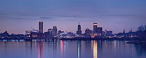
The U.S. state of Rhode Island is home to 27 buildings over 175 feet (53 m) in height. Five of these buildings are taller than 300 feet (91 m), all of which are located in the state's capital and largest city, Providence.
The tallest skyscraper in the city and state is the Industrial National Bank Building at 111 Westminster Street in Downtown Providence, which rises 26 floors and 428 feet (130 m). The Industrial National Bank Building, nicknamed the "Superman Building" due to its resemblance to the fictional Daily Planet building from the 1950s TV series, Adventures of Superman, is also the sixth-tallest building in New England outside of Boston. The second-tallest building in Providence is One Financial Plaza, which rises 30 floors and 410 feet (125 m) and was completed in 1973.
As one of the early manufacturing centers in the United States, many of Providence's tallest buildings were constructed prior to 1930; among these are the Industrial National Bank Building, Turk's Head Building, and Bannigan Building. The city went through a second building boom in the 1970s, during which One Financial Plaza and Textron Tower, the city's second and fifth-tallest buildings, were completed. In the 1990s and 2000s, the city again experienced a construction boom. Dubbed the Providence "Renaissance," this period saw the construction of four of the cities ten tallest buildings.
Tallest buildings
This lists ranks Rhode Island structures based on standard height measurement. This includes spires and architectural details but does not include antenna masts. An equal sign (=) following a rank indicates the same height between two or more buildings. The "Year" column indicates the year in which the building was completed.
| Rank | Name | Image | Height ft (m) |
Floors | Year | Location | Use | Notes |
|---|---|---|---|---|---|---|---|---|
| 1 | Industrial National Bank Building | 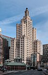 |
428 (130) | 26 | 1928 | Providence
41°49′28.27″N 71°24′39.89″W / 41.8245194°N 71.4110806°W |
Vacant |
|
| 2 | One Financial Plaza | 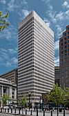 |
410 (125) | 30 | 1973 | Providence
41°49′31.11″N 71°24′36.14″W / 41.8253083°N 71.4100389°W |
Office |
|
| 3 | The Residences Providence | 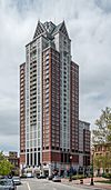 |
380 (116) | 31 | 2007 | Providence
41°49′30.32″N 71°24′54.77″W / 41.8250889°N 71.4152139°W |
Residential | Tallest building in Rhode Island constructed in the 2000s |
| 4 | Omni Providence Hotel | 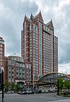 |
329 (100) | 25 | 1993 | Providence
41°49′31.15″N 71°24′58.5″W / 41.8253194°N 71.416250°W |
Hotel |
|
| N/A | Manchester Street Generating Station | 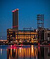 |
321 (98) | 1996 | Providence
41°48′57″N 71°24′16″W / 41.815829°N 71.404329°W |
Power station |
|
|
| 5 | Textron Tower | 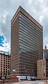 |
311 (95) | 23 | 1971-72 | Providence
41°49′29.63″N 71°24′33.05″W / 41.8248972°N 71.4091806°W |
Office |
|
| 6 | 50 Kennedy Plaza | 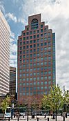 |
285 (87) | 20 | 1985 | Providence
41°49′29.8″N 71°24′38.09″W / 41.824944°N 71.4105806°W |
Office | Tallest building in Rhode Island constructed in the 1980s |
| 7 | Blue Cross & Blue Shield of Rhode Island Headquarters | 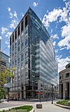 |
236 (72) | 14 | 2009 | Providence
41°49′40.2672″N 71°24′48.261″W / 41.827852000°N 71.41340583°W |
Office | |
| 8 | Waterplace 1 | 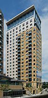 |
236 (72) | 19 | 2008 | Providence
41°49′38.44″N 71°24′45.098″W / 41.8273444°N 71.41252722°W |
Residential |
|
| 9 | Rhode Island State House | 223 (68) | 4 | 1904 | Providence
41°49′51.1032″N 71°24′54.053″W / 41.830862000°N 71.41501472°W |
Governmental |
|
|
| 10= | Biltmore Hotel |  |
220 (67) | 18 | 1922 | Providence
41°49′27.73″N 71°24′48.4″W / 41.8243694°N 71.413444°W |
Hotel |
|
| 10= | The Tower at Carnegie Abbey | 220 (67) | 17 | 2009 | Portsmouth
41°36′58.3″N 71°16′10.8″W / 41.616194°N 71.269667°W |
Residential |
|
|
| 12 | Providence County Courthouse |  |
217 (66) | 7 | 1930 | Providence
41°49′31.76″N 71°24′24.84″W / 41.8254889°N 71.4069000°W |
Governmental | Tallest building in Rhode Island constructed in the 1930s |
| 13 | Turk's Head Building | 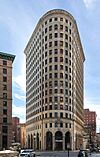 |
217 (66) | 16 | 1913 | Providence
41°49′28.42″N 71°24′35.5″W / 41.8245611°N 71.409861°W |
Office | Tallest building in Rhode Island constructed in the 1910s |
| 14 | Waterplace 2 | 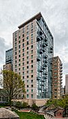 |
210 (64) | 17 | 2008 | Providence
41°49′38.22″N 71°24′48.05″W / 41.8272833°N 71.4133472°W |
Residential | |
| 15 | Pawtucket City Hall |  |
209 (64) | 3 | 1933 | Pawtucket
41°52′44.2″N 71°22′55.8″W / 41.878944°N 71.382167°W |
Governmental |
|
| 16 | Grace Church | 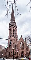 |
~206 (63) | 1 | 1860 | Providence
41°49′19″N 71°24′49″W / 41.82183°N 71.413507°W |
Church | Tallest building in Rhode Island constructed in the 19th century |
| 17= | Carrol Tower |  |
199 (61) | 16 | 1973 | Providence
41°49′38.22″N 71°24′48.05″W / 41.8272833°N 71.4133472°W |
Residential |
|
| 17= | Parenti Villa | 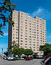 |
199 (61) | 16 | 1973 | Providence
41°49′11.6″N 71°26′10.0″W / 41.819889°N 71.436111°W |
Residential |
|
| 19 | Towers East | 194 (59) | 16 | 1976 | Pawtucket
41°52′33″N 71°23′09″W / 41.875806°N 71.385755°W |
Residential | ||
| 20 | First Unitarian Church of Providence | 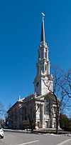 |
189 (58) | 1816 | Providence
41°49′28″N 71°24′18″W / 41.824381°N 71.404901°W |
Church |
|
|
| 21 | Charlesgate North | 187 (57) | 15 | 1970 | Providence
41°50′19.6902″N 71°24′35.2368″W / 41.838802833°N 71.409788000°W |
Residential | ||
| 22 | First Baptist Church | 185 (56) | 1775 | Providence
41°49′39″N 71°24′30″W / 41.827476°N 71.408292°W |
Church | Tallest building in Rhode Island constructed in the 18th century | ||
| 23 | Fogarty Manor | 182 (55) | 1969 | Pawtucket
41°52′50″N 71°22′59″W / 41.880481°N 71.38316°W |
Residential | Tallest building in Rhode Island constructed in the 1960s | ||
| 24= | One Citizens Plaza | 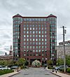 |
180 (55) | 13 | 1990 | Providence
41°49′38.4558″N 71°24′38.2926″W / 41.827348833°N 71.410636833°W |
Office | |
| 24= | Brown University Sciences Library | 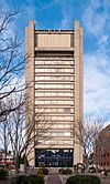 |
180 (55) | 15 | 1971 | Providence
41°49′36.85″N 71°24′0.49″W / 41.8269028°N 71.4001361°W |
University |
|
| 26 | 121 South Main Street | 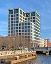 |
178 (54) | 11 | 1984 | Providence
41°49′27″N 71°24′25″W / 41.824074°N 71.407019°W |
University |
|
| 27 | Hospital Trust Building | 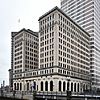 |
177 (54) | 13 | 1920 | Providence
41°49′32.38″N 71°24′34.83″W / 41.8256611°N 71.4096750°W |
University |
|
| 28 | Sister Dominica Manor | 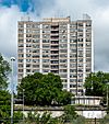 |
175 (53) | 16 | 1966 | Providence
41°49′21.84″N 71°25′16.69″W / 41.8227333°N 71.4213028°W |
Residential |
|
| 29 | Hilton Providence Hotel |  |
~173 (53) | 14 | 1969 | Providence
41°49′23″N 71°25′07″W / 41.822989°N 71.418550°W |
Hotel |
|
| 30 | Edge College Hill | 172 (52) | 15 | 2018 | Providence
41°49′40″N 71°24′36″W / 41.827908°N 71.410074°W |
Residential |
|
|
| 31 | Slater Hill Apartments | 170 (52) | 14 | Pawtucket
41°52′29″N 71°23′10″W / 41.874726°N 71.386038°W |
Residential | |||
| 32 | One Regency Plaza | ~161 | 13 | 1973 | Residential | |||
| 33 | Bannigan Building | 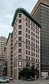 |
~160 (49) | 11 | 1896 | Providence
41°49′29″N 71°24′33″W / 41.824679°N 71.409209°W |
Office |
|
| 34 | Union Trust Company Building | 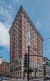 |
~157 (48) | 12 | 1902 | Providence
41°49′25″N 71°24′41″W / 41.823685°N 71.411350°W |
Office | |
| 35 | Cathedral of Saints Peter and Paul | 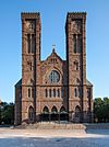 |
156 (48) | 1889 | Providence
41°49′09″N 71°24′59″W / 41.819282°N 71.416506°W |
Church |
|
Tallest proposed
| Name | Height ft (m) |
Floors | Status | Location | Notes |
|---|---|---|---|---|---|
| Hope Point Tower | 550 (168) | 46 | Never built | Jewelry District, Providence |
|
| Edge College Hill II | 187 (57) | 15 | Proposed | College Hill, Providence |
|
| 137-151 Friendship St. | 120 (37) | 12 | Proposed | Jewelry District, Providence |
|
| 151 Chestnut St. | 112 (34) | 9 | In approval | Jewelry District, Providence |
|
Tallest demolished
| Name | Height ft (m) |
Floors | Built | Destroyed | Location | Use | Notes |
|---|---|---|---|---|---|---|---|
| Hartford Park | 10 | 1951 | 1989 | Providence | Residential |
|
Timeline of tallest buildings
This table lists buildings that once held the title of tallest building in Rhode Island. Since the completion of the First Baptist Church in America, all structures to hold the title have been located in Providence.
| Name | Image | Location | Years as tallest | Height ft (m) |
Floors | Coordinates | Reference |
|---|---|---|---|---|---|---|---|
| Trinity Church | 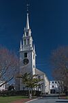 |
Newport | c. 1750–1775 | ~150 (46) | 41°29′14″N 71°18′48″W / 41.48732°N 71.31328°W | ||
| First Baptist Church | Providence | 1775–1816 | 185 (56) | 41°49′39″N 71°24′30″W / 41.827476°N 71.408292°W | |||
| First Unitarian Church of Providence |  |
Providence | 1816–1816 | 189 (58) | |||
| Grace Church |  |
Providence | 1860–1904 | ~206 (63) | 41°49′19″N 71°24′49″W / 41.82208°N 71.41365°W | ||
| Rhode Island State House | Providence | 1904–1927 | 223 (68) | 4 | 41°49′51.08″N 71°24′53.87″W / 41.8308556°N 71.4149639°W | ||
| Industrial National Bank Building |  |
Providence | 1927–present | 428 (130) | 26 | 41°49′28.27″N 71°24′39.89″W / 41.8245194°N 71.4110806°W |


