
Llanos Costa, Cabo Rojo, Puerto Rico facts for kids
Quick facts for kids
Llanos Costa
|
|||
|---|---|---|---|
|
Barrio
|
|||

A view of Llanos Costa
|
|||
|
|||

Location of Llanos Costa within the municipality of Cabo Rojo shown in red
|
|||

Llanos Costa, Cabo Rojo, Puerto Rico
Location in Caribbean
|
|||
| Commonwealth | |||
| Municipality | |||
| Area | |||
| • Total | 23.49 sq mi (60.8 km2) | ||
| • Land | 19.52 sq mi (50.6 km2) | ||
| • Water | 3.97 sq mi (10.3 km2) | ||
| Elevation | 223 ft (68 m) | ||
| Population
(2010)
|
|||
| • Total | 3,571 | ||
| • Density | 182.9/sq mi (70.6/km2) | ||
| Source: 2010 Census | |||
| Time zone | UTC−4 (AST) | ||
| ZIP code |
00623
|
||


Llanos Costa is a barrio in the municipality of Cabo Rojo, Puerto Rico. Its population in 2010 was 3,571.
History
Puerto Rico was ceded by Spain in the aftermath of the Spanish–American War under the terms of the Treaty of Paris of 1898 and became an unincorporated territory of the United States. In 1899, the United States Department of War conducted a census of Puerto Rico finding that the population of Llanos Costa barrio was 867.
| Historical population | |||
|---|---|---|---|
| Census | Pop. | %± | |
| 1900 | 867 | — | |
| 1910 | 1,246 | 43.7% | |
| 1920 | 1,281 | 2.8% | |
| 1930 | 1,402 | 9.4% | |
| 1940 | 2,059 | 46.9% | |
| 1950 | 2,471 | 20.0% | |
| 1980 | 1,849 | — | |
| 1990 | 2,511 | 35.8% | |
| 2000 | 3,495 | 39.2% | |
| 2010 | 3,571 | 2.2% | |
| U.S. Decennial Census 1899 (shown as 1900) 1910-1930 1930-1950 1980-2000 2010 |
|||
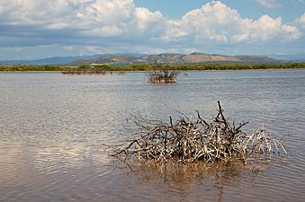
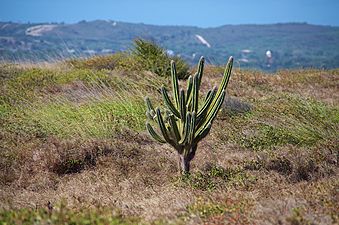
Gallery
-
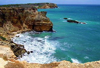
Rocky seashore in Llanos Costa near the Faro Los Morrillos de Cabo Rojo
-
-
.jpg)
.jpg)
.jpg)
See also
 In Spanish: Llanos Costa (Cabo Rojo) para niños
- List of communities in Puerto Rico

All content from Kiddle encyclopedia articles (including the article images and facts) can be freely used under Attribution-ShareAlike license, unless stated otherwise. Cite this article:
Llanos Costa, Cabo Rojo, Puerto Rico Facts for Kids. Kiddle Encyclopedia.