
Loei province facts for kids
Quick facts for kids
Loei
เลย
|
|||
|---|---|---|---|
 |
|||
|
|||
| Motto(s):
City of the sea of mountains, coldest place in Siam, with beautiful flowers of three seasons
|
|||

Map of Thailand highlighting Loei province
|
|||
| Country | Thailand | ||
| Capital | Loei | ||
| Area | |||
| • Total | 10,500 km2 (4,100 sq mi) | ||
| Area rank | Ranked 16th | ||
| Population
(2019)
|
|||
| • Total | 642,950 | ||
| • Rank | Ranked 42nd | ||
| • Density | 61/km2 (160/sq mi) | ||
| • Density rank | Ranked 68th | ||
| Human Achievement Index | |||
| • HAI (2017) | 0.5819 "average" Ranked 42nd |
||
| Time zone | UTC+7 (ICT) | ||
| Postal code |
42xxx
|
||
| Calling code | 042 | ||
| ISO 3166 code | TH-42 | ||
| Vehicle registration | เลย | ||


Loei (Thai: เลย, pronounced [lɤ̄ːj]), is one of the more sparsely populated provinces (changwat) of Thailand. It lies in the Isan region of upper northeastern Thailand. Neighboring provinces are (from east clockwise) Nong Khai, Udon Thani, Nong Bua Lamphu, Khon Kaen, Phetchabun, and Phitsanulok. In the north it borders Xaignabouli and Vientiane province of Laos.
As of 2020[update], the provincial governor is Chaiwat Chuenkosum. The province was allocated 225.6 million baht in the FY2019 Thailand budget.
Contents
History
Loei was founded by a Thai tribe from the Kingdom of Yonok Chiang Saen. Khun Pha Muang founded the village of Dan-kwa, and Bang Klang Hao founded Dan Sai. Drought and disease later led to the villagers move to the site of present-day Loei.
In 1907, King Chulalongkorn (Rama V) created Loei province. The Loei Cultural Centre (ศูนย์วัฒนธรรมจังหวัดเลย) displays Loei's history, religions, and traditions. The province is home to many Lao people who fled the Communist take-over of the Kingdom of Laos. The area of the province along the Lao border is used by the Laotians to buy and sell goods with the locals on the Thai side.
Geography

The province is mountainous. The seat of provincial government, Loei, is in a fertile basin surrounded by mountains whose summits are covered by fog and abundant varied flora. The best known mountains in the province are Phu Kradueng, Phu Luang, and Phu Ruea. The Loei River, which flows through the province, is a tributary of the Mekong, which forms part of the northern boundary of the province with neighboring Laos. Phu Thap Buek, the highest mountain of the Phetchabun Range, is in the province. The mountain Phu Kradueng is in Phu Kradueng National Park (อุทยานแห่งชาติภูกระดึง). The western part of the province reaches the southern end of the Luang Prabang Range of the Thai highlands. The total forested area is 3,382 km2 (1,306 sq mi) or 32.2 percent of the province.
National parks
There are four national parks, along with two other national parks, make up region 8 (Khon Kaen), and Na Yung–Nam Som in region 10 (Udon Thani) and Phu Hin Rong Kla region 11 (Phitsanulok) of Thailand's protected areas.
- Na Yung–Nam Som National Park, 397 km2 (153 sq mi)
- Phu Pha Man National Park, 350 km2 (140 sq mi)
- Phu Kradueng National Park, 348 km2 (134 sq mi)
- Phu Hin Rong Kla National Park, 307 km2 (119 sq mi)
- Phu Ruea National Park, 121 km2 (47 sq mi)
- Phu Suan Sai National Park, 117 km2 (45 sq mi)
Wildlife sanctuaries
There are three wildlife sanctuaries, two of which are in region 8 (Khon Kaen), and Phu Khat in region 11 (Phitsanulok) of Thailand's protected areas.
- Phu Luang Wildlife Sanctuary, 897 km2 (346 sq mi)
- Phu Khat Wildlife Sanctuary, 241 km2 (93 sq mi)
- Phu Kho–Phu Kratae Wildlife Sanctuary, 232 km2 (90 sq mi)
Demographics
Loei province is home to several Tai peoples. The indigenous people are the Tai Lue, while the Phuan, Tai Dam, Thai, and Chinese people make up the rest of the population. The Tai Phuan people came to the province after migrating from Luang Prabang in Laos.
Symbols
The seal of the province shows the stupa at Phra That Si Song Rak, which was built in 1560 by King Maha Chakrapat of the Ayutthaya Kingdom and King Saysettha of Lan Xang as a symbol of friendship between the two kingdoms. The provincial tree is the Khasi pine (Pinus kesiya).
The provincial slogan is "city of the sea of mountains, coldest place in Siam, with beautiful flowers of three seasons."
Economy
Agriculture drives Loei's economy. Macadamia nuts, passion fruit, and Arabica coffee are grown in the highlands; bananas, sesame, and rubber on the plains. Loei is an ecotourism destination due to its natural environment and amalgam of northern and northeastern cultures.
Wang Saphung District is the site of a large open pit gold mine that employs many locals. The locality has been the site of a long-standing dispute as well as physical conflict between the villagers of Ban Na Nong Bong and its environs and Tungkum Limited, a subsidiary of Tongkah Harbour PCL. Tungkum's gold mining operation has been accused in the courts of environmental destruction.
Administrative divisions
Provincial government
 |
The province is divided into 14 districts (amphoe). The districts are further divided into 89 subdistricts (tambons) and 839 villages (mubans).
|
|
Local government
As of 26 November 2019 there are: one Loei Provincial Administration Organisation (ongkan borihan suan changwat) and 29 municipal (thesaban) areas in the province. Loei with Wang Saphung have town (thesaban mueang) status. There are a further 27 subdistrict municipalities (thesaban tambon). The non-municipal areas are administered by 71 Subdistrict Administrative Organisations, SAO (ongkan borihan suan tambon).
Transport
Route 201 leads from Chiang Khan in the north on the border with Laos, through Loei, to Non Sa-at near Chum Phae. Route 203 leads west to the vicinity of Phu Ruea, and then turns south to Lom Sak.
Loei is served by Loei Airport.
Human achievement index 2017
| Health | Education | Employment | Income |
| 75 | 46 | 15 | 49 |
| Housing | Family | Transport | Participation |
 |
 |
 |
.png) |
| 24 | 16 | 56 | 16 |
| Loei province, with a 2017 HAI value of 0.5819, is "average", ranking 42nd among Thailand's 76 provinces. |
Since 2003, United Nations Development Programme (UNDP) in Thailand has tracked progress on human development at the provincial level using the Human achievement index (HAI), a composite index measuring eight key areas of human development. The National Economic and Social Development Board (NESDB) has taken over this task since 2017.
| Rank | Classification |
| 1 - 15 | "high" |
| 16 - 30 | "somewhat high" |
| 31 - 45 | "average" |
| 45 - 60 | "somewhat low" |
| 61 - 77 | "low" |
| Map with provinces and HAI 2017 rankings |
 |
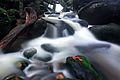
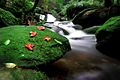
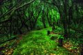
Gallery
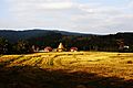
-
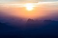
Sunrise, Pha Nok Aen
-
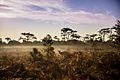
Phu Kradueng National Park
-
Phu Kradueng National Park
-
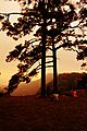
Phu Kradueng
-
Phu Kradueng
-
Phu Kradueng
-
Phu Ruea National Park
-
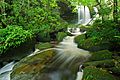
Man Daeng Waterfall, Phu Hin Rong Kla National Park
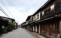
-
Na Haeo District
-
Chiang Khan


See also
 In Spanish: Provincia de Loei para niños
