
Massac County, Illinois facts for kids
Quick facts for kids
Massac County
|
|
|---|---|

Massac County Courthouse in Metropolis
|
|

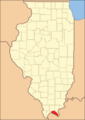
Location within the U.S. state of Illinois
|
|
 Illinois's location within the U.S. |
|
| Country | |
| State | |
| Founded | February 8, 1843 |
| Seat | Metropolis |
| Largest city | Metropolis |
| Area | |
| • Total | 242 sq mi (630 km2) |
| • Land | 237 sq mi (610 km2) |
| • Water | 4.6 sq mi (12 km2) 1.9% |
| Population
(2010)
|
|
| • Total | 15,429 |
| • Estimate
(2018)
|
14,080 |
| • Density | 63.76/sq mi (24.62/km2) |
| Time zone | UTC−6 (Central) |
| • Summer (DST) | UTC−5 (CDT) |
| Congressional district | 15th |
Massac County is a county in the U.S. state of Illinois. According to the 2010 census, it had a population of 15,429. Established in 1843 and named for a French fort founded in the 18th century, its county seat is Metropolis.
Massac County is included in the Paducah, KY-IL Micropolitan Statistical Area. It is located along the Ohio River, in the portion of the state known locally as "Little Egypt".
Contents
History
This area was occupied by various cultures of indigenous peoples for thousands of years before European contact. The most complex and last was that of the Mississippian culture, which built the complex mounds and plaza at the Kincaid Site (now a National Historic Landmark). They abandoned the site in about 1500, centuries before European contact.
Part of the Illinois Country was claimed by French explorers; this area was barely settled, with most French colonial villages close to the Mississippi River. During the French and Indian War against the British, the French built a fort here in 1757. It was named Fort Massac after Claude Louis d'Espinchal, Marquis de Massiac, the French Naval Minister. Massiac is a commune in Cantal, France. Although beginning to be settled by Americans after the American Revolution, Massac County was formally organized on February 8, 1843, out of territory from both Johnson and Pope counties. In the mid-19th century, after the revolutions of 1848, the Midwest received many German immigrants. Their descendants today comprise nearly one-third of the population of the county.
-
Massac County at the time of its creation in 1843

Geography
According to the U.S. Census Bureau, the county has a total area of 242 square miles (630 km2), of which 237 square miles (610 km2) is land and 4.6 square miles (12 km2) (1.9%) is water.
Climate and weather
| Weather chart for Metropolis, Illinois | |||||||||||||||||||||||||||||||||||||||||||||||
|---|---|---|---|---|---|---|---|---|---|---|---|---|---|---|---|---|---|---|---|---|---|---|---|---|---|---|---|---|---|---|---|---|---|---|---|---|---|---|---|---|---|---|---|---|---|---|---|
| J | F | M | A | M | J | J | A | S | O | N | D | ||||||||||||||||||||||||||||||||||||
|
3.5
42
25
|
3.9
48
29
|
4.4
58
38
|
4.7
69
47
|
4.8
77
56
|
4
86
64
|
4.3
90
68
|
3
88
66
|
3.3
82
59
|
3.2
71
47
|
4.5
58
38
|
4.4
47
29
|
||||||||||||||||||||||||||||||||||||
| temperatures in °F precipitation totals in inches source: The Weather Channel |
|||||||||||||||||||||||||||||||||||||||||||||||
|
Metric conversion
|
|||||||||||||||||||||||||||||||||||||||||||||||
In recent years, average temperatures in the county seat of Metropolis have ranged from a low of 25 °F (−4 °C) in January to a high of 90 °F (32 °C) in July, although a record low of −21 °F (−29 °C) was recorded in January 1984 and a record high of 105 °F (41 °C) was recorded in July 1999. Average monthly precipitation ranged from 3.00 inches (76 mm) in August to 4.76 inches (121 mm) in May.
Major highways
 Interstate 24
 U.S. Route 45
 Illinois Route 145
 Illinois Route 169
Adjacent counties
- Pope County - north
- Livingston County, Kentucky - east
- McCracken County, Kentucky - south
- Pulaski County - west
- Johnson County - northwest
National protected area
- Shawnee National Forest (part)
Demographics
| Historical population | |||
|---|---|---|---|
| Census | Pop. | %± | |
| 1850 | 4,092 | — | |
| 1860 | 6,213 | 51.8% | |
| 1870 | 9,581 | 54.2% | |
| 1880 | 10,443 | 9.0% | |
| 1890 | 11,313 | 8.3% | |
| 1900 | 13,110 | 15.9% | |
| 1910 | 14,200 | 8.3% | |
| 1920 | 13,559 | −4.5% | |
| 1930 | 14,081 | 3.8% | |
| 1940 | 14,937 | 6.1% | |
| 1950 | 13,594 | −9.0% | |
| 1960 | 14,341 | 5.5% | |
| 1970 | 13,889 | −3.2% | |
| 1980 | 14,990 | 7.9% | |
| 1990 | 14,752 | −1.6% | |
| 2000 | 15,161 | 2.8% | |
| 2010 | 15,429 | 1.8% | |
| 2018 (est.) | 14,080 | −8.7% | |
| U.S. Decennial Census 1790-1960 1900-1990 1990-2000 2010-2013 |
|||
2010
Whereas according to the 2010 U.S. Census Bureau:
- 91.0% White
- 5.9% Black
- 0.4% Native American
- 0.3% Asian
- 0.0% Native Hawaiian or Pacific Islander
- 2.0% Two or more races
- 0.4% Other races
- 1.9% Hispanic or Latino (of any race)
2010
As of the 2010 United States Census, there were 15,429 people, 6,362 households, and 4,242 families residing in the county. The population density was 65.0 inhabitants per square mile (25.1/km2). There were 7,113 housing units at an average density of 30.0 per square mile (11.6/km2). The racial makeup of the county was 91.0% white, 5.9% black or African American, 0.4% American Indian, 0.3% Asian, 0.5% from other races, and 2.0% from two or more races. Those of Hispanic or Latino origin made up 1.9% of the population. In terms of ancestry, 25.7% were German, 16.1% were Irish, 8.5% were English, and 8.5% were American.
Of the 6,362 households, 30.8% had children under the age of 18 living with them, 50.3% were married couples living together, 12.0% had a female householder with no husband present, 33.3% were non-families, and 29.2% of all households were made up of individuals. The average household size was 2.38 and the average family size was 2.91. The median age was 42.1 years.
The median income for a household in the county was $41,077 and the median income for a family was $51,794. Males had a median income of $46,231 versus $25,717 for females. The per capita income for the county was $20,216. About 9.7% of families and 13.7% of the population were below the poverty line, including 21.5% of those under age 18 and 11.7% of those age 65 or over.
Communities
Cities
Village
Unincorporated communities
- Bargerville
- New Liberty
- Round Knob
- Shady Grove
- Unionville
See also
 In Spanish: Condado de Massac para niños
