
Moosup River facts for kids
The Moosup River is a river in the U.S. states of Rhode Island and Connecticut. It flows approximately 23.7 miles (38.1 km).

Contents
Course
The river rises from Clark Pond in Foster, Rhode Island. From there, it flows south through Foster and Coventry, then turns west and heads into Connecticut, flowing through Sterling and Plainfield to its mouth at the Quinebaug River.
Dam Removal
The American Rivers organization has targeted the Moosup River for dam removal to help fish to swim upstream to spawn. In late June 2014 Moosup Dam #1 in Connecticut was removed and on September 29, 2015 the Griswold Rubber dam in Connecticut was removed.
Crossings
Below is a list all crossings over the Moosup River. The list starts at the headwaters and goes downstream.
| State | County | Town | Carrying |
|---|---|---|---|
| RI | Providence | Foster | Harrington Road |
| Moosup Valley Road | |||
| Kent | Coventry | Barbs Hill Road | |
| CT | Windham | Sterling | Deerfield Drive |
| Plainfield | |||
| Barber Hill Road | |||
| River Street | |||
| Pond Street | |||
| South Main Street | |||
| Water Street | |||
| Black Hill Road |
Tributaries
In addition to many unnamed tributaries, the following brooks feed the Moosup:
- West Meadow Brook
- Bucks Horn Brook
- Roaring Brook
- Vaughn Brook
- Quanduck Brook
- Angell Brook
Images for kids
-
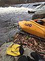
Action Paddling The Moosup River

