Mount Lewis (Nevada) facts for kids
Quick facts for kids Mount Lewis |
|
|---|---|

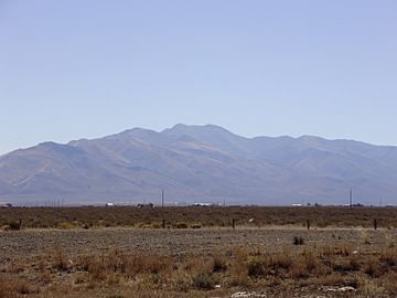
View of Mount Lewis from Interstate 80 near Battle Mountain
|
|
| Highest point | |
| Elevation | 9,678 ft (2,950 m) NAVD 88 |
| Prominence | 4,280 ft (1,305 m) |
| Geography | |
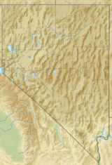
| Location | Lander County, Nevada, U.S. |
| Parent range | Shoshone Range |
| Topo map | USGS MT LEWIS |
| Climbing | |
| Easiest route | A well-maintained gravel road ascends directly to the summit |
Mount Lewis is the highest peak in the Shoshone Range in Lander County, Nevada, United States. It is the most topographically prominent peak in Lander County and the twentieth-most prominent peak in Nevada. The peak is located about 14 miles southeast of the town of Battle Mountain. An FAA Long Range Air Route Surveillance Radar station is located just west of the summit. The peak is on public land administered by the Bureau of Land Management and thus has no access restrictions.
Summit panorama

All content from Kiddle encyclopedia articles (including the article images and facts) can be freely used under Attribution-ShareAlike license, unless stated otherwise. Cite this article:
Mount Lewis (Nevada) Facts for Kids. Kiddle Encyclopedia.


