National Register of Historic Places listings in New Madrid County, Missouri facts for kids
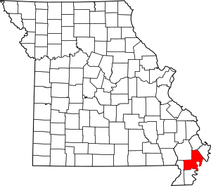
This is a list of the National Register of Historic Places listings in New Madrid County, Missouri.
This is intended to be a complete list of the properties and districts on the National Register of Historic Places in New Madrid County, Missouri, United States. Latitude and longitude coordinates are provided for many National Register properties and districts; these locations may be seen together in a map.
There are 10 properties and districts listed on the National Register in the county.
Current listings
| Name on the Register | Image | Date listed | Location | City or town | Description | |
|---|---|---|---|---|---|---|
| 1 | Double Bridges Archeological Site |
(#74001085) |
2.5 miles (4.0 km) north of Stewart, along Open Bayou 36°24′38″N 89°37′00″W / 36.410556°N 89.616667°W |
Portageville | ||
| 2 | Hunter-Dawson House |
(#12000563) |
312 Dawson Rd. 36°35′48″N 89°31′31″W / 36.596667°N 89.525278°W |
New Madrid | ||
| 3 | Hurricane Ridge Site |
(#72000725) |
Address Restricted |
Catron | ||
| 4 | King II Archeological Site |
(#75001070) |
Address Restricted |
Howardville | ||
| 5 | La Plant Archeological Site |
(#74001084) |
Northwest of Bayouville at the center of the northeastern quarter of Section 1, Township 23 North, Range 15 East 36°40′07″N 89°22′42″W / 36.668611°N 89.378333°W |
La Forge | ||
| 6 | Lilbourn Fortified Village Archeological Site |
(#69000118) |
U.S. Routes 61/62, in and east of Mound Cemetery 36°34′17″N 89°35′15″W / 36.571389°N 89.587500°W |
Lilbourn | ||
| 7 | Portwood Village and Mound |
(#77000812) |
Address Restricted |
Portageville | ||
| 8 | Sikeston Fortified Village Archeological Site |
(#71000471) |
South of Sikeston near the confluence of the North Cut and St. John's Ditches 36°48′55″N 89°33′35″W / 36.815278°N 89.559722°W |
Sikeston | ||
| 9 | St. Johns-Laplant IV Archeological District |
(#75001069) |
Southeastern quarter of the southwestern quarter of Section 11, Township 23 North, Range 15 East 36°38′47″N 89°24′21″W / 36.646389°N 89.405833°W |
Bayouville |

All content from Kiddle encyclopedia articles (including the article images and facts) can be freely used under Attribution-ShareAlike license, unless stated otherwise. Cite this article:
National Register of Historic Places listings in New Madrid County, Missouri Facts for Kids. Kiddle Encyclopedia.


