
National Register of Historic Places listings in Westmoreland County, Virginia facts for kids

This is a list of the National Register of Historic Places listings in Westmoreland County, Virginia.
This is intended to be a complete list of the properties and districts on the National Register of Historic Places in Westmoreland County, Virginia, United States. The locations of National Register properties and districts for which the latitude and longitude coordinates are included below, may be seen in an online map.
There are 24 properties and districts listed on the National Register in the county, including 2 National Historic Landmarks.
Current listings
| Name on the Register | Image | Date listed | Location | City or town | Description | |
|---|---|---|---|---|---|---|
| 1 | Bell House |
 |
(#87000692) |
821 Irving Ave. 38°14′27″N 76°57′27″W / 38.240833°N 76.957500°W |
Colonial Beach | |
| 2 | Blenheim |
.jpg) |
(#75002042) |
N of Wakefield Corner off VA 204 38°10′51″N 76°56′56″W / 38.180833°N 76.948750°W |
Wakefield Corner | |
| 3 | Bushfield |
(#04000053) |
367 Club House Loop 38°08′00″N 76°42′50″W / 38.133333°N 76.713889°W |
Mount Holly | ||
| 4 | Chantilly |
(#71000990) |
Address Restricted |
Montross | ||
| 5 | Ingleside |
(#79003094) |
S of Oak Grove on VA 638 38°09′01″N 77°00′14″W / 38.150278°N 77.003889°W |
Oak Grove | ||
| 6 | Armstead T. Johnson High School |
|
(#98001071) |
0.2 mi. NW of jct. of VA 3 and VA 202 38°04′39″N 76°46′54″W / 38.077500°N 76.781667°W |
Montross | |
| 7 | Morgan Jones 1677 Pottery Kiln |
(#74002150) |
Southwestern section of the Glebe Harbor subdivision peninsulaKelson, William M., and Edward A. Chappell. 38°08′01″N 76°39′13″W / 38.133611°N 76.653611°W |
Hague | ||
| 8 | Kinsale Historic District |
(#05000476) |
Roughly along Kinsale Rd, Kinsale Bridge Rd., Sigouney Dr., Great House Rd., and Yeocomico Ln. 38°01′46″N 76°34′48″W / 38.029444°N 76.580000°W |
Kinsale | ||
| 9 | James Monroe Family Home Site |
 |
(#79003095) |
4460 James Monroe Highway 38°14′31″N 76°59′25″W / 38.241944°N 76.990278°W |
Colonial Beach | Specific location represents a boundary increase of April 10, 2008; the site was originally listed as "Address Restricted" |
| 10 | Mount Pleasant |
(#02001440) |
317 Coles Point Rd. 38°04′32″N 76°38′41″W / 38.075417°N 76.644722°W |
Hague | ||
| 11 | Panorama |
 |
(#10001186) |
1006 Panorama Road 38°06′09″N 76°50′33″W / 38.102500°N 76.842500°W |
Montross | |
| 12 | Rochester House |
(#90002205) |
Co. Rt. 613, 1 mi. NE of Lyells off VA 3 38°00′05″N 76°43′02″W / 38.001389°N 76.717222°W |
Lyells | ||
| 13 | Roxbury |
(#79003096) |
1.7 mi. S of Oak Grove 38°09′27″N 77°00′10″W / 38.157500°N 77.002778°W |
Oak Grove | ||
| 14 | St. Peter's Episcopal Church |
(#03001445) |
Junction of VA 3 and VA 205 38°10′56″N 76°59′45″W / 38.182222°N 76.995833°W |
Oak Grove | ||
| 15 | Spence's Point |
.jpg) |
(#71000991) |
On Sandy Point Neck, on VA 749 38°05′13″N 76°33′46″W / 38.087083°N 76.562778°W |
Westmoreland | |
| 16 | Spring Grove |
 |
(#85003130) |
VA 202 38°05′10″N 76°42′22″W / 38.086111°N 76.706111°W |
Mount Holly | |
| 17 | Stratford Hall |
 |
(#66000851) |
North of Lerty on VA 214 38°09′07″N 76°50′22″W / 38.151944°N 76.839444°W |
Lerty | |
| 18 | George Washington Birthplace National Monument |
 |
(#66000850) |
E of Fredericksburg off U.S. 301 and VA 3 38°11′09″N 76°55′05″W / 38.185833°N 76.918056°W |
Fredericksburg | |
| 19 | Westmoreland State Park Historic District |
.jpg) |
(#05001265) |
1650 State Park Rd. 38°10′12″N 76°51′46″W / 38.170000°N 76.862778°W |
Montross | |
| 20 | Wirtland |
(#79003097) |
S of Oak Grove on VA 638 38°09′23″N 77°00′28″W / 38.156389°N 77.007778°W |
Oak Grove | ||
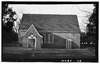
| 21 | Yeocomico Church |
 |
(#69000331) |
SW of Tucker Hill on Rte. 606 38°03′45″N 76°35′49″W / 38.062500°N 76.596944°W |
Tucker Hill |

All content from Kiddle encyclopedia articles (including the article images and facts) can be freely used under Attribution-ShareAlike license, unless stated otherwise. Cite this article:
National Register of Historic Places listings in Westmoreland County, Virginia Facts for Kids. Kiddle Encyclopedia.