Niwot, Colorado facts for kids
Quick facts for kids
Niwot, Colorado
|
|
|---|---|

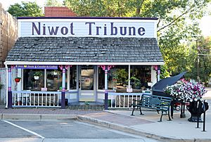
The old Niwot Tribune office on 2nd Avenue.
|
|

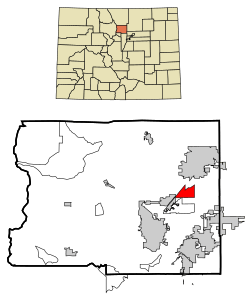
Location of the Niwot CDP in Boulder County, Colorado.
|
|
| Country | |
| State | |
| County | Boulder County |
| Named for | Chief Niwot |
| Government | |
| • Type | unincorporated town |
| Area | |
| • Total | 4.005 sq mi (10.374 km2) |
| • Land | 3.996 sq mi (10.350 km2) |
| • Water | 0.009 sq mi (0.024 km2) |
| Elevation | 5,167 ft (1,575 m) |
| Population
(2020)
|
|
| • Total | 4,306 |
| • Density | 1,003/sq mi (387/km2) |
| Time zone | UTC-7 (MST) |
| • Summer (DST) | UTC-6 (MDT) |
| ZIP Code |
80503, 80544
|
| Area codes | 303 & 720 |
| GNIS feature | Niwot CDP |
Niwot is an unincorporated town, a post office, and a census-designated place (CDP) located in and governed by Boulder County, Colorado, United States. The CDP is a part of the Boulder, CO Metropolitan Statistical Area. The Niwot post office has the ZIP Codes 80503 and 80544 (for post office boxes). At the United States Census 2020, the population of the Niwot CDP was 4,306.
Contents
Geography
Niwot is located at 40°5′59″N 105°9′37″W / 40.09972°N 105.16028°W (40.099855, -105.160305), along State Highway 119, halfway between Boulder and Longmont.
According to the United States Census Bureau, the CDP has a total area of 4.0 square miles (10.4 km2), of which 0.008 square miles (0.02 km2), or 0.23%, is water.
Demographics
As of the 2020 census, there were 4,306 people and 1,541 households residing in the CDP. The population density was 1,076.5 people per square mile. The racial makeup of the CDP was 86.2% White, 0.9% African American, 0.3% Native American, 4.7% Asian, 0.1% Pacific Islander, 3.1% from other races, and 4.6% from two or more races. Hispanic or Latino of any race were 5.1% of the population.
According to the U.S. Census Bureau's American Community Survey data estimates for 2019, there were 1,541 households, out of which 31.9% had children under the age of 18 living with them, 63.4% were married couples living together, and 28.5% were non-families. The average household size was 2.51 and the average family size was 3.00.
The median income for a household in the CDP was $118,914, and the median income for a family was $179,038. Males had a median income of $81,813 versus $39,279 for females. The per capita income for the CDP was $74,961. About 2.9% of families and 6.0% of the population were below the poverty line, including 3.8% of those under age 18 and 3.8% of those age 65 or over.
The United States Census Bureau initially defined the Niwot CDP for the 1990 United States Census.
| Niwot CDP, Colorado | ||
|---|---|---|
| Year | Pop. | ±% |
| 1990 | 2,666 | — |
| 2000 | 4,160 | +56.0% |
| 2010 | 4,006 | −3.7% |
| 2020 | 4,306 | +7.5% |
| Source: United States Census Bureau | ||
Education
Niwot is served by the St. Vrain Valley School District.
Notable facts
- In 2013, downtown Niwot was used as the set for the Leonardo DiCaprio-produced film Dear Eleanor, which featured actors such as Jessica Alba and Luke Wilson.
See also
 In Spanish: Niwot para niños


