
Pawhuska, Oklahoma facts for kids
Quick facts for kids
Pawhuska, Oklahoma
𐓄𐓘𐓢𐓶𐓮𐓤𐓘
hpahúska |
|
|---|---|
.jpg)
Historic Downtown Pawhuska (2005)
|
|

Location of Pawhuska, Oklahoma
|
|
| Country | United States |
| State | Oklahoma |
| County | Osage |
| Area | |
| • Total | 3.65 sq mi (9.45 km2) |
| • Land | 3.63 sq mi (9.41 km2) |
| • Water | 0.02 sq mi (0.04 km2) |
| Elevation | 820 ft (250 m) |
| Population
(2010)
|
|
| • Total | 3,584 |
| • Estimate
(2019)
|
3,415 |
| • Density | 940.25/sq mi (363.00/km2) |
| Time zone | UTC-6 (Central (CST)) |
| • Summer (DST) | UTC-5 (CDT) |
| ZIP codes |
74056
|
| Area code(s) | 539/918 |
| FIPS code | 40-57600 |
| GNIS feature ID | 1096476 |
Pawhuska (Osage: 𐓄𐓘𐓢𐓶𐓮𐓤𐓘 / hpahúska, meaning: "White Hair", Iowa-Oto: Paháhga) is a city in and the county seat of Osage County, Oklahoma, United States. It was named after the 19th-century Osage chief, Paw-Hiu-Skah, which means "White Hair" in English. The Osage tribal government, which opened offices in Pawhuska in 1872 when its reservation was established in Indian Territory, continues to be based in Pawhuska.
One of the United States' first Boy Scout troops was organized here in 1909.
Contents
History
The town, originally known as Deep Ford, was established in 1872 with the reservation for the Osage Nation, part of Indian Territory. The Osage Indian Agency was located along Bird Creek. One of the three main bands of the tribe settled here. Traders followed, building stores during 1872 and 1873. Pawhuska's first newspaper, the Indian Herald (also known as Wah-Sha-She News.), was founded in 1875 by George Edward Tinker, an Osage who became the father of Clarence L. Tinker, highest-ranking Native American officer in the US Army. The first post office opened in 1876.
The Midland Valley Railroad reached Pawhuska in September 1905. By the time of statehood in 1907, the town population was 2,407.
The first Boy Scout troop is claimed to have been organized in Pawhuska, in May 1909 by John F. Mitchell, a missionary priest from England sent to St. Thomas Episcopal Church by the Church of England. On Independence day weekend 2009, the Pawhuska Boy Scout troop celebrated its centennial with a mini-jamboree attended by over 300 Scouts from across the United States.
During the Osage oil boom of the 1910s and 1920s, Pawhuska was the site of public lease options. The population grew to 6,414 by 1920. The Atchison, Topeka and Santa Fe Railroad extended its line from Owen, a community in Washington County, to Pawhuska in 1923. As the oil boom declined and the Great Depression set in, the population declined. The steady decline has continued to the present.
Geography
Pawhuska is located at 36°40′9″N 96°19′59″W / 36.66917°N 96.33306°W (36.669194, -96.333048). It is 57 miles (92 km) northwest of Tulsa. According to the United States Census Bureau, the city has a total area of 3.8 square miles (9.8 km2), all of it land.
The Tallgrass Prairie Preserve is north of the town.
Demographics
| Historical population | |||
|---|---|---|---|
| Census | Pop. | %± | |
| 1910 | 2,776 | — | |
| 1920 | 6,414 | 131.1% | |
| 1930 | 5,931 | −7.5% | |
| 1940 | 5,443 | −8.2% | |
| 1950 | 5,331 | −2.1% | |
| 1960 | 5,414 | 1.6% | |
| 1970 | 4,278 | −21.0% | |
| 1980 | 4,771 | 11.5% | |
| 1990 | 3,825 | −19.8% | |
| 2000 | 3,629 | −5.1% | |
| 2010 | 3,584 | −1.2% | |
| 2020 | 2,984 | −16.7% | |
| U.S. Decennial Census | |||
Pawhuska is in the Tulsa metropolitan area, which includes part of Osage County.
The population of the city was 3,589 at the 2010 census, a decline of 1.2 percent from 3,629 at the 2000 census.
As of the census of 2000, there were 3,629 people, 1,513 households, and 954 families residing in the city. The population density was 966.4 people per square mile (372.7/km2). There were 1,802 housing units at an average density of 479.9 per square mile (185.0/km2). The racial makeup of the city was 64.98% White, 2.78% African American, 25.46% Native American, 0.25% Asian, 0.52% from other races, and 6.01% from two or more races. Hispanic or Latino of any race were 1.85% of the population.
There were 1,513 households, out of which 29.5% had children under the age of 18 living with them, 44.7% were married couples living together, 14.4% had a female householder with no husband present, and 36.9% were non-families. 33.8% of all households were made up of individuals, and 18.1% had someone living alone who was 65 years of age or older. The average household size was 2.37 and the average family size was 3.02.
In the city, the population was spread out, with 27.8% under the age of 18, 7.3% from 18 to 24, 23.0% from 25 to 44, 22.2% from 45 to 64, and 19.8% who were 65 years of age or older. The median age was 39 years. For every 100 females, there were 88.1 males. For every 100 females age 18 and over, there were 78.2 males.
The median income for a household in the city was $25,156, and the median income for a family was $31,599. Males had a median income of $25,682 versus $17,690 for females. The per capita income for the city was $13,916. About 13.7% of families and 17.5% of the population were below the poverty line, including 22.3% of those under age 18 and 14.9% of those age 65 or over.
Popular culture
Tracy Letts' Pulitzer Prize-winning play August: Osage County (2007) is set in a country house near Pawhuska.
Sister cities
- Kenny A. Franks, The Osage Oil Boom (Oklahoma City: Oklahoma Heritage Association, 1989). *Osage County Profiles (Pawhuska, Okla.: Osage County Historical Society, 1978).
- "Pawhuska," Vertical File, Research Division, Oklahoma Historical Society, Oklahoma City.
- Les Warehime, History of Ranching the Osage (Tulsa, Okla.: W. W. Publishing, 2000).
Economy
Other than cattle ranches nearby, local employment consisted primarily of a brick plant, a creamery, an ice factory, and a rock crusher. The Osage Nation has opened a gaming casino here, hoping to generate revenue for the tribe.
In 2016, "Pioneer Woman" Ree Drummond opened The Mercantile on Main Street. The establishment includes a store and restaurant which serves up to 6,000 people per day. Drummond operates a boutique hotel, The PW Boarding House, and also offers tours of the blogger-turned-Food Network star's cooking lodge on nearby Drummond Ranch, from which her nickname-eponymous TV show originates. These business ventures have solidified Drummond's place as a major economic force in Pawhuska.
Education
The area is served by Pawhuska High School. In the past there was a federally-run Osage boarding school.
Infrastructure
Transportation
Pawhuska is served by one U.S. Highway and two state highways.
- US-60 is an east–west highway that enters Pawhuska on the east side of town at the junction of SH-99/SH-11 and follows Main Street. The highway will exit Pawhuska to the west near Elk Lodge Drive.
- SH-11 is a predominately east–west state highway that enters Pawhuska on the east side of town at the junction of US-60/OK-99 and runs along Main Street. Like US-60, the highway will exit Pawhuska to the west near Elk Lodge Drive.
- SH-99 is a north–south state highway. SH-99 will skirt Pawhuska on the east side of town and run concurrently with US-60 to Main Street, where it will continue south. SH-99 will then overlap OK-11 until the highway exits Pawhuska near Osage County Road 2625.
Pawhuska Municipal Airport, FAA Identifier H76, is a single runway airport located on US-60 and Osage County Road 4291, about four miles west of the city. Runway 35/17 is paved, 3,200-foot-long (980 m) and 60-foot-wide (18 m). The airport opened in September 1945.
Notable people
- Louis F. Burns, historian and author of 13 books about the Osage Indians
- Bill Campbell, American player of gridiron football
- G. R. Carter, jockey
- Ree Drummond, "Accidental" blogger, author, food writer, chef, photographer, television personality and local businesswoman
- Lucy Tayiah Eads, Kaw tribal chief
- Ben Johnson, actor
- M. John Kane IV, Oklahoma Supreme Court Justice
- John Joseph Mathews, historian and author
- Carter Revard, writer and poet
- William Salyers, actor
- Mitch Schauer, creator of The Angry Beavers
- Larry Sellers, actor
- Shockley Shoemake, Oklahoma state legislator and lawyer
- Clarence L. Tinker, United States Air Force general and namesake of Tinker Air Force Base, near Oklahoma City
Images for kids
-
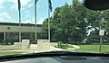
The Bureau of Indian Affairs' Osage Agency building in Pawhuska, adjacent to the Osage Nation Campus (2022)

See also
 In Spanish: Pawhuska (Oklahoma) para niños
