
Province of Macerata facts for kids
Quick facts for kids
Province of Macerata
|
|
|---|---|

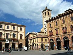
Palazzo degli Studi in Macerata, the provincial seat.
|
|

Map with the province of Macerata, in red, in Italy
|
|
| Country | |
| Region | Marche |
| Capital | Macerata |
| Comuni | 55 |
| Area | |
| • Total | 2,779.34 km2 (1,073.11 sq mi) |
| Population
(January 2017)
|
|
| • Total | 318,921 |
| • Density | 114.7470/km2 (297.1934/sq mi) |
| Time zone | UTC+1 (CETU) |
| • Summer (DST) | UTC+2 (CEST) |
| Postal code |
62100
|
| Telephone prefix | 0733 |
| Vehicle registration | MC |
| ISTAT | 043 |
| Website | Official website: http://www.provincia.mc.it/ |
The Province of Macerata (Italian: Provincia di Macerata) is a province in the region of Marche in Italy. Its capital is the city of Macerata.
Geography

Macerata is the largest of provinces of the Marche, with an area of 2,779.34 km2 (1,073 sq mi). The province is bordered to the east by the Adriatic Sea and to the west by the Umbria region (Province of Perugia). It is the only province of the Marche that borders with other three provinces of the same regionː the Ancona to the north, Ascoli Piceno to the southwest and the Fermo to the south.
 |
Ancona (province) | |
||
| Umbria | Adriatic Sea | |||
| Ascoli Piceno (province) | Fermo (province) |
The main rivers in the province areː
- Chienti, 91 km (56.5 mi) long
- Potenza, 95 km (59.0 mi) long.
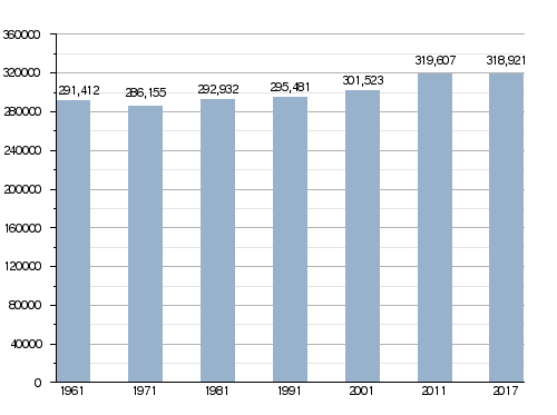
Population
There are 318,921 persons living in the province (1 January 2017), for a population density of 114.7 inhabitants/km².
Evolution of the population
Municipalities
There are 55 municipalities (or comuni) in the province; they are:
- Apiro
- Appignano
- Belforte del Chienti
- Bolognola
- Caldarola
- Camerino
- Camporotondo di Fiastrone
- Castelraimondo
- Castelsantangelo sul Nera
- Cessapalombo
- Cingoli
- Civitanova Marche
- Colmurano
- Corridonia
- Esanatoglia
- Fiastra
- Fiuminata
- Gagliole
- Gualdo
- Loro Piceno
- Macerata
- Matelica
- Mogliano
- Monte Cavallo
- Monte San Giusto
- Monte San Martino
- Montecassiano
- Montecosaro
- Montefano
- Montelupone
- Morrovalle
- Muccia
- Penna San Giovanni
- Petriolo
- Pieve Torina
- Pioraco
- Poggio San Vicino
- Pollenza
- Porto Recanati
- Potenza Picena
- Recanati
- Ripe San Ginesio
- San Ginesio
- San Severino Marche
- Sant'Angelo in Pontano
- Sarnano
- Sefro
- Serrapetrona
- Serravalle di Chienti
- Tolentino
- Treia
- Urbisaglia
- Ussita
- Valfornace
- Visso
The largest comune is San Severino Marche, with 194.26 km2 (75 sq mi) and the smallest is Camporotondo di Fiastrone, with 8.81 km2 (3 sq mi). The two Comune|comuni with fewest people living in it are Bolognola, with 137 inhabitants, and Monte Cavallo, with 133 inhabitants.
Main comuni
The following table shows the 10 comuni with more inhabitants with their population, and their area and altitude.
| No. | Comune | Population (2017) |
Area (km²) |
Density | Altitude (m) |
|---|---|---|---|---|---|
| 1 | Civitanova Marche | 42,251 | 46.07 | 917.1 | 3 |
| 2 | Macerata | 42,209 | 92.53 | 456.2 | 315 |
| 3 | Recanati | 21,241 | 103.46 | 205.3 | 293 |
| 4 | Tolentino | 19,831 | 95.12 | 208.5 | 228 |
| 5 | Potenza Picena | 15,836 | 48.55 | 326.2 | 237 |
| 6 | Corridonia | 15,461 | 61.97 | 249.5 | 255 |
| 7 | San Severino Marche | 12,630 | 194.26 | 65.0 | 235 |
| 8 | Porto Recanati | 12,571 | 17.25 | 728.8 | 6 |
| 9 | Cingoli | 10,289 | 148.20 | 69.4 | 631 |
| 10 | Morrovalle | 10,150 | 42.58 | 238.4 | 245 |
Gallery
-
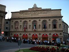
Sferisterio, Macerata.
-
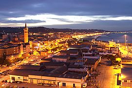
Civitanova Marche.
-
Recanati.
-
Piazza della Libertà, Tolentino.
-
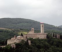
Castle of Monte Nero, San Severino Marche.


Related pages
See also
 In Spanish: Provincia de Macerata para niños
